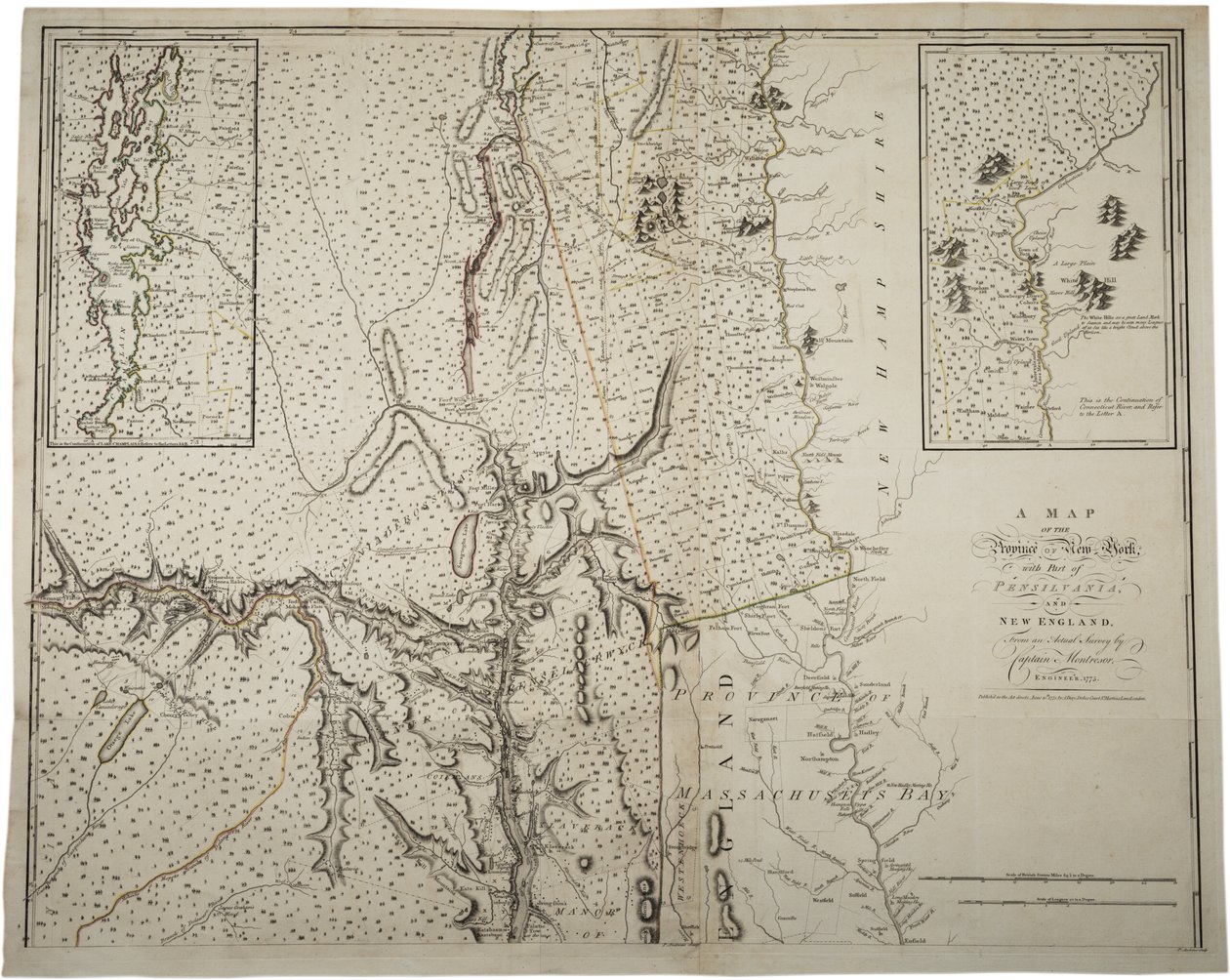
A Map of the Province of New York with Part of Pennsylvania, and New England, from an Actual Survey by Captain Montrésor, Engineer, 1775 by John Montresor

A Map of the Province of New York with Part of Pennsylvania, and New England, from an Actual Survey by Captain Montrésor, Engineer, 1775

(A Map of the Province of New York with part of Pensylvania, and New England, from an actual survey by Captain Montrésor, Engineer, 1775, 10 June 1775 )


John Montresor

€ 112.91
Enthält 0% MwSt.
   Configure art print
1775  ·  lithograph  ·  Picture ID: 317817

Nonclassified artists  ·  Cartography

A Map of the Province of New York with Part of Pennsylvania, and New England, from an Actual Survey by Captain Montrésor, Engineer, 1775 by John Montresor. Available as an art print on canvas, photo paper, watercolor board, uncoated paper or Japanese paper.
connecticut river · lake champlain · united states of america · mapping · cartography · maps · c18th · c19th · survey · Massachusetts Bay · The War for Independence · American Revolution · Gilder Lehrman Collection, New York, USA / Bridgeman Images
AR/3D   View in 3D / AR zu Favoriten hinzufügen   Add to favorites    Select wall color    View painting in a room
0 Reviews

Configure art print

Picture Frame

Medium & Stretcher

Glass & Passepartout

Miscellaneous & Extras

 Save / compare configuration
Preview Icon

Summary

Gemälde
Veredelung
Keilrahmen
Museumslizenz

€ 112.91
(inkl. 20% MwSt)
   Add to cart

Bildschärfe: PERFEKT

Should you desire adjustments to brightness and color, or a custom crop of the motif, we are happy to make these changes at no additional cost to you. Please do not hesitate to contact us.

Similar artworks selected for you

A Map of the Province of New York by Captain Montresor Land of the Cherokees with the western part of North Carolina and Virginia, engraving by G. Zuliani taken from Tome I of the A Map of the Most Inhabited Part of Virginia by Fry and Jefferson Map of the greater part of New Mexico, and a portion of Upper California Map of the United States, 1816 A Map of New York A Map of Kentucky, in The Discovery, Settlement and present State of Kentucke Map of the Cutch region of India and its border with neighbouring Baluchistan, by Carl Zimmerman, 1851 A Map of the Inhabited part of Virginia by Fry and Jefferson Map of the United States, 1816 Civil War Map of General Sherman A Map of Cadiz A Map of the British and French Dominions in America Map of Kentucke, Engraved by Henry D. Pursell, Printed by T. Rook, Philadelphia, 1784 A Copy of the Plan Projected in the Year 1721 for Bringing a New River from Uxbridge, Corrected, 6 February 1766 Lister and Mandal Counties in the Kingdom of Norway with the Help of Geographical Maps Maryland, Southern New Jersey, Delaware and the Eastern Part of Virginia and North Carolina, Engraving by G. Zuliani from Tome I of the "Newest Atlas" A plan of Fort Montgomery & Fort Clinton, 1774-1779 Geographical Map of Ejdangerske Company in Tellemarkske Infantry Geological and Geographical Atlas of Colorado and Portions of Adjacent Territory Map of Jemtland (1831) Outlines of the Physical and Political Divisions of South America A Map of the British and French Dominions in America Map of Sydney and Surrounding Areas, Australia, circa 1798 A Map of the Most Inhabited Part of Virginia A Plan of the Navigable Canals now making in the Inland Parts of the Kingdom, for opening a Communication to the Ports of London, Bristol, Liverpool and Hull, with the adjacent Towns and Rivers. By James Brindley Engineer. Drawn by Rob.t Whitworth. Map of the Congo region, from an album belonging to Henry Morton Stanley The Battle of Falkirk, 28 January 1746 A Map of the United States of North America
Show more similar artworks

Other art prints by John Montresor

Map of Lower New York State and surrounding areas, c.1775 A Map of the Province of New York with Part of Pennsylvania, and New England, from an Actual Survey by Captain Montrésor, Engineer, 1775 A Plan of the City of New York and Its Environs to Greenwich on the North (Hudson) River to Crown Point on the East River, Surveyed 1766, 1775 Early Survey of the City of New York and Its Environs to Greenwich, 1766 A Map of New York A Map of Boston A Map of the Province of New York by Captain Montresor Map of Boston and Charlestown A Sketch of the Battle of Germantown, 4th October 1777, where the Rebels were Repulsed Plan of the Battle of Brandywine, 11 September 1777 Battle of Brandywine, 11th September 1777 Gov. Tryon Disposition of British Troops, with Fortifications North of Fort Knipehausen to Fort Independence Map of the Ohio River from Fort Pitt
Discover more works by John Montresor

Other motives from the category Cartography

A Map of Clerkenwell, City of London, 1746 Map of Rome Map of Visby, from Map of Portsoken Ward, London Map of Cadiz, from Map of India, published under the direction of Colonel H.R. Thuillier, R.E., Surveyor General of India, 1877 Civil War Map of General Sherman Map of London, from Map of Paris at the Outbreak of the French Revolution, published by William Blackwood and Sons Map of the United States in 1803, from Our Whole Country: The Past and Present of the United States, Historical and Descriptive, by John Warner Barber and Henry Hare, 1861 Froggett Map of London, showing the Bear Baiting Garden in Southwark Map of the Travels of Alexander the Great (356-323 BC) from Map of North America, 1747 Map of Brazil, from Dutch Marine Maps, 1637
View More from "Cartography"

Excerpt from our top sellers

Sower at Sunset Intersecting Lines Night: A Port in the Moonlight, 1748 Mother of the World Several Circles Rock at Jávea The Cave of the Storm Nymphs Baku agitation panel The Course of Empire: The Arcadian or Pastoral State Lascaux Cave Painting, Bordeaux, France Main and Side Paths The Kiss Pergola on Capri with View of Vesuvius Composition VIII, 1915 Spring, Flora Picking Flowers
Show More Artworks


What our customers think about us


Frequently Asked Questions about Meisterdrucke


Personalizing your art print at Meisterdrucke is a simple and intuitive process that allows you to design an artwork exactly to your specifications: Choose a frame, determine the image size, decide on a printing medium, and add suitable glazing or a stretcher frame. We also offer customization options such as mats, fillets, and spacers. Our customer service is available to help you design your perfect artwork.

At Meisterdrucke, you have the fascinating option to visualize the artwork you configured directly in your own space. For a tailored preview, simply upload a photo of your room and let the artwork appear on it. If you visit us via a mobile device, be it a phone or tablet, our augmented reality feature brings the image to life and seamlessly projects it into your space. An experience that uniquely combines art and technology.

Choosing the medium is often a matter of personal taste. To give you a clearer idea, we have provided some images for each medium. For a holistic experience, we also offer you a sample set of all paper variants so you can make a decision not just visually but also haptically. You can take advantage of the sample set free of charge – only the shipping costs will apply. You can order the sample set directly.

Do not worry. At Meisterdrucke, we do not proceed mechanically. We manually review each order. If there are any inconsistencies or peculiarities in the configuration, we will immediately contact you. Of course, our courteous and patient support is always at your side to assist you with the configuration. Together with you, we adjust your image by phone or email so that the final result exactly meets your expectations.


Do you have any questions?

Are you interested in an art print from our manufactory but still unsure? Do you need advice on choosing the medium or help with the order?

Our experts are happy to assist you.

+43 4257 29415
support@meisterdrucke.com
Mo-Do: 7:00 - 16:00 | Fr: 7:00 - 13:00

Do you have any questions?

Are you interested in an art print from our manufactory but still unsure? Do you need advice on choosing the medium or help with the order?

Our experts are happy to assist you.

+43 4257 29415
support@meisterdrucke.com
Mo-Do: 7:00 - 16:00 | Fr: 7:00 - 13:00


Meisterdrucke

   Kärntner Strasse 46
        9586 Finkenstein am Faaker See
        Austria
        +43 4257 29415
        support@meisterdrucke.com
Other languages

                   
Erfahrungen & Bewertungen zu Meisterdrucke
Post.at DHL Express Quehenberger Cargoboard
Kaiser Franz Joseph

Meisterdrucke
Kärntner Strasse 46
9586 Finkenstein am Faaker See · Austria
+43 4257 29415 · office@meisterdrucke.com
Post.at DHL Express Quehenberger Cargoboard


Meisterdrucke 2705 Bewertungen auf ProvenExpert.com

(c) 2025 meisterdrucke.uk