support@meisterdrucke.com  ·  0043 4257 29415

Deutsch English Italiano Español Français Nederlands Português Svenska Polski Dansk
Search by artist, work title or style – e.g. Monet, Starry Night, Impressionism, Hokusai wave, nude. Describe the scene – e.g. green meadow, abstract with lots of red, dark oil painting, standing nude next to a tree.

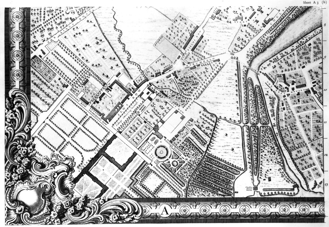
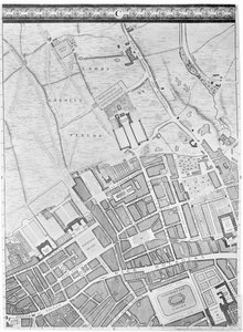
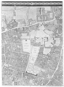
A Map of Chelsea, 1746 by John Rocque

A Map of Chelsea, 1746

(A Map of Chelsea, 1746 )


John Rocque

€ 133.83
Tax-free
   Configure art print
1746  ·  engraving  ·  Image ID: 70937

Victorian Art  ·  Cartography

A Map of Chelsea, 1746 by John Rocque. Available as an art print on canvas, photo paper, watercolor board, natural paper, or Japanese paper.
london · suburb · outskirts · ranelagh gardens · chelsea college · royal hospital · the kings road · embankment · jews row · college burying ground · ranelegh · ranleigh · gardiners row · franklins row · city · aerial view · fields · bridge · river thames · the neat houses · water works · pleasure garden · chelsea · plan · street · streets · england · english · britain · british · capital city · Georgian · Private Collection / Bridgeman Images
Other color versions of this image  
AR/3D   View in 3D / AR zu Favoriten hinzufügen   Add to favorites    Change wall color    View picture in a room
0 Reviews

Configure art print

Picture Frame

Medium & Stretcher

Glass & Passepartout

Miscellaneous & Extras

 Save / compare configuration
Preview Icon

Summary

Gemälde
Veredelung
Keilrahmen
Museumslizenz

€ 133.83
(inkl. 20% MwSt)
   Add to cart

Bildschärfe: PERFEKT

If you'd like us to adjust the brightness, colors, or crop the image, we're happy to do this for you at no extra cost. Just get in touch!

Similar artworks selected for you

Plan of Kensington Palace (detail) by Joshua Rhodes, 1764 A Plan of the House and Gardens at Stowe, Buckinghamshire A Map of the Royal Palace and Gardens of Kensington, London, 1736 A Map of the West End and Soho, London, 1746 A Map of Marylebone, London, 1746 A Map of St. James A Map of Mile End and Stepney Green, London, 1746 A Map of St James Map of Racconigi, Engraving by Joan Blaeu, Italy Hollar Loggan City map of Naples with Capodimonte (detail) A Map of Bloomsbury and Holborn, London, 1746 Detail of a Map of Vienna showing 135 Alsergrund where Mozart and his family lived during 1788 Loggan Bristol in 1670, 1903 The Observatory, detail from the Plan of Paris, known as the Plan de Turgot, engraved by Claude Lucas (detail) Charles Bridgeman’s (fl. 1713-38) plan for Stowe Gardens, from a book on views of Stowe published by Mrs Charles Bridgeman in 1739 The Villa d Frankfurt Judengasse 1628 Map of Campus Martius Paris: The Palace and Garden of the Tuileries in 1615, Facsimile of Mathieu Merian Map of Manchester, 1751 Copper Engraving - Abbey and Market Berchtesgaden A Map of Bermondsey, London New York Map of Paris, 1620 (detail of 285193)
Show more similar artworks

More art prints by John Rocque

A Map of The King A Map of Bloomsbury and Holborn, London, 1746 A Map of the Royal Palace and Gardens of Kensington, London, 1736 A Map of Tyburn, 1746 (detail of 438496) A Map of Old London Bridge, London, 1746 A Map of Limehouse and Rotherhithe, London, 1746 A Map of Mile End, London, 1746 A Map of St Paul A Map of Moorfields and Hoxton, London, 1746 A Map of the West End and Soho, London, 1746 A Map of Clerkenwell, City of London, 1746 A Map of Mile End and Stepney Green, London, 1746 Plan of the Cities of London and Westminster and Borough of Southwark, Engraved by John Tinney, Published 1746 A Map of Chelsea, 1746 A Map of St. James
Show more works by John Rocque

More motifs from the category Cartography

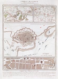
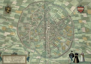
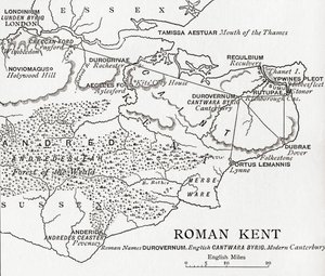
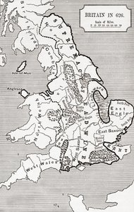
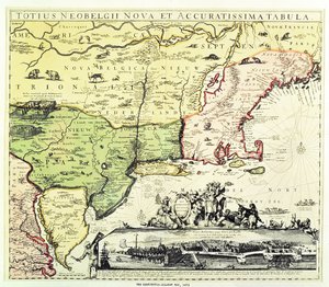
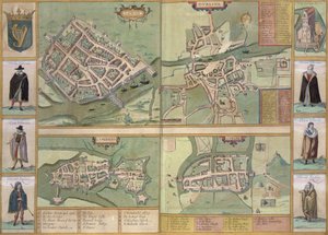
Map of combat at the Battle of Lübeck, showing positions of the French, Prussian, Swedish and Danish armies Sketch map of Africa, from Map of Louvain, from ’Civitates Orbis Terrarum’ by Georg Braun (1541-1622) and Frans Hogenberg (1535-90) c.1572-1617 Map of Roman Kent, England, from “A Short History of the English People” by J. R. Green, published 1893 Map of Britain in 626, from The Northumbrian Kingdom 588 to 685 in Town map of Constantinople, Turkey, c.1650 The Restitutio-Allardt Map of New Amsterdam, engraved and published by Carolus Allardt, 1673 Maps of Galway, Dublin, Limerick, and Cork, from “Civitates Orbis Terrarum” by Georg Braun (1541-1622) and Frans Hogenberg (1535-90), c. 1573 Map of Tenochtitlan from „Praeclara Ferdinandi Cortesii de Nova Maris Oceani Hispania Narrati“ A Map of Bloomsbury and Holborn, London, 1746 Map of the Kingdom of Scotland, 17th Century, Scotia Regnum, Influenced by Mercator Map of Southern India Map of Berlin showing buildings of interest, 1773 Map of the Battle of Vitoria, published by William Blackwood and Sons, Edinburgh and London, 1848 A General Map, from ’A Discourse of a Discovery for a New Passage to Cataia’ written by Humphrey Gilbert (c. 1539-83)
View More from "Cartography"

A selection of our top sellers

Girl by a Birch Trunk (also: Girl at a Tree) The Garden of Earthly Delights, central panel, c. 1500 The Dreamer Lyrical Knight, Death and the Devil, 1513 (copper plate engraving) Sunlight in the Blue Room Daniel in the Lions The Gleaners The Young Bacchus, c.1589 Circles in a Circle, 1923. After Sunset The Plague Is Coming Olive Trees in the Moreno Garden, 1884 Blooming Cherry Tree Trail in the woods, c. 1874-77
Show more artworks


What our customers think about us


Frequently Asked Questions about Meisterdrucke


Personalizing your art print at Meisterdrucke is simple and intuitive: Choose a frame, set the image size, pick a printing medium, and add suitable glazing or a stretcher frame. We also offer additional customization options like mats, fillets, and spacers. If you have any questions, our customer service team is ready to help you create your perfect artwork.

At Meisterdrucke, you can visualize your configured artwork directly in your own room. Simply upload a photo of your space and see how the artwork looks in it. If you're visiting us on a mobile device — phone or tablet — our augmented reality feature brings the picture to life and projects it right into your room. A unique experience that combines art and technology.

Choosing the right medium is often a matter of personal taste. To give you a better idea, we've provided some images for each medium. We also offer a sample set of all paper variants, so you can decide not just visually but by touch as well. You can order the sample set free of charge — only shipping costs apply.

Don't worry! At Meisterdrucke, we don't just process orders mechanically. Every order is manually reviewed by our team. If we spot any inconsistencies or issues with your configuration, we'll get in touch with you right away. And of course, our friendly and patient support team is always here to help you with your configuration. We'll work with you by phone or email to adjust your image so the final result is exactly what you had in mind.


Still have questions?

Are you interested in an art print from our manufactory but still unsure? Do you need advice on choosing the medium or help with the order?

Our experts are happy to assist you.

+43 4257 29415
support@meisterdrucke.com

Mo-Do: 7:00 - 16:00 | Fr: 7:00 - 13:00

Still have questions?

Are you interested in an art print from our manufactory but still unsure? Do you need advice on choosing the medium or help with the order?

Our experts are happy to assist you.

+43 4257 29415
support@meisterdrucke.com
Mo-Do: 7:00 - 16:00 | Fr: 7:00 - 13:00


Meisterdrucke

   Kärntner Strasse 46
        9586 Finkenstein am Faaker See
        Austria
        +43 4257 29415
        support@meisterdrucke.com
Other languages

                   
Erfahrungen & Bewertungen zu Meisterdrucke
Post.at DHL Express Quehenberger Cargoboard
Kaiser Franz Joseph

Meisterdrucke
Kärntner Strasse 46
9586 Finkenstein am Faaker See · Austria
+43 4257 29415 · support@meisterdrucke.com
Post.at DHL Express Quehenberger Cargoboard


(c) 2026 meisterdrucke.uk