support@meisterdrucke.com  ·  0043 4257 29415

Deutsch English Italiano Español Français Nederlands Português Svenska Polski Dansk
Search by artist, work title or style – e.g. Monet, Starry Night, Impressionism, Hokusai wave, nude. Describe the scene – e.g. green meadow, abstract with lots of red, dark oil painting, standing nude next to a tree.

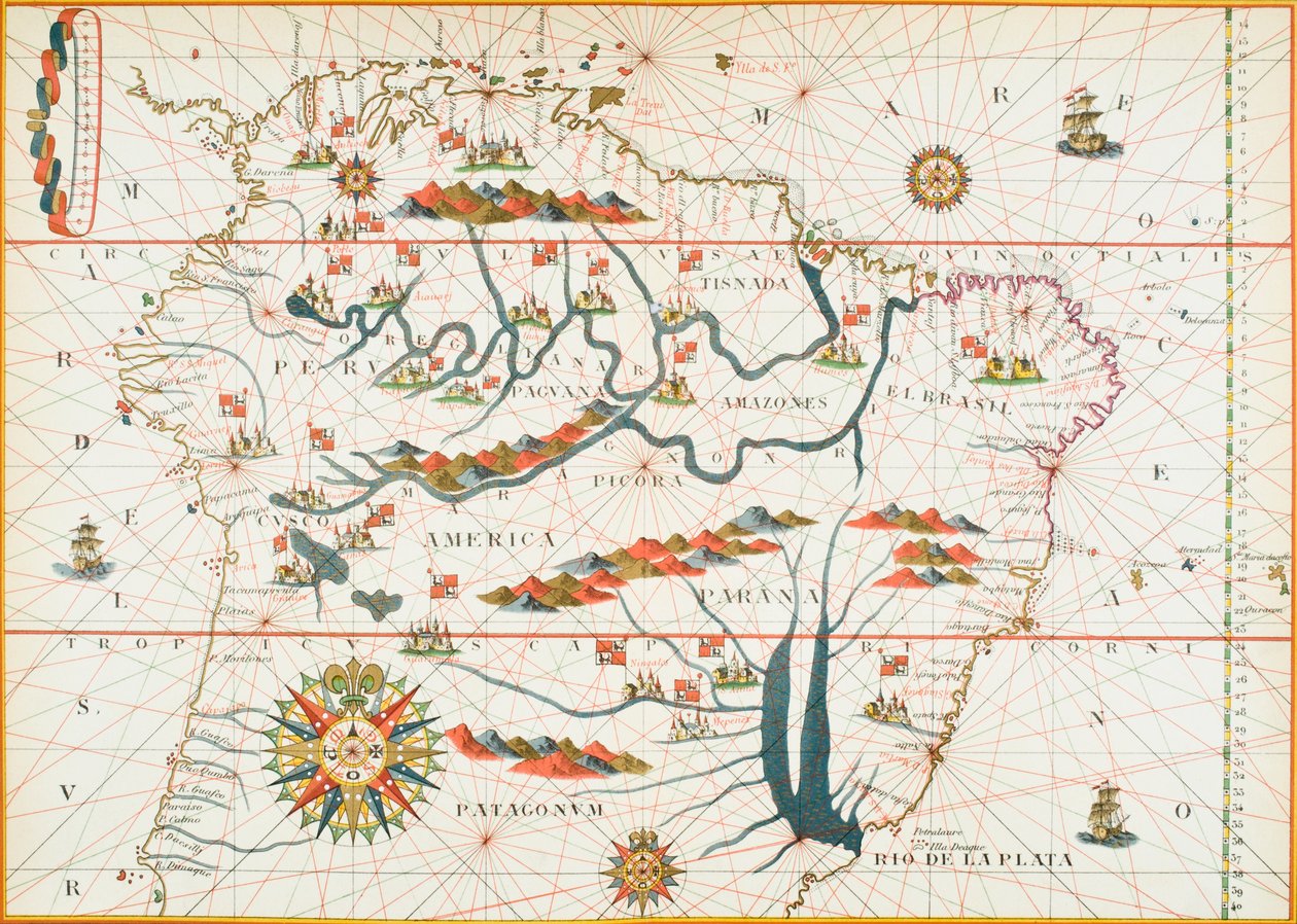
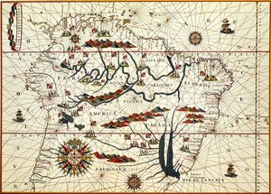
Map of America, 1878 by English School

Map of America, 1878

(Map of America, 1878 )


English School

€ 130.83
Tax-free
   Configure art print
1878  ·  colour lithograph  ·  Image ID: 95290

Cultural Circles  ·  Cartography

Map of America, 1878 by English School. Available as an art print on canvas, photo paper, watercolor board, natural paper, or Japanese paper.
new world · american · grid · cartography · mapping · exploration · compass · Private Collection / Bridgeman Images
Other color versions of this image  
AR/3D   View in 3D / AR zu Favoriten hinzufügen   Add to favorites    Change wall color    View picture in a room
0 Reviews

Configure art print

Picture Frame

Medium & Stretcher

Glass & Passepartout

Miscellaneous & Extras

 Save / compare configuration
Preview Icon

Summary

Gemälde
Veredelung
Keilrahmen
Museumslizenz

€ 130.83
(inkl. 20% MwSt)
   Add to cart

Bildschärfe: PERFEKT

If you'd like us to adjust the brightness, colors, or crop the image, we're happy to do this for you at no extra cost. Just get in touch!

Similar artworks selected for you

Map of South America in 1582 Illustration from the Queen Mary Atlas A double-page map of the Atlantic Ocean, showing the east coast of North and South America, 1544 Northern South America, detail from a world atlas, 1565 Fol. 13 Map of South America and the Magellan Straits, from an atlas, 1571 Map of Western Europe, Africa and America, with drawings of mountains, animals, etc. Joseph da Costa e Miranda French Map of Central and South America Chart of Arabia and the Eastern Mediterranean, Part of a Portolan Atlas, c.1650 Route of Drake Ormuz-Calicut The East Mediterranean and Black Sea Africa, Europe and Part of Americas, from Atlas of the World in Thirty-Three Maps, by Battista Agnese Chart of the north-east Atlantic, from Ireland to Cape Verde, c.1600 View of the western coast of Mexico, and southern California - Map Chart of the western Mediterranean showing the north African and Spanish coasts, and the Atlantic Map of the Mediterranean, 1625 The coasts of Europe and North Africa Map of the Magellan Straits, Patagonia, from the Mercator Atlas published by Jodocus Hondius (1563-1612), Amsterdam, 1606 Map of Asia, including Armenia, Iran and Afghanistan, with wind rose, details of ports, coasts and sea routes, in the Atlas of Joan Martines Part of Mexico and South America Map of South America. Portulan by Bartolomeo Velhio Europe and Central Asia, from an Atlas of the World in 33 Maps, Venice, 1st September 1553 Chart of the Western Mediterranean, c.1600 The Caribbean Fol. 16 Map of Persia, Arabia and India, from an atlas, 1571 Ms Ital 550.0.3.15 fol. 6r Map of Egypt, from the „Carte Geografiche“ The Eastern Mediterranean, from a nautical atlas, 1520 Map of Virginia
Show more similar artworks

More art prints by English School

Church and Cottage with Lighted Windows Portrait of a bodybuilder, c. 1898 The Portrait of King Richard III Kidbrooke Park, Kent, formerly attributed to George Lambert (1700-65) c.1740-50 Portrait of the Greek philosopher Socrates (469-399 BC) - From the series “Leaders of Men” - Chromolithography - English School, 20th century Map of Europe in 1910 Map of Ireland from ’The History of Ireland’ by Thomas Wright, published c.1854 Venice, 1338, after a manuscript in the Bodleian Library, from Poster advertising ‘A Midsummer Night Winston Churchill on horseback in Bangalore, India in 1897, from ’A Roving Commission by Winston S. Churchill’, published by Scribner’s, 1930 Romeo buys poison from the apothecary, illustration from Romeo and Juliet, from "The Illustrated Library Shakespeare", published in London 1890 Detailed Map of Gallipoli Peninsula and the Dardanelles, Turkey, 1915, from Ms 26 fol. 7r. Psalm 1, David harping, from the Ramsey Abbey Psalter, c. 1380 Ever-flowering Rose (Rosa semperflorens), plate 284 from William Curtis
Show more works by English School

More motifs from the category Cartography

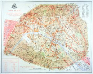
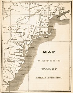
Plan and Map of the Town and Citadel of Mont-Louis Ms 782 f.374v World map with Jerusalem in the centre, from Map of England and Wales, 1644 Map of the Kingdom of Great Britain and Ireland, 1610 Map of India and the East Indies Map of Herefordshire, 1695 Renaissance map of Europe, Jacopo Russo (after), 1528 A New Map of the English Plantations in America, 1673 Map of Arras, from Map of London, from Map showing the extent of work during the Haussmann period of development in Paris from 1854-71, 1871 Part of the Tabula Peutingeriana (Peutinger Table, Peutinger Map), an illustrated itinerarium of the road network in the Roman Empire. Detail of Italy from the Peutinger Map copy Map of the World, Based on Descriptions and Coordinates Given in “Geographia”, by Ptolemy (Claudius Ptolemaeus of Alexandria) (c. 90-168 AD) Map of the Kingdom of Hungary, printed by Godfried Map to illustrate the War of American Independence, from
View More from "Cartography"

A selection of our top sellers

Women of Tahiti, On the Beach, 1891 Blue, 1922 The Deluge Sin Poster for the Vienna Secession Exhibition, 1902 Fallen Angel, 1847. Joan of Arc, 1879 Comrades, 1924 Lavender Fields in Old Provence View of L Via Appia Accent in Rose, 1926 Marie Krøyer seated in the deckchair in the garden by Mrs Bendsen Back from the Hunt, 1890, Milan Cat in a Rainbow
Show more artworks


What our customers think about us


Frequently Asked Questions about Meisterdrucke


Personalizing your art print at Meisterdrucke is simple and intuitive: Choose a frame, set the image size, pick a printing medium, and add suitable glazing or a stretcher frame. We also offer additional customization options like mats, fillets, and spacers. If you have any questions, our customer service team is ready to help you create your perfect artwork.

At Meisterdrucke, you can visualize your configured artwork directly in your own room. Simply upload a photo of your space and see how the artwork looks in it. If you're visiting us on a mobile device — phone or tablet — our augmented reality feature brings the picture to life and projects it right into your room. A unique experience that combines art and technology.

Choosing the right medium is often a matter of personal taste. To give you a better idea, we've provided some images for each medium. We also offer a sample set of all paper variants, so you can decide not just visually but by touch as well. You can order the sample set free of charge — only shipping costs apply.

Don't worry! At Meisterdrucke, we don't just process orders mechanically. Every order is manually reviewed by our team. If we spot any inconsistencies or issues with your configuration, we'll get in touch with you right away. And of course, our friendly and patient support team is always here to help you with your configuration. We'll work with you by phone or email to adjust your image so the final result is exactly what you had in mind.


Still have questions?

Are you interested in an art print from our manufactory but still unsure? Do you need advice on choosing the medium or help with the order?

Our experts are happy to assist you.

+43 4257 29415
support@meisterdrucke.com

Mo-Do: 7:00 - 16:00 | Fr: 7:00 - 13:00

Still have questions?

Are you interested in an art print from our manufactory but still unsure? Do you need advice on choosing the medium or help with the order?

Our experts are happy to assist you.

+43 4257 29415
support@meisterdrucke.com
Mo-Do: 7:00 - 16:00 | Fr: 7:00 - 13:00


Meisterdrucke

   Kärntner Strasse 46
        9586 Finkenstein am Faaker See
        Austria
        +43 4257 29415
        support@meisterdrucke.com
Other languages

                   
Erfahrungen & Bewertungen zu Meisterdrucke
Post.at DHL Express Quehenberger Cargoboard
Kaiser Franz Joseph

Meisterdrucke
Kärntner Strasse 46
9586 Finkenstein am Faaker See · Austria
+43 4257 29415 · support@meisterdrucke.com
Post.at DHL Express Quehenberger Cargoboard


(c) 2026 meisterdrucke.uk