support@meisterdrucke.com  ·  0043 4257 29415

Deutsch English Italiano Español Français Nederlands Português Svenska Polski Dansk
Search by artist, work title or style – e.g. Monet, Starry Night, Impressionism, Hokusai wave, nude. Describe the scene – e.g. green meadow, abstract with lots of red, dark oil painting, standing nude next to a tree.

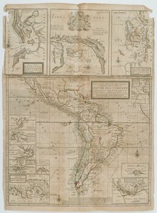
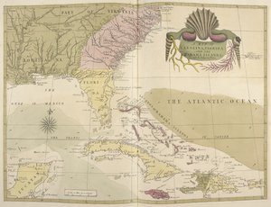
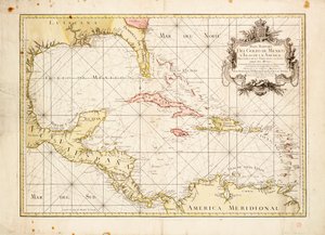
A New Map of the English Plantations in America, 1673 by Robert Morden

A New Map of the English Plantations in America, 1673

(A New Map of the English Plantations in America, 1673 )


Robert Morden

€ 121.68
Tax-free
   Configure art print
1673  ·  coloured engraving  ·  Image ID: 97798

Nonclassified artists  ·  Cartography

A New Map of the English Plantations in America, 1673 by Robert Morden. Available as an art print on canvas, photo paper, watercolor board, natural paper, or Japanese paper.
cartography · north america · english colony · colonies · gulf of mexico · caribbean · atlantic ocean · layout · colonial · island · islands · continent · central america · panama · british colonies · plantation · cartouche · deep south · west indies · Yale Center for British Art, Paul Mellon Collection, USA / Bridgeman Images
AR/3D   View in 3D / AR zu Favoriten hinzufügen   Add to favorites    Change wall color    View picture in a room
0 Reviews

Configure art print

Picture Frame

Medium & Stretcher

Glass & Passepartout

Miscellaneous & Extras

 Save / compare configuration
Preview Icon

Summary

Gemälde
Veredelung
Keilrahmen
Museumslizenz

€ 121.68
(inkl. 20% MwSt)
   Add to cart

Bildschärfe: PERFEKT

If you'd like us to adjust the brightness, colors, or crop the image, we're happy to do this for you at no extra cost. Just get in touch!

Similar artworks selected for you

Gulf of Mexico chart by de la Cruz Archipelago of Mexico Including the Islands of Cuba, Hispaniola, Jamaica, etc. Map of Central America New and accurate map of the West Indies Caribbean, Honduras and Florida, in Trading Map of the West Indies, 1707 (hand coloured print) American Islands in the North Ocean with Adjacent Lands Map of the Caribbean, 1715 Pascaerte vande Caribische Eylanden, vande Barbados tot aende Bocht van Mexico The Caribbean Sea: The Bermuda Triangle between the Bermuda Archipelago, Miami, and Puerto Rico. According to Wilhelm Blaeu Map of Central and North America, published in 1700, Paris Map of the West Indies, 18th century North America A Complete Map of the West Indies Containing the Coasts of Florida, Louisiana, New Spain and Terra Firma with All the Islands Gulf of Mexico and the Caribbean, from Blaeu Map of the Gulf of Mexico and the Caribbean Mexico and Florida East Canada, East United States, Mexico, Guatemala, El Salvador, Belize, Honduras, Nicaragua, Costa Rica, Panama, Antigua and Barbuda, The Bahamas, Barbados, Cuba, Dominica, Jamaica, Grenada, Haiti, Dominican Republic, Saint Kitts and Nevis, Saint Lucia Accurate Delineation of the Islands of Hispaniola and Cuba with Surrounding Islands Chart of the West Indies A Complete Map of the West Indies Containing the Coasts of Florida, Louisiana, New Spain, and Terra Firma with All the Islands Map of the Americas The Caribbean Sea: Gulf of Mexico and Caribbean Sea from the Atlas of Wilhelm Blaeu Map of the Mexican Archipelago A New and Exact Map of the Coast Countries and Islands Within Ye Limits of Ye South Sea Company America Map of North America (Greenland, Canada, USA, Mexico and the Caribbean Islands: Cuba, Haiti, Jamaica, West Indies) The West-India Islands, 1794-1801 A Map of Carolina, Florida and the Bahama Islands
Show more similar artworks

More art prints by Robert Morden

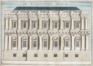
St. Paul A New Map of the English Plantations in America, 1673 Customs House, from St. Marie Overie in Southwark, from Whitehall, from The Temple, from Map 57 New Mexico Mercers Chapel, from Royal Exchange from Tartary Banqueting House, Whitehall, from St. Paul Whitehall: The Kings Gate Leading to Westminster, from The King St. Mary le Strand, from A Book of the Prospects of the Remarkable Places in and About the City of London, c.1700
Show more works by Robert Morden

More motifs from the category Cartography

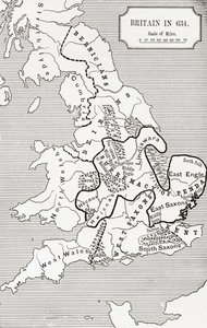
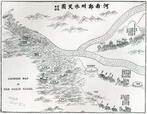
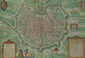
Map of Afghanistan, 1898 Map of Britain in 634, from Chinese Map of the Great Flood, from Map of Milan, from Civitates Orbis Terrarum by Georg Braun (1541-1622) and Frans Hogenburg (1535-90), c. 1572 Map illustrating the Welsh wars of William Rufus and Henry I, from Map of Africa showing Treaty Boundaries, 1891 Map of Persia, 1638 A General Map, from Map of the Holy Land, based on descriptions and co-ordinates given in Cosmographica, by Ptolemy (Claudius Ptolemaeus of Alexandria) published in Ulm, Germany, by Johann Reger England, Wales and Scotland, from a Renaissance map of Europe, after Jacopo Russo, 1528 Map of Arras, from Map of Madras at the time of the capture of the town and Fort of St. George in 1746 by the French under the command of Mahé de la Bourdonnais, 1750 Northern Europe, from an Atlas of the World in 33 Maps, Venice, 1st September 1553 Map of South Africa Illustrating Dr. Livingstone Map of South Pacific Island
View More from "Cartography"

A selection of our top sellers

Richelieu (1585-1642) on the sea wall at La Rochelle, 1881 Ecce Homo Rose: Bengale the Hymenes, from The Valley of Tears, 1883 Self-Portrait as the Allegory of Painting Stag Beetle First Steps Interior with Young Woman from Behind The Battle of Trafalgar, 1805 Sails on the Sea, Valencia A Moonlit Lane. Two lovers at a gate Knight, Death and the Devil, 1513 (copper plate engraving) Reflection in the Surface of the Water, Misaka, Kai Province from the series Thirty-Six Views of Mt Fuji, 1830-1833 The Consummation of Empire, 1836 Snow at Benzaiten Shrine in the Pond of Inokashira, 1843-1847
Show more artworks


What our customers think about us


Frequently Asked Questions about Meisterdrucke


Personalizing your art print at Meisterdrucke is simple and intuitive: Choose a frame, set the image size, pick a printing medium, and add suitable glazing or a stretcher frame. We also offer additional customization options like mats, fillets, and spacers. If you have any questions, our customer service team is ready to help you create your perfect artwork.

At Meisterdrucke, you can visualize your configured artwork directly in your own room. Simply upload a photo of your space and see how the artwork looks in it. If you're visiting us on a mobile device — phone or tablet — our augmented reality feature brings the picture to life and projects it right into your room. A unique experience that combines art and technology.

Choosing the right medium is often a matter of personal taste. To give you a better idea, we've provided some images for each medium. We also offer a sample set of all paper variants, so you can decide not just visually but by touch as well. You can order the sample set free of charge — only shipping costs apply.

Don't worry! At Meisterdrucke, we don't just process orders mechanically. Every order is manually reviewed by our team. If we spot any inconsistencies or issues with your configuration, we'll get in touch with you right away. And of course, our friendly and patient support team is always here to help you with your configuration. We'll work with you by phone or email to adjust your image so the final result is exactly what you had in mind.


Still have questions?

Are you interested in an art print from our manufactory but still unsure? Do you need advice on choosing the medium or help with the order?

Our experts are happy to assist you.

+43 4257 29415
support@meisterdrucke.com

Mo-Do: 7:00 - 16:00 | Fr: 7:00 - 13:00

Still have questions?

Are you interested in an art print from our manufactory but still unsure? Do you need advice on choosing the medium or help with the order?

Our experts are happy to assist you.

+43 4257 29415
support@meisterdrucke.com
Mo-Do: 7:00 - 16:00 | Fr: 7:00 - 13:00


Meisterdrucke

   Kärntner Strasse 46
        9586 Finkenstein am Faaker See
        Austria
        +43 4257 29415
        support@meisterdrucke.com
Other languages

                   
Erfahrungen & Bewertungen zu Meisterdrucke
Post.at DHL Express Quehenberger Cargoboard
Kaiser Franz Joseph

Meisterdrucke
Kärntner Strasse 46
9586 Finkenstein am Faaker See · Austria
+43 4257 29415 · support@meisterdrucke.com
Post.at DHL Express Quehenberger Cargoboard


(c) 2026 meisterdrucke.uk