support@meisterdrucke.com  ·  0043 4257 29415

Deutsch English Italiano Español Français Nederlands Português Svenska Polski Dansk
Search by artist, work title or style – e.g. Monet, Starry Night, Impressionism, Hokusai wave, nude. Describe the scene – e.g. green meadow, abstract with lots of red, dark oil painting, standing nude next to a tree.

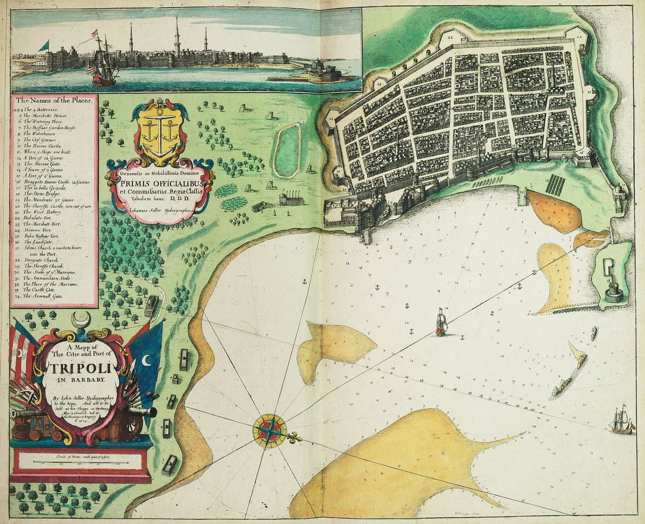
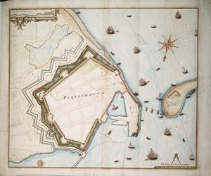
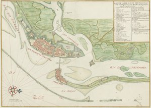
A Map of the City and Port of Tripoli in Barbary by John Seller

A Map of the City and Port of Tripoli in Barbary

(A map of the city and port of Tripoli in Barbary)


John Seller

€ 120.17
Tax-free
   Configure art print
1675  ·  coloured engraving  ·  Image ID: 1501778

Nonclassified artists

A Map of the City and Port of Tripoli in Barbary by John Seller. Available as an art print on canvas, photo paper, watercolor board, natural paper, or Japanese paper.
17th century · cartography · colour · engraving · port · tripoli · libya · north africa · africa · city · mzengraving · · National Maritime Museum, London, UK / Bridgeman Images
AR/3D   View in 3D / AR zu Favoriten hinzufügen   Add to favorites    Change wall color    View picture in a room
0 Reviews

Configure art print

Picture Frame

Medium & Stretcher

Glass & Passepartout

Miscellaneous & Extras

 Save / compare configuration
Preview Icon

Summary

Gemälde
Veredelung
Keilrahmen
Museumslizenz

€ 120.17
(inkl. 20% MwSt)
   Add to cart

Bildschärfe: PERFEKT

If you'd like us to adjust the brightness, colors, or crop the image, we're happy to do this for you at no extra cost. Just get in touch!

Similar artworks selected for you

Brielle, Netherlands Kronborg from Civitates Orbis Terrarum Map of Madras at the time of the capture of the town and Fort of St. George in 1746 by the French under the command of Mahé de la Bourdonnais, 1750 Helsingor, Denmark - Helsingborg, Sweden (engraving) Helsingor, Denmark - Helsingborg, Sweden - in City of Dunkirk during the Spanish domination: plan showing the coastal defences, castle, and bastion fortifications, 1649 Plan of Ancona (Ancona), Italy Ancona, Italy Eckernforde, Germany (engraving) Map of Messina Map of Ancona Eckernforde, Germany - in Map of the Island of Voorne and Plan of Brielle, 1572 Plymouth Map of Gallipoli from Civitates Orbis Terrarum Map of Brielle from Civitates Orbis Terrarum by Georg Braun Domingo, from Drake Map of the Island of Voorne and Plan of Brielle, 1572 Map of the Siege of Barcelona, 1706 Capture of the Spanish settlement of Santo Domingo in Hispaniola Map of Galway, Dublin, Limerick and Cork from Civitates Orbis Terrarum A coloured facsimile copy of a bird Redraft of The Castello Plan, New Amsterdam in 1660 Chart of Portsmouth, c.1668 La Valletta, Malta Map of Naples, from ‘Civitates Orbis Terrarum’ by Georg Braun (1541-1622) and Frans Hogenberg (1535-90), c.1572 Orleans, France - in Watercolour chart of the city of Recife (Brazil) in the 17th century Map of Messina, Italy
Show more similar artworks

More art prints by John Seller

A Map of the North Pole Kent, Actually Surveyed and Delineated by John Seller, c.1680 A map of the world from Atlas maritimus by John Seller A Chart of the West Indies from Cape Cod to River Oronoque from Atlas Maritimus by John Seller The English pilot the first book: describing the northern navigation, c.1671 A chart of the sea coasts of England, Flanders and Holland, c.1672 The Windward Passage from Jamaica, Between the East End of Cuba, and the West End of Hispaniola A New Map of the Sea Coasts of England, France and Holland The English Pilot the First Book: Describing the Northern Navigation, c.1671 Map containing the island and kingdom of Sicily, with a part of Naples, and other adjacent coasts including the Tyrrhenean Sea Chart of the Sea Coasts of England and Ireland and of the Bay of Biscay The Starry Zodiac, by the Limits of Which the Visible Paths of All the Planets Are Bounded - John Seller Author, Hydrographer of the Most Serene King Map of Bombay and Salsette by Samuel Thornton World map by John Seller Polar Projection Map with Arctic Circle, c.1680
Show more works by John Seller

A selection of our top sellers

The Roses of Heliogabalus The White Cat Renard the Fox, c. 1800, 1922 View of Delft Morning in a Pine Forest Rosa banksiae (Banks Sunlight in the Blue Room Karelia and Murmansk Agitation Panel, 1926 The Tower of Babel (Rotterdam) Ophelia The Goldfinch (The Thistle Finch, The European Goldfinch) Spring, from the series Les Saisons, 1900 Irises The Interior of the Palm House, 1832-1833 Ghost of a Genius
Show more artworks


What our customers think about us


Frequently Asked Questions about Meisterdrucke


Personalizing your art print at Meisterdrucke is simple and intuitive: Choose a frame, set the image size, pick a printing medium, and add suitable glazing or a stretcher frame. We also offer additional customization options like mats, fillets, and spacers. If you have any questions, our customer service team is ready to help you create your perfect artwork.

At Meisterdrucke, you can visualize your configured artwork directly in your own room. Simply upload a photo of your space and see how the artwork looks in it. If you're visiting us on a mobile device — phone or tablet — our augmented reality feature brings the picture to life and projects it right into your room. A unique experience that combines art and technology.

Choosing the right medium is often a matter of personal taste. To give you a better idea, we've provided some images for each medium. We also offer a sample set of all paper variants, so you can decide not just visually but by touch as well. You can order the sample set free of charge — only shipping costs apply.

Don't worry! At Meisterdrucke, we don't just process orders mechanically. Every order is manually reviewed by our team. If we spot any inconsistencies or issues with your configuration, we'll get in touch with you right away. And of course, our friendly and patient support team is always here to help you with your configuration. We'll work with you by phone or email to adjust your image so the final result is exactly what you had in mind.


Still have questions?

Are you interested in an art print from our manufactory but still unsure? Do you need advice on choosing the medium or help with the order?

Our experts are happy to assist you.

+43 4257 29415
support@meisterdrucke.com

Mo-Do: 7:00 - 16:00 | Fr: 7:00 - 13:00

Still have questions?

Are you interested in an art print from our manufactory but still unsure? Do you need advice on choosing the medium or help with the order?

Our experts are happy to assist you.

+43 4257 29415
support@meisterdrucke.com
Mo-Do: 7:00 - 16:00 | Fr: 7:00 - 13:00


Meisterdrucke

   Kärntner Strasse 46
        9586 Finkenstein am Faaker See
        Austria
        +43 4257 29415
        support@meisterdrucke.com
Other languages

                   
Erfahrungen & Bewertungen zu Meisterdrucke
Post.at DHL Express Quehenberger Cargoboard
Kaiser Franz Joseph

Meisterdrucke
Kärntner Strasse 46
9586 Finkenstein am Faaker See · Austria
+43 4257 29415 · support@meisterdrucke.com
Post.at DHL Express Quehenberger Cargoboard


(c) 2026 meisterdrucke.uk