Search by artist, work title or style – e.g. Monet, Starry Night, Impressionism, Hokusai wave, nude. Describe the scene – e.g. green meadow, abstract with lots of red, dark oil painting, standing nude next to a tree.

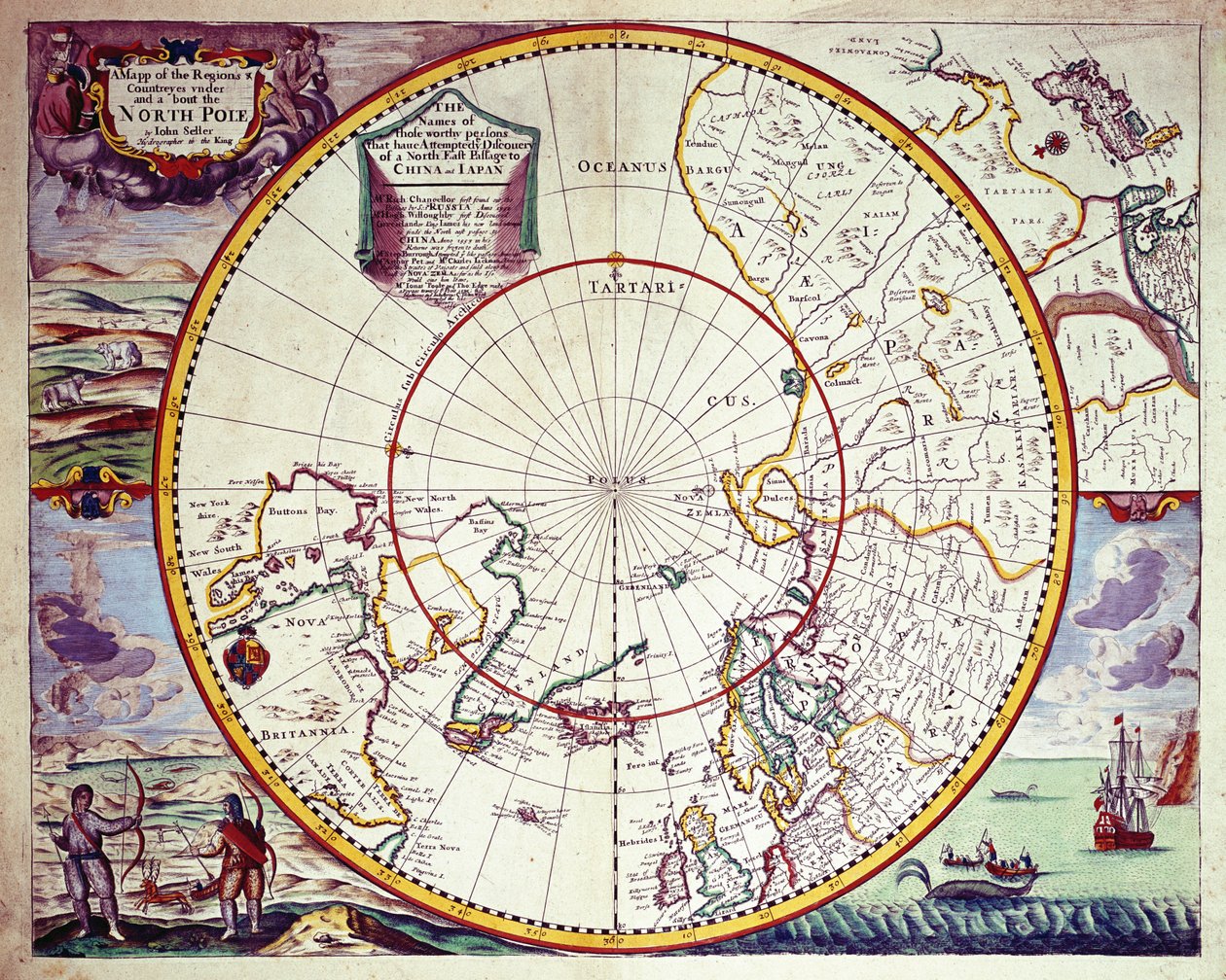
A Map of the North Pole by John Seller

A Map of the North Pole

(A Map of the North Pole (colour engraving))


John Seller

€ 113.87
Enthält 0% MwSt.
   Configure art print
Undated  ·  colour engraving  ·  Picture ID: 61569

Nonclassified artists  ·  Cartography

A Map of the North Pole by John Seller. Available as an art print on canvas, photo paper, watercolor board, uncoated paper or Japanese paper.
cartography · geography · geographical · mapping · discovery · discoveries · arctic ci hunting · whaling · border · regi countries · arctic · exploration · cartouche · Private Collection / Bridgeman Images
AR/3D   View in 3D / AR zu Favoriten hinzufügen   Add to favorites    Select wall color    View painting in a room
0 Reviews

Configure art print

Picture Frame

Medium & Stretcher

Glass & Passepartout

Miscellaneous & Extras

 Save / compare configuration
Preview Icon

Summary

Gemälde
Veredelung
Keilrahmen
Museumslizenz

€ 113.87
(inkl. 20% MwSt)
   Add to cart

Bildschärfe: PERFEKT

Should you desire adjustments to brightness and color, or a custom crop of the motif, we are happy to make these changes at no additional cost to you. Please do not hesitate to contact us.

Similar artworks selected for you

Polar Projection Map with Arctic Circle, c.1680 Terra Australis Map of Willem Barentsz Third Voyage, 1598 Polus Antarcticus Map of polar regions, by Dutch cartographer Willem Janszoon Blaeu Septentrionalium terrarum descriptio, map of the Arctic, 1595 World Map with Magellan’s Circumnavigation from Scherer’s Atlas Novus 1657 Map Polus Antarcticus Map of the Pacific Ocean engraved in Venice in the 18th century The Antarctic Pole Septentrionalium Terrarum Descriptio, c.1595 The North Polar Regions Ancient Hemispheres of the World, plate 94 from America or the New World A Map of the Countries Thirty Degrees round the North Pole, from Map of the Lands Around the Arctic Circle with the Three Voyages of the Dutch, 1598 View of the South (Antarctic) Pole (Atlas by Guillaume Delisle) World Map by Abraham Ortelius (1527-1598) North of World North and South America and New Guinea America sive India Nova, from A Map of the Americas Trajectories of planets and stars as seen from Earth, from Harmonia Macrocosmica North and South Poles, 1593 America sive India Nova, from Map of the Countries Around the Arctic Circle with the Three Voyages of the Dutch in 1598 Map charting the movement of the Earth and Planets Septentrionalium Terrarum descriptio, 1595 Hemispheriu from the Equinoctial Line to the Antarctic Circle - colored
Show more similar artworks

Other art prints by John Seller

A map of the world from Atlas maritimus by John Seller Polar Projection Map with Arctic Circle, c.1680 A Map of the North Pole A Map of the City and Port of Tripoli in Barbary A chart of the North Sea A Chart of the Trading Part of the East Indies and China, with the Adjacent Islands, from Surrat to Japan The Windward Passage from Jamaica, Between the East End of Cuba, and the West End of Hispaniola The Starry Zodiac, by the Limits of Which the Visible Paths of All the Planets Are Bounded - John Seller Author, Hydrographer of the Most Serene King The coast of England from the Southforeland to Orfordness A chart of the sea coasts of England, Flanders and Holland, c.1672 The English pilot the first book: describing the northern navigation, c.1671 Chart of the Sea Coasts of England and Ireland and of the Bay of Biscay A general chart of the northern navigation A chart of the coast of America from Newfoundland to Cape Cod A chart of the easternmost part of the East Indies with all the adjacent islands from Cape Comorin to Japan
Discover more works by John Seller

Other motives from the category Cartography

Map of the world, based on descriptions and co-ordinates given in A New and Correct Map of Hackney Marsh, 1745 Fol.10v Map of Scandinavia and Northern Russia, from Map of the Caribbean Islands and the American State of Florida Map of Brazil, from Dutch Marine Maps, 1637 Map of the Caribbean and Venezuela, from the Map of Europe, Published in 1700, Paris Map of Britain in 658, Produced by Stanford Dutch Trade Map of the Baltic Sea Map of Antwerp Map of Brobdingnag, illustration from the first edition of Map of Alexandria from A new and correct map of the world laid down according to the newest discoveries and from the most exact observations Map of Asia, Nuremberg Map of Naples, from
View More from "Cartography"

Excerpt from our top sellers

Poster for the 14th Exhibition of Vienna Secession, 1902 Sailing Ship in the Fog Vampire Portrait of the philosopher and esotericist Rudolf Steiner The School Walk, 1872 The Terrace at the Restaurant Jacob in Nienstedten on the Elbe Nude Woman in Bed, c.1914 Composition No. VII, 1913 Tulip Fields with the Rijnsburg Windmill Tiger A Moonlit Lane. Two Lovers at a Gate Moon Over Landscape Hygieia Lensing Galaxy Cluster (Webb Vertumnus
Show More Artworks


What our customers think about us


Frequently Asked Questions about Meisterdrucke


Personalizing your art print at Meisterdrucke is a simple and intuitive process that allows you to design an artwork exactly to your specifications: Choose a frame, determine the image size, decide on a printing medium, and add suitable glazing or a stretcher frame. We also offer customization options such as mats, fillets, and spacers. Our customer service is available to help you design your perfect artwork.

At Meisterdrucke, you have the fascinating option to visualize the artwork you configured directly in your own space. For a tailored preview, simply upload a photo of your room and let the artwork appear on it. If you visit us via a mobile device, be it a phone or tablet, our augmented reality feature brings the image to life and seamlessly projects it into your space. An experience that uniquely combines art and technology.

Choosing the medium is often a matter of personal taste. To give you a clearer idea, we have provided some images for each medium. For a holistic experience, we also offer you a sample set of all paper variants so you can make a decision not just visually but also haptically. You can take advantage of the sample set free of charge – only the shipping costs will apply. You can order the sample set directly.

Do not worry. At Meisterdrucke, we do not proceed mechanically. We manually review each order. If there are any inconsistencies or peculiarities in the configuration, we will immediately contact you. Of course, our courteous and patient support is always at your side to assist you with the configuration. Together with you, we adjust your image by phone or email so that the final result exactly meets your expectations.


Do you have any questions?

Are you interested in an art print from our manufactory but still unsure? Do you need advice on choosing the medium or help with the order?

Our experts are happy to assist you.

+43 4257 29415
support@meisterdrucke.com
Mo-Do: 7:00 - 16:00 | Fr: 7:00 - 13:00

Do you have any questions?

Are you interested in an art print from our manufactory but still unsure? Do you need advice on choosing the medium or help with the order?

Our experts are happy to assist you.

+43 4257 29415
support@meisterdrucke.com
Mo-Do: 7:00 - 16:00 | Fr: 7:00 - 13:00


Meisterdrucke

   Kärntner Strasse 46
        9586 Finkenstein am Faaker See
        Austria
        +43 4257 29415
        support@meisterdrucke.com
Other languages

                   
Erfahrungen & Bewertungen zu Meisterdrucke
Post.at DHL Express Quehenberger Cargoboard
Kaiser Franz Joseph

Meisterdrucke
Kärntner Strasse 46
9586 Finkenstein am Faaker See · Austria
+43 4257 29415 · office@meisterdrucke.com
Post.at DHL Express Quehenberger Cargoboard


Meisterdrucke 2734 Bewertungen auf ProvenExpert.com

(c) 2025 meisterdrucke.uk