support@meisterdrucke.com  ·  0043 4257 29415

Deutsch English Italiano Español Français Nederlands Português Svenska Polski Dansk
Search by artist, work title or style – e.g. Monet, Starry Night, Impressionism, Hokusai wave, nude. Describe the scene – e.g. green meadow, abstract with lots of red, dark oil painting, standing nude next to a tree.

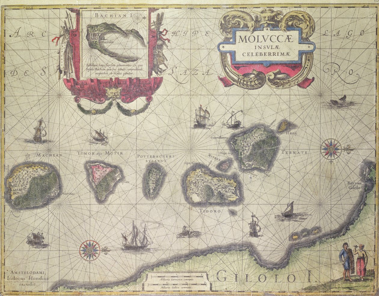
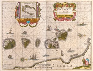
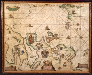
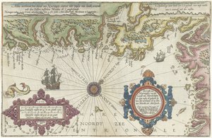
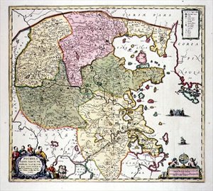
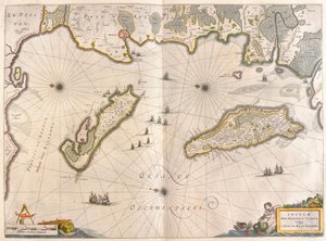
Map showing the Molucca Islands off Halmahera, 1640 by Joannes Jansson

Map showing the Molucca Islands off Halmahera, 1640

(Map showing the Molucca Islands off Halmahera, 1640 )


Joannes Jansson

€ 123.19
Tax-free
   Configure art print
1640  ·  coloured engraving  ·  Image ID: 136237

Nonclassified artists  ·  Cartography

Map showing the Molucca Islands off Halmahera, 1640 by Joannes Jansson. Available as an art print on canvas, photo paper, watercolor board, natural paper, or Japanese paper.
cartography · cartouche · explorer · spice islands · maluku · molucca sea · moluccas · chart · ships · native · navigation · mapping · exploration · iles · moluques · Private Collection / Bridgeman Images
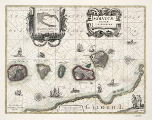
Other color versions of this image  
AR/3D   View in 3D / AR zu Favoriten hinzufügen   Add to favorites    Change wall color    View picture in a room
0 Reviews

Configure art print

Picture Frame

Medium & Stretcher

Glass & Passepartout

Miscellaneous & Extras

 Save / compare configuration
Preview Icon

Summary

Gemälde
Veredelung
Keilrahmen
Museumslizenz

€ 123.19
(inkl. 20% MwSt)
   Add to cart

Bildschärfe: PERFEKT

If you'd like us to adjust the brightness, colors, or crop the image, we're happy to do this for you at no extra cost. Just get in touch!

Similar artworks selected for you

L East Friesland 1584 Map Nova Francia (New France) Freti Magellanici ac Novi Freti Vulgo Le Maire Exactissima Delineatio European Coast, Map on Parchment by Willem and Joan Blaeu Map Part of the Coast of Norway and Sweden Map of Part of the Coast of Norway and Sweden Map showing the Island of Crete, c.1570, by Abraham Ortelius (1527-98) The coast of England from the Southforeland to Orfordness Map of the coasts of Flanders, Normandy and England. Description of the sea coasts of Flanders and Picardy (...) (title on object) Map of the island of Malta Majorca, Minorca, and Ibiza, including the coasts of Catalonia and Valencia, in Western Atlantic Ocean Map of the Coast of Flanders, Normandy and England A chart of the North Sea A general chart of the northern navigation Malta A chart of the sea coasts of England, Flanders and Holland, c.1672 Pascaart van de Noort Zee verthoonende in zich alle de Custen en havens daer rontom gelegen Nice on the Mediterranean Map of the Coast of Norway and Sweden between Merdøy and Uddevalla Map of East Africa and Madagascar, 1596 Caribbean, Honduras and Florida, in Map of the Coast of Norway and Sweden Between Merdøy and Uddevalla
Show more similar artworks

More art prints by Joannes Jansson

Map of New Belgium with a View of New Amsterdam, compiled by Nicolaes Visscher (1618-1709), c. 1651-55 Map of the Ottoman Empire, from the ‘Atlas Novus’ Map showing the Molucca Islands off Halmahera, 1640 Map showing the Molucca Islands off Halmahera, 1640 Representation of the Seven Wonders of Antiquity: The Statue of Jupiter by Phidias in Representation of the Seven Wonders of Antiquity: the Colossus of Rhodes. Atlas of Jansson Jannsonius, 1630 New Map of Switzerland America Pars Meridionalis, page 93 of Sichuan and Shanxi, China Frontispiece of the Fifth Volume of Jansson The Antarctic Pole Historical Geographical Map of Palestine. Jansson Atlas Northeastern China Representation of the Seven Wonders of Antiquity: the Temple of Diana (Artemis) in Ephesus. Atlas of Jansson Jannsonius, 1630 Representation of the Seven Wonders of Antiquity: the Gardens of Babylon. Atlas of Jansson Jannsonius, 1630
Show more works by Joannes Jansson

More motifs from the category Cartography

Map of Arnhem, Velmo, Gelre, and Ruerm, from Ms. 988, Vol. 3, fol. 7 Plan and Map of the Town, Citadel and Surroundings of Amiens, from the ’Atlas Louis XIV’, 1683-88 Map of Basel Map of Lublin, from ’Civitates Orbis Terrarum’ by Georg Braun (1541-1622) and Frans Hogenberg (1535-90), c. 1572-1617 Map of England, Britannia Antiqua, from “The Atlas of Ancient Geography” by Samuel Butler, published in London, c. 1829 Map of Paris depicting the city East Africa and the Red Sea with Prester John and the Legendary Kings of Africa, detail from a map of the Mediterranean Sea by Vesconte de Maggiolo, 1563 Ms. 986, Vol. 3, fol. 63 Plan and Map of Toulon, from the “Atlas Louis XIV”, 1683-88 Map of the Russian Empire, 1588 Map of South Pacific Island Map describing the islands of Salvador, Española, Fernanda, Isabella and Conception, 1493 Map of Tunis, from Map of the Battle of Pułtusk, published by William Blackwood and Sons, Edinburgh and London, 1848 Map of Bristol, from ’Civitates Orbis Terrarum’ by Georg Braun (1541-1622) and Frans Hogenberg (1535-90), c. 1572-1617 Map of the Siege of York in 1781, from “Guerre de l’Amérique”, 1782
View More from "Cartography"

A selection of our top sellers

The Kiss, 1907-08 Self-Portrait in an Orange Jacket Camelot, illustration from A Corner of the Garden at Montgeron, 1876-7 Collage on a Black Background Judith with the Head of Holofernes Elizabeth of Bavaria (1837-98), Empress of Austria, wife of Emperor Franz Joseph of Austria (1830-1916) Haymaking Blue, 1922 Head Study of a Lioness The Roundel in the Hedge Garden with a Flower Waterer Spruce Thicket in Snow Children of the Sea Farm Garden with Sunflowers, 1905-1906 Colored Leaves at Kaianji Temple, 1837-1844
Show more artworks


What our customers think about us


Frequently Asked Questions about Meisterdrucke


Personalizing your art print at Meisterdrucke is simple and intuitive: Choose a frame, set the image size, pick a printing medium, and add suitable glazing or a stretcher frame. We also offer additional customization options like mats, fillets, and spacers. If you have any questions, our customer service team is ready to help you create your perfect artwork.

At Meisterdrucke, you can visualize your configured artwork directly in your own room. Simply upload a photo of your space and see how the artwork looks in it. If you're visiting us on a mobile device — phone or tablet — our augmented reality feature brings the picture to life and projects it right into your room. A unique experience that combines art and technology.

Choosing the right medium is often a matter of personal taste. To give you a better idea, we've provided some images for each medium. We also offer a sample set of all paper variants, so you can decide not just visually but by touch as well. You can order the sample set free of charge — only shipping costs apply.

Don't worry! At Meisterdrucke, we don't just process orders mechanically. Every order is manually reviewed by our team. If we spot any inconsistencies or issues with your configuration, we'll get in touch with you right away. And of course, our friendly and patient support team is always here to help you with your configuration. We'll work with you by phone or email to adjust your image so the final result is exactly what you had in mind.


Still have questions?

Are you interested in an art print from our manufactory but still unsure? Do you need advice on choosing the medium or help with the order?

Our experts are happy to assist you.

+43 4257 29415
support@meisterdrucke.com

Mo-Do: 7:00 - 16:00 | Fr: 7:00 - 13:00

Still have questions?

Are you interested in an art print from our manufactory but still unsure? Do you need advice on choosing the medium or help with the order?

Our experts are happy to assist you.

+43 4257 29415
support@meisterdrucke.com
Mo-Do: 7:00 - 16:00 | Fr: 7:00 - 13:00


Meisterdrucke

   Kärntner Strasse 46
        9586 Finkenstein am Faaker See
        Austria
        +43 4257 29415
        support@meisterdrucke.com
Other languages

                   
Erfahrungen & Bewertungen zu Meisterdrucke
Post.at DHL Express Quehenberger Cargoboard
Kaiser Franz Joseph

Meisterdrucke
Kärntner Strasse 46
9586 Finkenstein am Faaker See · Austria
+43 4257 29415 · support@meisterdrucke.com
Post.at DHL Express Quehenberger Cargoboard


(c) 2026 meisterdrucke.uk