support@meisterdrucke.com  ·  0043 4257 29415

Deutsch English Italiano Español Français Nederlands Português Svenska Polski Dansk
Search by artist, work title or style – e.g. Monet, Starry Night, Impressionism, Hokusai wave, nude. Describe the scene – e.g. green meadow, abstract with lots of red, dark oil painting, standing nude next to a tree.

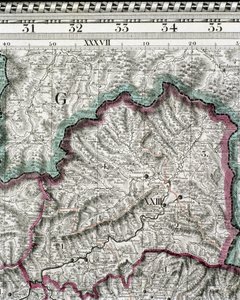
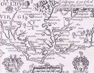
Detail of a Map of the County of Nottinghamshire Showing the Town of Nottingham by English School

Detail of a Map of the County of Nottinghamshire Showing the Town of Nottingham

(Detail of a map of the county of Nottinghamshire showing the town of Nottingham, 1642 )


English School

€ 125.55
Tax-free
   Configure art print
1642  ·  engraving  ·  Image ID: 77217

Cultural Circles  ·  Cartography

Detail of a Map of the County of Nottinghamshire Showing the Town of Nottingham by English School. Available as an art print on canvas, photo paper, watercolor board, natural paper, or Japanese paper.
mapping · cartography · geography · geographical · river trent · bingham · saxton · stuart · nottingham · Private Collection / Bridgeman Images
AR/3D   View in 3D / AR zu Favoriten hinzufügen   Add to favorites    Change wall color    View picture in a room
0 Reviews

Configure art print

Picture Frame

Medium & Stretcher

Glass & Passepartout

Miscellaneous & Extras

 Save / compare configuration
Preview Icon

Summary

Gemälde
Veredelung
Keilrahmen
Museumslizenz

€ 125.55
(inkl. 20% MwSt)
   Add to cart

Bildschärfe: PERFEKT

If you'd like us to adjust the brightness, colors, or crop the image, we're happy to do this for you at no extra cost. Just get in touch!

Similar artworks selected for you

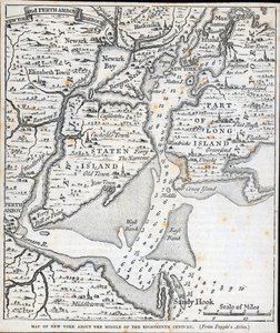
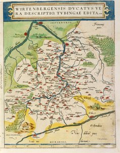
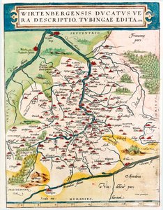
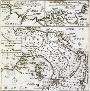
Map of Virginia, illustration from Cassell New York in the middle of the 18th century Map of Wurttemberg, from Theatrum Orbis Terrarum by Abraham Ortelius Connecticut, illustration from Cassell Connecticut Geography Map of Baden-Wuerttemberg Territory of Germany Taken from Theatrum Orbis Terrarum by Abraham Ortelius First Official Geographic Atlas of the Russian Empire (1745) Map of the Isthmus of Darien and the Gulf of Panama in A Map of Samaria, from 1513 Map Centered on Transylvania by Paolo Forlani Captain Snow Old bible in French, Old Testament Map of Lazio Region, from Theatrum Orbis Terrarum Colonial America: the Dutch Colony of New Netherland 17th century engraved illustration from a collection of proverbs by Jacques Lagniet Aquitaine, France Holland and Brabant, Belgium (engraving) The County of Leinster with the City of Dublin Described, engraved by Jodocus Hondius, from Map of Pennsylvania at the beginning of the 18th century, from Humphrey Map of Hungary and Balkans 1683 The Battle of Falkirk, 28 January 1746 View of London and Its Surroundings. Atlas by W. Blaeu Captain Snow Margraviate and Electorate of Brandenburg Connecticut Cambrey, Crevecoeur, Bouchain, in Map of Kentucke, Engraved by Henry D. Pursell, Printed by T. Rook, Philadelphia, 1784 The Course of the Rhine River in Westphalia, Germany Map of the area around Bordeaux (France)
Show more similar artworks

More art prints by English School

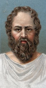
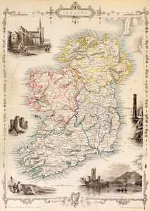
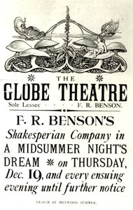
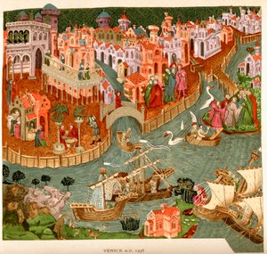
Church and Cottage with Lighted Windows Portrait of a bodybuilder, c. 1898 The Portrait of King Richard III Kidbrooke Park, Kent, formerly attributed to George Lambert (1700-65) c.1740-50 Map of Europe in 1910 Portrait of the Greek philosopher Socrates (469-399 BC) - From the series “Leaders of Men” - Chromolithography - English School, 20th century Map of Ireland from ’The History of Ireland’ by Thomas Wright, published c.1854 Map of the world with possessions of the British Empire coloured red, c. 1870 Poster advertising ‘A Midsummer Night Venice, 1338, after a manuscript in the Bodleian Library, from Detailed Map of Gallipoli Peninsula and the Dardanelles, Turkey, 1915, from Romeo buys poison from the apothecary, illustration from Romeo and Juliet, from "The Illustrated Library Shakespeare", published in London 1890 Winston Churchill on horseback in Bangalore, India in 1897, from ’A Roving Commission by Winston S. Churchill’, published by Scribner’s, 1930 Portrait of King James II, c. 1690
Show more works by English School

More motifs from the category Cartography

Map of the Kingdom of Hungary, printed by Godfried Map of Spain and Portugal, from “Geographia” Map of England and Wales, 1644 BT1.47.9 The Dedication to Queen Elizabeth I from a Book of Maps of England and Wales by Christopher Saxton, published 1579 Map of Civil War England and a View of Prague, 1632 Map of Paris from „Civitates orbis terrarum“ by Georg Braun (1541-1622) and Franz Hogenberg (1540-92), French, 1572-1617 Map No. 8 showing the route of the Armada fleet, engraved by Augustine Ryther, 1588 Map of India, published under the direction of Colonel H.R. Thuillier, R.E., Surveyor General of India, 1877 Map of Surrey, engraved by Jodocus Hondius (1563-1612) from John Speed Map of Naples, from ‘Civitates Orbis Terrarum’ by Georg Braun (1541-1622) and Frans Hogenberg (1535-90), c.1572 Map of Valencia, from ’Civitates Orbis Terrarum’ by Georg Braun (1541-1622) and Frans Hogenberg (1535-90) c.1572-1617 Ms 988 volume 3 fol.31 Map of Concarneau, from the ’Atlas Louis XIV’, 1683-88 Ms. Ital. 550.0.3.15, fol. 4v-5r. Map of the Eastern Mediterranean Coast and Islands, from the „Carte Geografiche“ Map of the World using the Mercator Projection, from Map of the Caribbean Islands
View More from "Cartography"

A selection of our top sellers

The Tortoise Trainer Rosa centifolia foliacea, hundred-petalled rose, foliacea, from Les Roses, 1817-24 Nocturne in Black and Gold: The Falling Rocket, 1875 Church in Unterach on Lake Attersee Hylas and the Water Nymphs Soft Hard Stables Cubist Lilies The Quiet Room Moonlight over Lake Lucerne before the backdrop of Salvator Mundi, c. 1500 The Lament for Icarus Japanese Vase with Roses and Anemones, 1890 The Japanese Footbridge and the Water Lily Pool, Giverny The Equatorial Jungle, 1909
Show more artworks


What our customers think about us


Frequently Asked Questions about Meisterdrucke


Personalizing your art print at Meisterdrucke is simple and intuitive: Choose a frame, set the image size, pick a printing medium, and add suitable glazing or a stretcher frame. We also offer additional customization options like mats, fillets, and spacers. If you have any questions, our customer service team is ready to help you create your perfect artwork.

At Meisterdrucke, you can visualize your configured artwork directly in your own room. Simply upload a photo of your space and see how the artwork looks in it. If you're visiting us on a mobile device — phone or tablet — our augmented reality feature brings the picture to life and projects it right into your room. A unique experience that combines art and technology.

Choosing the right medium is often a matter of personal taste. To give you a better idea, we've provided some images for each medium. We also offer a sample set of all paper variants, so you can decide not just visually but by touch as well. You can order the sample set free of charge — only shipping costs apply.

Don't worry! At Meisterdrucke, we don't just process orders mechanically. Every order is manually reviewed by our team. If we spot any inconsistencies or issues with your configuration, we'll get in touch with you right away. And of course, our friendly and patient support team is always here to help you with your configuration. We'll work with you by phone or email to adjust your image so the final result is exactly what you had in mind.


Still have questions?

Are you interested in an art print from our manufactory but still unsure? Do you need advice on choosing the medium or help with the order?

Our experts are happy to assist you.

+43 4257 29415
support@meisterdrucke.com

Mo-Do: 7:00 - 16:00 | Fr: 7:00 - 13:00

Still have questions?

Are you interested in an art print from our manufactory but still unsure? Do you need advice on choosing the medium or help with the order?

Our experts are happy to assist you.

+43 4257 29415
support@meisterdrucke.com
Mo-Do: 7:00 - 16:00 | Fr: 7:00 - 13:00


Meisterdrucke

   Kärntner Strasse 46
        9586 Finkenstein am Faaker See
        Austria
        +43 4257 29415
        support@meisterdrucke.com
Other languages

                   
Erfahrungen & Bewertungen zu Meisterdrucke
Post.at DHL Express Quehenberger Cargoboard
Kaiser Franz Joseph

Meisterdrucke
Kärntner Strasse 46
9586 Finkenstein am Faaker See · Austria
+43 4257 29415 · support@meisterdrucke.com
Post.at DHL Express Quehenberger Cargoboard


(c) 2026 meisterdrucke.uk