support@meisterdrucke.com  ·  0043 4257 29415

Deutsch English Italiano Español Français Nederlands Português Svenska Polski Dansk
Search by artist, work title or style – e.g. Monet, Starry Night, Impressionism, Hokusai wave, nude. Describe the scene – e.g. green meadow, abstract with lots of red, dark oil painting, standing nude next to a tree.

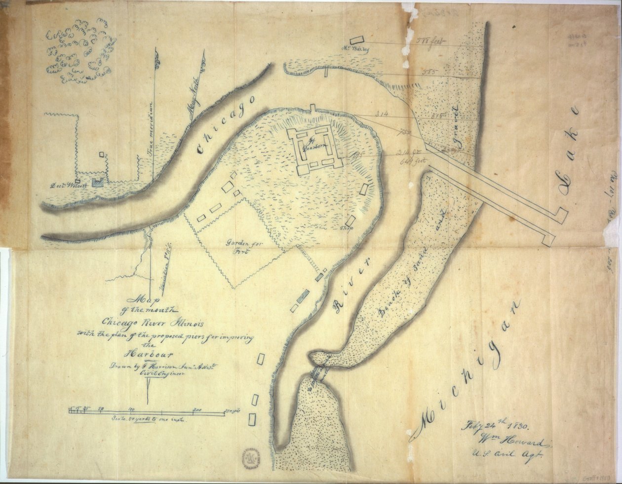
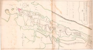
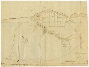
Map of the mouth of the Chicago River, Illinois with the plan of the proposed piers for improving the harbour, 1830 by E. Harrison

Map of the mouth of the Chicago River, Illinois with the plan of the proposed piers for improving the harbour, 1830

(Map of the mouth of the Chicago River, Illinois with the plan of the proposed piers for improving the harbour, 1830 )


E. Harrison

€ 121.41
Tax-free
   Configure art print
1830  ·  pen and ink on paper  ·  Image ID: 363760

Nonclassified artists  ·  Cartography

Map of the mouth of the Chicago River, Illinois with the plan of the proposed piers for improving the harbour, 1830 by E. Harrison. Available as an art print on canvas, photo paper, watercolor board, natural paper, or Japanese paper.
harbor · american city · redevelopment · city planning · plan · lake michigan · civil engineer · port · mid-west · midwest · america · american · North America · Newberry Library, Chicago, Illinois, USA / Bridgeman Images
AR/3D   View in 3D / AR zu Favoriten hinzufügen   Add to favorites    Change wall color    View picture in a room
0 Reviews

Configure art print

Picture Frame

Medium & Stretcher

Glass & Passepartout

Miscellaneous & Extras

 Save / compare configuration
Preview Icon

Summary

Gemälde
Veredelung
Keilrahmen
Museumslizenz

€ 121.41
(inkl. 20% MwSt)
   Add to cart

Bildschärfe: PERFEKT

If you'd like us to adjust the brightness, colors, or crop the image, we're happy to do this for you at no extra cost. Just get in touch!

Similar artworks selected for you

Map of Yorktown, Virginia, October 1781 Section of the Northern Course of the Canal from the Tide in the Elk River at Frenchtown to the Forked [Oak] in Mr. Rudulph Disposition of British Troops, with Fortifications North of Fort Knipehausen to Fort Independence Plan of the Map of Hoogly River A Topographical Sketch of New York Ms.255171 Estate map of Belchamp St. Paul, 1576 (detail) Draft for the Park Layout at the Future Royal Residence in Christiania Confederate Civil War map of the Army of Mississippi camp at Corinth, Mississippi, May 1862 Roy Military Survey of Scotland Seneca lands in 1802 Battle of Green Spring, Map of the Land on the Left Bank of the James River Opposite Jamestown in Virginia Where the Battle of July 6 A Survey of English Harbour in the Island of Antigua made by Order of Commissioner Laforey in 1783 Talke - Clough Hall A Rough Draft of Dublin Bay Battle of Camden, Augt. 16 Chart of Kinsale Vicinity of Harpers Ferry Map of Willesden, London (litho) A survey of the Kings lordship or manor of East Greenwich Map from "Red Books", for "Mogenhanger in Bedfordshire, a Seat of Godfrey Thornton Esq." (1792) Map of Willesden, London Plan of Paulus Chart of Kinsale Survey of the Field of Agincourt Dudley Castle British map of the Siege of Yorktown, 1781 Map of Christiania and Akershus Map of Phillipsburg, from
Show more similar artworks

More motifs from the category Cartography

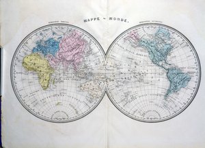
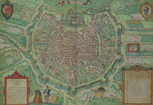
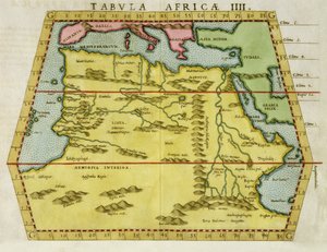
World map, illustration from Atlas Géographique Moderne by Prosper-Auguste Poulain de Bossay, c. 1850 Map of the island of Martinique, 1599 Map of India and the East Indies A map showing the journey of the Israelites out of Egypt and into Canaan, facsimile of an image from the Geneva Bible of 1560 Map of Madras at the time of the capture of the town and Fort of St. George in 1746 by the French under the command of Mahé de la Bourdonnais, 1750 Map of Milan, from Civitates Orbis Terrarum by Georg Braun (1541-1622) and Frans Hogenburg (1535-90), c. 1572 Map of the return of the 8th Crusade in 1270 with the resting places of Louis IX Map of Scotland, c.1700 Ms 466 fol. 1 Map of the city of Jerusalem, before 1167 Map of Rovigo, from “Les Villes de Venetie”, 1704, published by Pierre Mortier in Amsterdam A Map of Old London Bridge, London, 1746 Part of Africa, from an Atlas of the World in 33 Maps, Venice, 1st September 1553 (detail) Atlas 131 F fol. 2, Map of Bas-Poitou, Pays d Map of the route taken by Vitus Bering (1681-1741) across Siberia to Kamchatka, from Navigantium atque Itinerantium Bibliotheca, published 1744 Map of North Africa, c. 1580s
View More from "Cartography"

A selection of our top sellers

Waterlilies: Green Reflections, 1914-18 (left and right section) Flowers on the windowsill Emilie Flöge, 1902 The Apple Tree The Apparition Red Tree Flowering Garden in Spring Theater of Marcellus Tulip Fields with the Rijnsburg Windmill, 1886 Orchard with roses Roses, 1890 Roaring Stag in the Mountains Danaë, 1907 The Sun The Art of Painting
Show more artworks


What our customers think about us


Frequently Asked Questions about Meisterdrucke


Personalizing your art print at Meisterdrucke is simple and intuitive: Choose a frame, set the image size, pick a printing medium, and add suitable glazing or a stretcher frame. We also offer additional customization options like mats, fillets, and spacers. If you have any questions, our customer service team is ready to help you create your perfect artwork.

At Meisterdrucke, you can visualize your configured artwork directly in your own room. Simply upload a photo of your space and see how the artwork looks in it. If you're visiting us on a mobile device — phone or tablet — our augmented reality feature brings the picture to life and projects it right into your room. A unique experience that combines art and technology.

Choosing the right medium is often a matter of personal taste. To give you a better idea, we've provided some images for each medium. We also offer a sample set of all paper variants, so you can decide not just visually but by touch as well. You can order the sample set free of charge — only shipping costs apply.

Don't worry! At Meisterdrucke, we don't just process orders mechanically. Every order is manually reviewed by our team. If we spot any inconsistencies or issues with your configuration, we'll get in touch with you right away. And of course, our friendly and patient support team is always here to help you with your configuration. We'll work with you by phone or email to adjust your image so the final result is exactly what you had in mind.


Still have questions?

Are you interested in an art print from our manufactory but still unsure? Do you need advice on choosing the medium or help with the order?

Our experts are happy to assist you.

+43 4257 29415
support@meisterdrucke.com

Mo-Do: 7:00 - 16:00 | Fr: 7:00 - 13:00

Still have questions?

Are you interested in an art print from our manufactory but still unsure? Do you need advice on choosing the medium or help with the order?

Our experts are happy to assist you.

+43 4257 29415
support@meisterdrucke.com
Mo-Do: 7:00 - 16:00 | Fr: 7:00 - 13:00


Meisterdrucke

   Kärntner Strasse 46
        9586 Finkenstein am Faaker See
        Austria
        +43 4257 29415
        support@meisterdrucke.com
Other languages

                   
Erfahrungen & Bewertungen zu Meisterdrucke
Post.at DHL Express Quehenberger Cargoboard
Kaiser Franz Joseph

Meisterdrucke
Kärntner Strasse 46
9586 Finkenstein am Faaker See · Austria
+43 4257 29415 · support@meisterdrucke.com
Post.at DHL Express Quehenberger Cargoboard


(c) 2026 meisterdrucke.uk