support@meisterdrucke.com  ·  0043 4257 29415

Deutsch English Italiano Español Français Nederlands Português Svenska Polski Dansk
Search by artist, work title or style – e.g. Monet, Starry Night, Impressionism, Hokusai wave, nude. Describe the scene – e.g. green meadow, abstract with lots of red, dark oil painting, standing nude next to a tree.

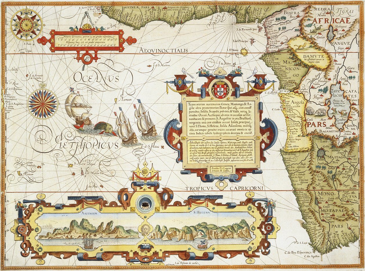
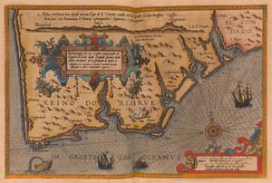
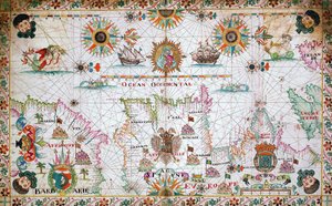
Map of the West African Coastline, 1596 by Arnold Florent van Langren

Map of the West African Coastline, 1596

(Map of West African coastline, 1596 (hand coloured engraving))


Arnold Florent van Langren

€ 127.04
Tax-free
   Configure art print
1596  ·  hand coloured engraving  ·  Image ID: 175078

Nonclassified artists  ·  Cartography

Map of the West African Coastline, 1596 by Arnold Florent van Langren. Available as an art print on canvas, photo paper, watercolor board, natural paper, or Japanese paper.
coast · chart · atlantic ocean · namibia · South Africa · Private Collection / Bridgeman Images
AR/3D   View in 3D / AR zu Favoriten hinzufügen   Add to favorites    Change wall color    View picture in a room
0 Reviews

Configure art print

Picture Frame

Medium & Stretcher

Glass & Passepartout

Miscellaneous & Extras

 Save / compare configuration
Preview Icon

Summary

Gemälde
Veredelung
Keilrahmen
Museumslizenz

€ 127.04
(inkl. 20% MwSt)
   Add to cart

Bildschärfe: PERFEKT

If you'd like us to adjust the brightness, colors, or crop the image, we're happy to do this for you at no extra cost. Just get in touch!

Similar artworks selected for you

Map of the Republic of Genoa From East Africa to the Tip of Ceylon Map, illustration from the Illustration from the A 16th Century Map of Africa Map of the newly discovered Nova Zembla, illustration from Diarium Nauticum, seu vera descriptio trium navigationum admirandarum... by Gerrit de Veer, 1598 East Friesland 1584 Map The Republic of Genoa, Map by Jan Baptist Vrients from Theatrum Orbis Terrarum by Abraham Ortelius Nova Francia (New France) Straits of Magellan (engraving) Oversize Atlas Titled Chart of the English Channel Map of the English Coast Between the Isle of Wight and Dover Map of the English Coast between the Isle of Wight and Dover Dutch Trade Map of the Baltic Sea Chart of the north-east Atlantic, from Ireland to Cape Verde, c.1600 Map of the Magellan Straits, Patagonia, from the Mercator Atlas published by Jodocus Hondius (1563-1612), Amsterdam, 1606 Maris Pacifici A Map of East Africa, Arabia and India Venezuela, Trinidad, Tobago, Tortuga, Antilles, Caribbean, in New and Accurate Map of the Lands and Kingdoms of California, New Spain, Mexico, and Peru Map of Netherlands, from Theatrum Orbis Terrarum by Abraham Ortelius DeBry Map of Caribbean & Florida 1594 The Azores, according to the Atlas of Ortelius Strait of Magellan, Tierra del Fuego, from Chart of the western Mediterranean showing the north African and Spanish coasts, and the Atlantic Republic of Genoa, Map by Jan Baptist Vrients, Copper engraving Map of Livonia Map of East Africa and Madagascar, 1596
Show more similar artworks

More motifs from the category Cartography

Map of Venice, by Sebastian Münster (1488-1552), published in Basel, c. 1560 The Continent of Africa, from an Atlas of the World in 33 Maps, Venice, 1st September 1553 Ms. 986, Vol. 1, Plan and Map of Cambrai, from the “Atlas Louis XIV”, 1683-88 Map of Jerusalem and the surrounding area, from World Map, early 18th century Map of Cutch and Kathiawar, published under the direction of Colonel G.C. de Pree, S.C., Surveyor General of India, 1885 MS CCC 2* f.2v Map of Palestine Map of Berlin, published by Carl Glück Verlag, Berlin, 1860 A Map inspired by Candide by François Voltaire (1694-1778) for a competition organised by the École Nationale des Ponts et Chaussées in Paris, late 18th century Fol. 30v Map of the Sea of Maluku, from the Map of the World in Two Hemispheres, from Map of Leipzig, from „Civitates Orbis Terrarum“ by Georg Braun (1541-1622) and Frans Hogenberg (1535-90), c. 1572 Map Depicting North Africa, from an Atlas by Ptolemy, 1st Half of the 16th Century Map of the Austrian Empire, c. 1750 Map representing the approximate tonnage of wines and spirits in circulation in France in 1857 by water and by railway, 1860
View More from "Cartography"

A selection of our top sellers

Poppy field The Resurrection of Christ, from the right wing of the Isenheim Altarpiece, c.1512-16, detail of 17677 Lake Geneva with Mont Blanc in the Dawn Glow Poplars on the River Seine Lady in Yellow, 1899 After the Bath The Palace of the Queen of the Night, Set Design for Tsuki Plain in Kai Province (Kai tsuki no hara), from the series Thirty-six Views of Mount Fuji The Bookworm Blue Horse I Genealogical tree of the Rougon-Macquart family Yellow-Red-Blue Sails on the Sea, Valencia Italian Landscape with Umbrella Pines, 1807 The Zaporozhye Cossacks Writing a Letter to the Turkish Sultan, 1890-91
Show more artworks


What our customers think about us


Frequently Asked Questions about Meisterdrucke


Personalizing your art print at Meisterdrucke is simple and intuitive: Choose a frame, set the image size, pick a printing medium, and add suitable glazing or a stretcher frame. We also offer additional customization options like mats, fillets, and spacers. If you have any questions, our customer service team is ready to help you create your perfect artwork.

At Meisterdrucke, you can visualize your configured artwork directly in your own room. Simply upload a photo of your space and see how the artwork looks in it. If you're visiting us on a mobile device — phone or tablet — our augmented reality feature brings the picture to life and projects it right into your room. A unique experience that combines art and technology.

Choosing the right medium is often a matter of personal taste. To give you a better idea, we've provided some images for each medium. We also offer a sample set of all paper variants, so you can decide not just visually but by touch as well. You can order the sample set free of charge — only shipping costs apply.

Don't worry! At Meisterdrucke, we don't just process orders mechanically. Every order is manually reviewed by our team. If we spot any inconsistencies or issues with your configuration, we'll get in touch with you right away. And of course, our friendly and patient support team is always here to help you with your configuration. We'll work with you by phone or email to adjust your image so the final result is exactly what you had in mind.


Still have questions?

Are you interested in an art print from our manufactory but still unsure? Do you need advice on choosing the medium or help with the order?

Our experts are happy to assist you.

+43 4257 29415
support@meisterdrucke.com

Mo-Do: 7:00 - 16:00 | Fr: 7:00 - 13:00

Still have questions?

Are you interested in an art print from our manufactory but still unsure? Do you need advice on choosing the medium or help with the order?

Our experts are happy to assist you.

+43 4257 29415
support@meisterdrucke.com
Mo-Do: 7:00 - 16:00 | Fr: 7:00 - 13:00


Meisterdrucke

   Kärntner Strasse 46
        9586 Finkenstein am Faaker See
        Austria
        +43 4257 29415
        support@meisterdrucke.com
Other languages

                   
Erfahrungen & Bewertungen zu Meisterdrucke
Post.at DHL Express Quehenberger Cargoboard
Kaiser Franz Joseph

Meisterdrucke
Kärntner Strasse 46
9586 Finkenstein am Faaker See · Austria
+43 4257 29415 · support@meisterdrucke.com
Post.at DHL Express Quehenberger Cargoboard


(c) 2026 meisterdrucke.uk