support@meisterdrucke.com  ·  0043 4257 29415

Deutsch English Italiano Español Français Nederlands Português Svenska Polski Dansk
Search by artist, work title or style – e.g. Monet, Starry Night, Impressionism, Hokusai wave, nude. Describe the scene – e.g. green meadow, abstract with lots of red, dark oil painting, standing nude next to a tree.

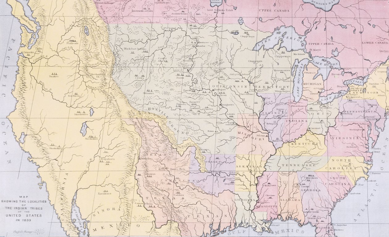
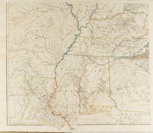
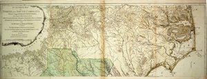
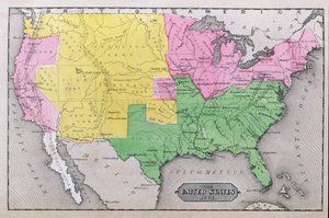
Map showing the localities of the Indian tribes of the US in 1833, illustration from

Map showing the localities of the Indian tribes of the US in 1833, illustration from 'The Indian Tribes of North America, Vol. 3', by Thomas L. McKenney and James Hall, published by John Grant

(Map showing the localities of the Indian tribes of the US in 1833, illustration from 'The Indian Tribes of North America, Vol.3', by Thomas L. McKenney and James Hall, pub. by John Grant (colour litho)


George Catlin

€ 120.98
Tax-free
   Configure art print
Undated  ·  colour lithograph  ·  Image ID: 95703

American Art  ·  Cartography

Map showing the localities of the Indian tribes of the US in 1833, illustration from 'The Indian Tribes of North America, Vol. 3', by Thomas L. McKenney and James Hall, published by John Grant by George Catlin. Available as an art print on canvas, photo paper, watercolor board, natural paper, or Japanese paper.
united states of america · tribe · native american indian · indians · Private Collection / Bridgeman Images
AR/3D   View in 3D / AR zu Favoriten hinzufügen   Add to favorites    Change wall color    View picture in a room
0 Reviews

Configure art print

Picture Frame

Medium & Stretcher

Glass & Passepartout

Miscellaneous & Extras

 Save / compare configuration
Preview Icon

Summary

Gemälde
Veredelung
Keilrahmen
Museumslizenz

€ 120.98
(inkl. 20% MwSt)
   Add to cart

Bildschärfe: PERFEKT

If you'd like us to adjust the brightness, colors, or crop the image, we're happy to do this for you at no extra cost. Just get in touch!

Similar artworks selected for you

Map of the United States in 1861, from “Our Whole Country: The Past and Present of the United States, Historical and Descriptive”, by John Warner Barber and Henry Hare, 1861 Persia, Afghanistan and Baluchistan in 1892 Map to Illustrate the Route of Prince Maximilian of Wied in the Interior of North America from Boston to the Upper Missouri Map of North America with locations of Native American tribes, 1841 Map of Manitoba and the North West, 1902 Argow with Southern Part of Zurichgow Map of the state of Texas, 1835 Growth Map of United States Gray Map of the British Dominions of North America, 1772 Lloyd The Colonies of North America at the Declaration of Independence A Map of the United States of North America The colonies of North America at the declaration of independence Persia, Georgia and Independent Tartary, from Map of China and Japan in the Middle of the 19th Century Map of the United States in 1803, from Map of the Russian Empire Mitchell A map of the British and French dominions in North America with the roads, distances, limits and extent of the settlements, humbly inscribed to the Right Honourable the Earl of Halifax and the other Right Honourable the Lords Commissioners for Trade & Plan Map of Central Asia 1842 Map of Central Asia Map of Cutch and Bombay Presidency, India, 1898 Map of the Colonies of North America at the Time of the Declaration of Independence Map of Massachusetts, from An Accurate Map of Canada, with the Adjacent Countries Map Illustrating the Campaign Preceding the Treaty of Campo-Formio, 1797, 1896 Colombia and Venezuela Map of North and South Carolina
Show more similar artworks

More art prints by George Catlin

St. Louis from the River Below, 1832-1833 Buffalo Hunt, plate 7 from Catlin Comanche Feats of Horsemanship, 1834-35 Excavating a Canoe - Nayas Indians, 1855-1869. Shé-de-ah, Wild Sage, a Wichita Woman, 1834 Osage hunters catching wild horses Fort Union, Mouth of the Yellowstone River, 2000 Miles above St. Louis, 1832 Mouth of the Platte River, 900 Miles above St. Louis, 1832 Buffalo Herds Crossing the Upper Missouri, 1832 View in the Cross Timbers, Texas, 1832 or 1834-1835 Indians of America: Bear Dance, ritual of a tribe of Red Skin. Illustration by George Catlin (1794-1872) Map showing the localities of the Indian tribes of the US in 1833, illustration from Comanche Indians Chasing Buffalo with Lances and Bows, 1846-1848 The Buffalo Hunt, c. 1832 Indians of America: Portrait of a leader of the Sauk and Fox tribe
Show more works by George Catlin

More motifs from the category Cartography

Maps of the Moon, Illustration from Sidereus Nuncius by Galileo Galilei, 1610 Fol. 7v: Map of the North Pole, from Map of the Western Part of the Roman Empire, 1763 Map of Raleigh Map of the Great Lakes Map of New Belgium with a View of New Amsterdam, compiled by Nicolaes Visscher (1618-1709), c. 1651-55 Map of New Spain, New Galicia and Guatemala, 1625 World map of the different time zones, published by Blondel La Rougery in Paris c.1920 Map of Northumberland, from Renaissance map of Europe, Jacopo Russo (after) 1528 Map of Southern Italy, Corsica, and Sardinia known in Ancient Times as Great Greece or Magna Graecia, early 18th century Maps of Holy Island and Farne Island, Northumberland, from Map of Spain and Portugal, from “Smith A Map of Moorfields and Hoxton, London, 1746 Map of Canterbury, from
View More from "Cartography"

A selection of our top sellers

Roses, 1890 Nymphs and Satyr Striped Jug with Spring Flowers, 1992 Standing Girl Virgin and Child Lady in Yellow, 1899 Winter Landscape with Ice Skaters, circa 1608 Dante and Virgil Avenue near Arles with Houses The Foxes Irises Villa by the Sea Psyche entering Cupid The Great Wave off the Coast of Kanagawa, c. 1829-c. 1831 Hygieia
Show more artworks


What our customers think about us


Frequently Asked Questions about Meisterdrucke


Personalizing your art print at Meisterdrucke is simple and intuitive: Choose a frame, set the image size, pick a printing medium, and add suitable glazing or a stretcher frame. We also offer additional customization options like mats, fillets, and spacers. If you have any questions, our customer service team is ready to help you create your perfect artwork.

At Meisterdrucke, you can visualize your configured artwork directly in your own room. Simply upload a photo of your space and see how the artwork looks in it. If you're visiting us on a mobile device — phone or tablet — our augmented reality feature brings the picture to life and projects it right into your room. A unique experience that combines art and technology.

Choosing the right medium is often a matter of personal taste. To give you a better idea, we've provided some images for each medium. We also offer a sample set of all paper variants, so you can decide not just visually but by touch as well. You can order the sample set free of charge — only shipping costs apply.

Don't worry! At Meisterdrucke, we don't just process orders mechanically. Every order is manually reviewed by our team. If we spot any inconsistencies or issues with your configuration, we'll get in touch with you right away. And of course, our friendly and patient support team is always here to help you with your configuration. We'll work with you by phone or email to adjust your image so the final result is exactly what you had in mind.


Still have questions?

Are you interested in an art print from our manufactory but still unsure? Do you need advice on choosing the medium or help with the order?

Our experts are happy to assist you.

+43 4257 29415
support@meisterdrucke.com

Mo-Do: 7:00 - 16:00 | Fr: 7:00 - 13:00

Still have questions?

Are you interested in an art print from our manufactory but still unsure? Do you need advice on choosing the medium or help with the order?

Our experts are happy to assist you.

+43 4257 29415
support@meisterdrucke.com
Mo-Do: 7:00 - 16:00 | Fr: 7:00 - 13:00


Meisterdrucke

   Kärntner Strasse 46
        9586 Finkenstein am Faaker See
        Austria
        +43 4257 29415
        support@meisterdrucke.com
Other languages

                   
Erfahrungen & Bewertungen zu Meisterdrucke
Post.at DHL Express Quehenberger Cargoboard
Kaiser Franz Joseph

Meisterdrucke
Kärntner Strasse 46
9586 Finkenstein am Faaker See · Austria
+43 4257 29415 · support@meisterdrucke.com
Post.at DHL Express Quehenberger Cargoboard


(c) 2026 meisterdrucke.uk