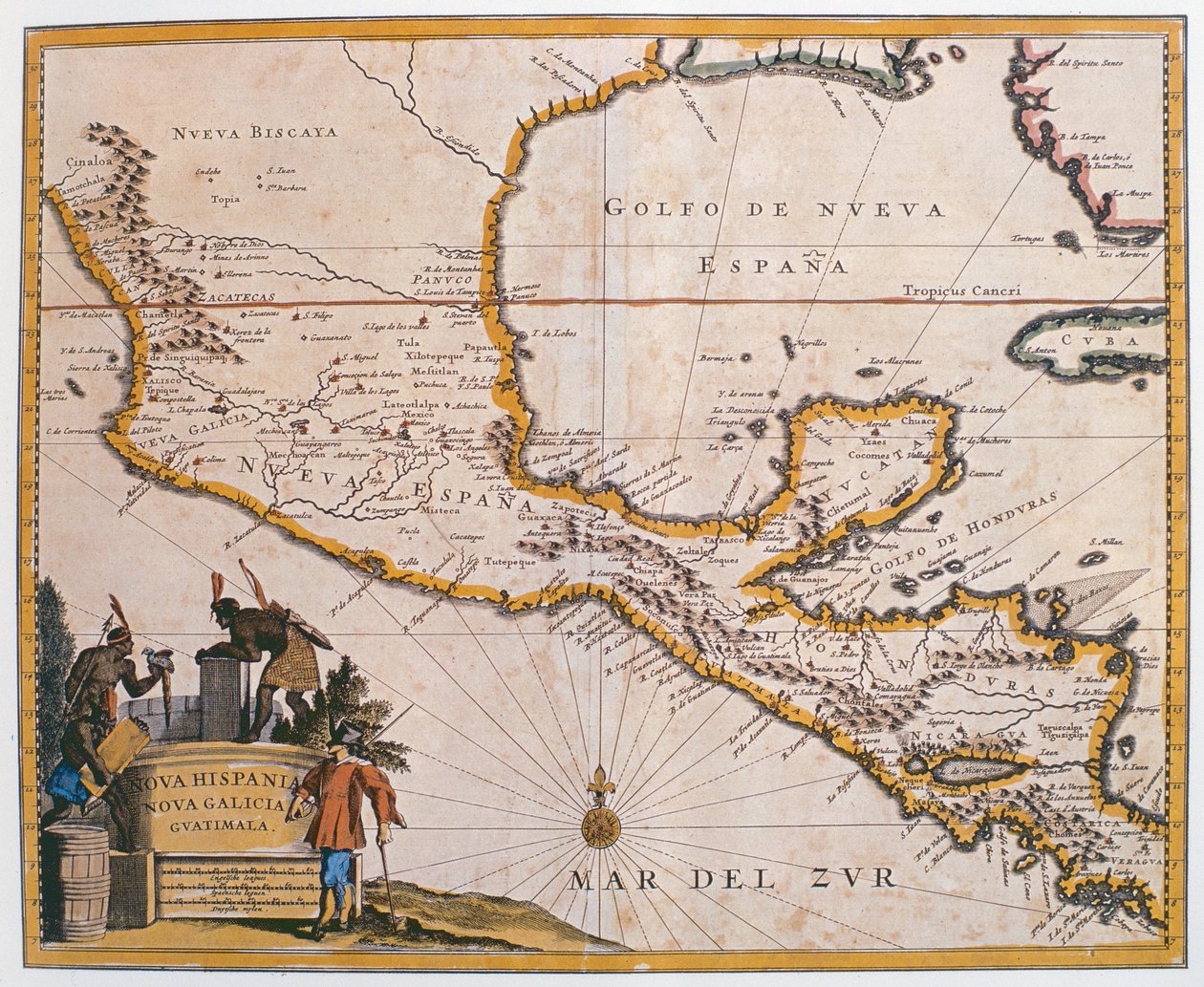
Map of New Spain, New Galicia and Guatemala, 1625 by Spanish School

Map of New Spain, New Galicia and Guatemala, 1625

(Map of New Spain, New Galicia and Guatemala, 1625 )


Spanish School

€ 110.72
Enthält 0% MwSt.
   Configure art print
1625  ·  coloured engraving  ·  Picture ID: 445333

Cultural Circles  ·  Cartography

Map of New Spain, New Galicia and Guatemala, 1625 by Spanish School. Available as an art print on canvas, photo paper, watercolor board, uncoated paper or Japanese paper.
nueva espana · nueva biscaya · mar del zur · cuba · honduras · cartography · mapping · Biblioteca Nacional de Mexico, Mexico / Bridgeman Images
AR/3D   View in 3D / AR zu Favoriten hinzufügen   Add to favorites    Select wall color    View painting in a room
0 Reviews

Configure art print

Picture Frame

Medium & Stretcher

Glass & Passepartout

Miscellaneous & Extras

 Save / compare configuration
Preview Icon

Summary

Gemälde
Veredelung
Keilrahmen
Museumslizenz

€ 110.72
(inkl. 20% MwSt)
   Add to cart

Bildschärfe: PERFEKT

Should you desire adjustments to brightness and color, or a custom crop of the motif, we are happy to make these changes at no additional cost to you. Please do not hesitate to contact us.

Similar artworks selected for you

The Caribbean Sea: The Bermuda Triangle between the Bermuda Archipelago, Miami, and Puerto Rico. According to Wilhelm Blaeu The Caribbean Sea: Gulf of Mexico and Caribbean Sea from the Atlas of Wilhelm Blaeu Strait of Magellan, Tierra del Fuego, from The Caribbean archipelago, based on an Atlas of 1798 Map of Central America New Belgium, plate from Map of Mexico or New Spain, 1625 Map of New Belgium with a View of New Amsterdam, compiled by Nicolaes Visscher c.1651-55 Map of New Belgium and New England Tabula Magellanica: Map of Strait of Magellan Gulf of Mexico and the Caribbean, from Blaeu Novi Belgii Map of the Island of Haiti New discoveries by the Russians to the north of the South Seas, both in Asia and in America, engraving by G. Zuliani taken from Tome I of the Newest Atlas published in Venice in 1776 by Antonio Zatta Mexico and Florida North America Map of Central and North America, Published in 1700, Paris New Netherland and New England, 1682 The Famous West Indian Voyage Made by the English Fleet of 23 Ships and Barks Pascaart van de Noort Zee verthoonende in zich alle de Custen en havens daer rontom gelegen North America A New Map of the English Plantations in America California or New Carolina - Theater of the Works, Apostles of the Society of Jesus in North America Freti Magellanici ac Novi Freti Vulgo Le Maire Exactissima Delineatio Map of the Mexican Archipelago Argentina, Chile, Strait of Magellan, Land of Fire, in Map of Africa, India, Indian Ocean and East Indies Venezuela, Trinidad, Tobago, Tortuga, Antilles, Caribbean, in A Chart of the West Indies from Cape Cod to River Oronoque from Atlas Maritimus by John Seller
Show more similar artworks

Other art prints by Spanish School

Cristo de Burgos, in the Capilla del Santisimo Cristo Map of Tenochtitlan and the Gulf of Mexico, from Praeclara Ferdinadi Cortesii de Nova maris Oceani Hyspania Narratio by Hernando Cortes (1485-1547) 1524 Map Showing the Route of Christopher Columbus on His First Voyage to the New World Angels and David with the Ark of the Covenant standing before the Temple of Solomon, from the Visigothic-Mozarabic Bible of St. Isidores, A.D. 960 Genealogy of the Inca Rulers and Their Spanish Successors from Manco Capac to Ferdinand VI of Spain, c.1750 Map of the Island of Mallorca, 1785 The Hand of God (Detail) Game of pelota in the open air, from the manuscript made under the direction of Alfonso X The Wise, King of Castile and Leon Anacaona, the Golden Flower Miquelet Lock, late 17th century Diego Columbus, eldest son of Columbus Assassination of Julius Caesar Tomb of the Navigator Christopher Columbus Muhammad Beatriz Enriquez de Arana, mistress of Columbus
Discover more works by Spanish School

Other motives from the category Cartography

Map of Siberia Showing the Immense Natural Resources of the Area and Depicting a Sea Route Which Would Open Up Trade, 1933 Map of the Turkish Empire, from the Mercator Atlas pub. by Jodocus Hondius Amsterdam, 1606 Map of the route taken by Vitus Bering across Siberia to Kamchatka, from Navigantium atque Itinerantium Bibliotheca published 1744 Map of Naples, c.1600 Indian campaign of 1832: Map of the country Map of the Old and New Worlds, c.1500 Map No.5 Showing the route of the Armada fleet, engraved by Augustine Ryther Map of Serravalle, from Map of the World Map of Manhattan World Map Cyprus, Renaissance map of Europe, Jacopo Russo (after) 1528 Map of Ancient Egypt Map showing Tycho Brahe Map of Le Marais, Paris
View More from "Cartography"

Excerpt from our top sellers

Tsuki Plain in Kai Province, from the series Thirty-six Views of Mount Fuji Self-Portrait in Orange Jacket Dining Room on the Garden, 1934-35 The Dolphin Fresco in the Queen Portrait of a Lady Self-Portrait at a Young Age Snow at Benzaiten Shrine in the Pond of Inokashira, 1843-1847 Kumoi Cherry Trees Impression, Sunrise The Geographer Avenue in Overveen Hylas and the Nymphs Reclining Female Nude with Spread Legs Standing Male Nude Senecio (Old Man)
Show More Artworks


What our customers think about us


Frequently Asked Questions about Meisterdrucke


Personalizing your art print at Meisterdrucke is a simple and intuitive process that allows you to design an artwork exactly to your specifications: Choose a frame, determine the image size, decide on a printing medium, and add suitable glazing or a stretcher frame. We also offer customization options such as mats, fillets, and spacers. Our customer service is available to help you design your perfect artwork.

At Meisterdrucke, you have the fascinating option to visualize the artwork you configured directly in your own space. For a tailored preview, simply upload a photo of your room and let the artwork appear on it. If you visit us via a mobile device, be it a phone or tablet, our augmented reality feature brings the image to life and seamlessly projects it into your space. An experience that uniquely combines art and technology.

Choosing the medium is often a matter of personal taste. To give you a clearer idea, we have provided some images for each medium. For a holistic experience, we also offer you a sample set of all paper variants so you can make a decision not just visually but also haptically. You can take advantage of the sample set free of charge – only the shipping costs will apply. You can order the sample set directly.

Do not worry. At Meisterdrucke, we do not proceed mechanically. We manually review each order. If there are any inconsistencies or peculiarities in the configuration, we will immediately contact you. Of course, our courteous and patient support is always at your side to assist you with the configuration. Together with you, we adjust your image by phone or email so that the final result exactly meets your expectations.


Do you have any questions?

Are you interested in an art print from our manufactory but still unsure? Do you need advice on choosing the medium or help with the order?

Our experts are happy to assist you.

+43 4257 29415
support@meisterdrucke.com
Mo-Do: 7:00 - 16:00 | Fr: 7:00 - 13:00

Do you have any questions?

Are you interested in an art print from our manufactory but still unsure? Do you need advice on choosing the medium or help with the order?

Our experts are happy to assist you.

+43 4257 29415
support@meisterdrucke.com
Mo-Do: 7:00 - 16:00 | Fr: 7:00 - 13:00


Meisterdrucke

   Kärntner Strasse 46
        9586 Finkenstein am Faaker See
        Austria
        +43 4257 29415
        support@meisterdrucke.com
Other languages

                   
Erfahrungen & Bewertungen zu Meisterdrucke
Post.at DHL Express Quehenberger Cargoboard
Kaiser Franz Joseph

Meisterdrucke
Kärntner Strasse 46
9586 Finkenstein am Faaker See · Austria
+43 4257 29415 · office@meisterdrucke.com
Post.at DHL Express Quehenberger Cargoboard


Meisterdrucke 2707 Bewertungen auf ProvenExpert.com

(c) 2025 meisterdrucke.uk