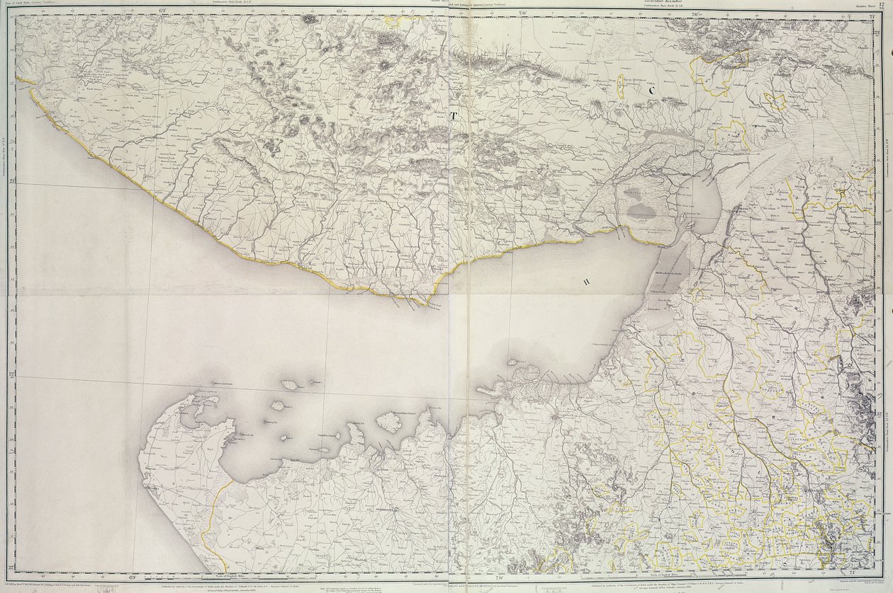
Map of Cutch and Kathiawar, published under the direction of Colonel G.C. de Pree, S.C., Surveyor General of India, 1885 by English School

Map of Cutch and Kathiawar, published under the direction of Colonel G.C. de Pree, S.C., Surveyor General of India, 1885

(Map of Cutch and Kathiawar, published under the direction of Colonel G.C. de Pree, S.C., Surveyor General of India, 1885 )


English School

€ 127.55
Enthält 0% MwSt.
   Configure art print
1885  ·  colour lithograph  ·  Picture ID: 66523

Cultural Circles  ·  Cartography

Map of Cutch and Kathiawar, published under the direction of Colonel G.C. de Pree, S.C., Surveyor General of India, 1885 by English School. Available as an art print on canvas, photo paper, watercolor board, uncoated paper or Japanese paper.
kutch · gulf · province · region · indian · colony · colonial · cartography · mapping · state · geography · british empire · asia · british raj · territory · desert · Asian · Private Collection / Bridgeman Images
AR/3D   View in 3D / AR zu Favoriten hinzufügen   Add to favorites    Select wall color    View painting in a room
0 Reviews

Configure art print

Picture Frame

Medium & Stretcher

Glass & Passepartout

Miscellaneous & Extras

 Save / compare configuration
Preview Icon

Summary

Gemälde
Veredelung
Keilrahmen
Museumslizenz

€ 127.55
(inkl. 20% MwSt)
   Add to cart

Bildschärfe: PERFEKT

Should you desire adjustments to brightness and color, or a custom crop of the motif, we are happy to make these changes at no additional cost to you. Please do not hesitate to contact us.

Similar artworks selected for you

Topographic Map of One Hundred Square Miles around Berlin Ferro. Unbound. Similar Version Described In Map of Southern Norway, No Title Map of Afghanistan, 1898 Map of the Gujarat state of India, published under the direction of Colonel J.T. Walker, Surveyor General of India Map of Central Asia Map of Spain said to have been used by the Duke of Wellington China Sea Singapore Strait by Staff Commander JW Reed Navg Lieuts TH Tizard... Assisted by the Officers of HMS Rifleman 1865-69 Map of France Anyang County, Henan Province Map of Western India, 1816 1842 Map of Central Asia The Mediterranean Sea and North Africa. Scale 1 A Chart of Nova Scotia Map of the Cutch region of India and its border with neighbouring Baluchistan, by Carl Zimmerman, 1851 Map of Kutch and Runn, India, 1854 Map of Cutch and Bombay Presidency, India, 1898 The Map is Published in Oslo (1845) and Shows Southern Norway West Asia Lake Superior & Mississippi Map of Verdopolis, or Glass Town; an imaginary land, illustration from The Ottoman Empire, from Europe, Describing All the Changes of Territory, Published 1816 Newent Map of the Ganges River Basin Map of the Crimea Geological and Geographical Atlas of Colorado and Portions of Adjacent Territory Chart of the Gulf of Finland and Baltic Sea A New Map of Mexico and Adjacent Provinces Coast of New England from Narragansett to Cape Cod
Show more similar artworks

Other art prints by English School

The Nonpareil with Portraits of Queen Victoria and Prince Albert Church and Cottage with Lighted Windows Portrait of a bodybuilder Woman beating her husband with a shoe The Great Green Tree Frog Homeric Table, the Shield of Achilles, designed by John Henning, Junior, Esquire View of the Acropolis of Athens Roman Augurs Lavater Lee and Sons, acrobats Princes Street Edinburgh - West End Elephant (engraving) Ships Arriving English Rose English Rose
Discover more works by English School

Other motives from the category Cartography

Map Showing the Kremlin, Moscow Map of the world with possessions of the British Empire coloured red, c.1870 Map of China and Burma, 1851 Map Of The World Maps of Africa, Upper Guinea, and the Gold Coast, Showing the Site of the Ashantee War Map of the Acropolis of the 2nd city at Troy Map of the Travels and the Expeditions of Alexander the Great in Asia Map Showing the Distribution of Deaths from Cholera in the Registration Districts of London, 1866 Map of North-East China, Showing the Gulf of Pechili, the Tien-Tsin (Peiho) River, and the Approaches to Pekin Military Map of Corsica Map of the Christian Constellations as Depicted by Julius Schiller, from Map showing the route of the Armada fleet, engraved by Augustine Ryther Map of Lake Ontario Map of the World, 1780 Map of Little Big Horn Battlefield
View More from "Cartography"

Excerpt from our top sellers

Farm Garden Standing Half-Nude with Brown Shirt Angelus Novus Path in the Wheat at Pourville, 1882 The Geese View of Florence Reclining Female Nude Bridge in Monet Wheatfield with Cypresses Sailing Ship in the Fog Christ in the Storm on the Lake of Galilee The Blue Room Tetrahedra The Piri Reis World Map, 1513 Lake Geneva with Mont-Blanc in Morning Red
Show More Artworks


What our customers think about us


Frequently Asked Questions about Meisterdrucke


Personalizing your art print at Meisterdrucke is a simple and intuitive process that allows you to design an artwork exactly to your specifications: Choose a frame, determine the image size, decide on a printing medium, and add suitable glazing or a stretcher frame. We also offer customization options such as mats, fillets, and spacers. Our customer service is available to help you design your perfect artwork.

At Meisterdrucke, you have the fascinating option to visualize the artwork you configured directly in your own space. For a tailored preview, simply upload a photo of your room and let the artwork appear on it. If you visit us via a mobile device, be it a phone or tablet, our augmented reality feature brings the image to life and seamlessly projects it into your space. An experience that uniquely combines art and technology.

Choosing the medium is often a matter of personal taste. To give you a clearer idea, we have provided some images for each medium. For a holistic experience, we also offer you a sample set of all paper variants so you can make a decision not just visually but also haptically. You can take advantage of the sample set free of charge – only the shipping costs will apply. You can order the sample set directly.

Do not worry. At Meisterdrucke, we do not proceed mechanically. We manually review each order. If there are any inconsistencies or peculiarities in the configuration, we will immediately contact you. Of course, our courteous and patient support is always at your side to assist you with the configuration. Together with you, we adjust your image by phone or email so that the final result exactly meets your expectations.


Do you have any questions?

Are you interested in an art print from our manufactory but still unsure? Do you need advice on choosing the medium or help with the order?

Our experts are happy to assist you.

+43 4257 29415
support@meisterdrucke.com
Mo-Do: 7:00 - 16:00 | Fr: 7:00 - 13:00

Do you have any questions?

Are you interested in an art print from our manufactory but still unsure? Do you need advice on choosing the medium or help with the order?

Our experts are happy to assist you.

+43 4257 29415
support@meisterdrucke.com
Mo-Do: 7:00 - 16:00 | Fr: 7:00 - 13:00


Meisterdrucke

   Kärntner Strasse 46
        9586 Finkenstein am Faaker See
        Austria
        +43 4257 29415
        support@meisterdrucke.com
Other languages

                   
Erfahrungen & Bewertungen zu Meisterdrucke
Post.at DHL Express Quehenberger Cargoboard
Kaiser Franz Joseph

Meisterdrucke
Kärntner Strasse 46
9586 Finkenstein am Faaker See · Austria
+43 4257 29415 · office@meisterdrucke.com
Post.at DHL Express Quehenberger Cargoboard


Meisterdrucke 2716 Bewertungen auf ProvenExpert.com

(c) 2025 meisterdrucke.uk