-
 ×
×
- Home
- Art Prints ▸
- Artists ▸
- Categories ▸
- Art Styles ▸
-
Picture Frame ▸
- All decorative frames
- Baroque decorative frames
- Simple decorative frames
- Rustic decorative frames
- Floating frames
- Golden decorative frames
- Silver decorative frames
- White decorative frames
- Black decorative frames
- Wood-look decorative frames
- Shabby chic decorative frames
- Thin decorative frames
- Thick decorative frames
-
Print Media ▸
- All print media
- Canvas Leonardo (satin)
- Canvas Salvador (matte)
- Canvas Raphael (matte)
- FineArt Photo Matte
- FineArt Photo Satin
- FineArt Photo Baryte
- FineArt Photo Glossy
- Watercolor Paper Munch
- Watercolor Paper Renoir
- Watercolor Paper Turner
- Watercolor Paper Dürer
- Natural Line Hemp
- Natural Line Rice
- Kozo White, 110g
- Kozo Natural, 110g
- Inbe White, 125g
- Unryu, 55g
- Bamboo, 110g
- Premio Unryu, 165g
- Murakumo Natural, 42g
- Bizan Natural, 300g
- Bizan White, 300g
- Aluminum composite 3mm
- Acrylic glass 5mm
- Order Sample Set
- Which print medium is right for you?
Canvas
Photo Paper
Watercolor Board
Natural Line
Japanese Paper
Special Media
More information
-
Help & Service ▸
- Contact us
- Sell your art
- Frequently Asked Questions
- Job Openings
- Complaint
- Order Samples
- Order Vouchers
- Shipping costs
- Production time
- Sustainability
- Image research
- Special requests
- Who are we?
- Pricing policy
- Company policy
- Quality promise
- Awards
- Stretcher frame
- Mats
- Decorative frames
- Glazing
- Fillets
- Mounting systems
- Print media
- Care tips
- Legal Notice
- Terms & Conditions
- Privacy Policy
- Right of Cancellation
Info & Service
More information
Good to know
Legal information
- Shop ▸
- Contact




.jpg)
.jpg)
 View in 3D / AR
 Add to favorites
 Change wall color
 View picture in a room
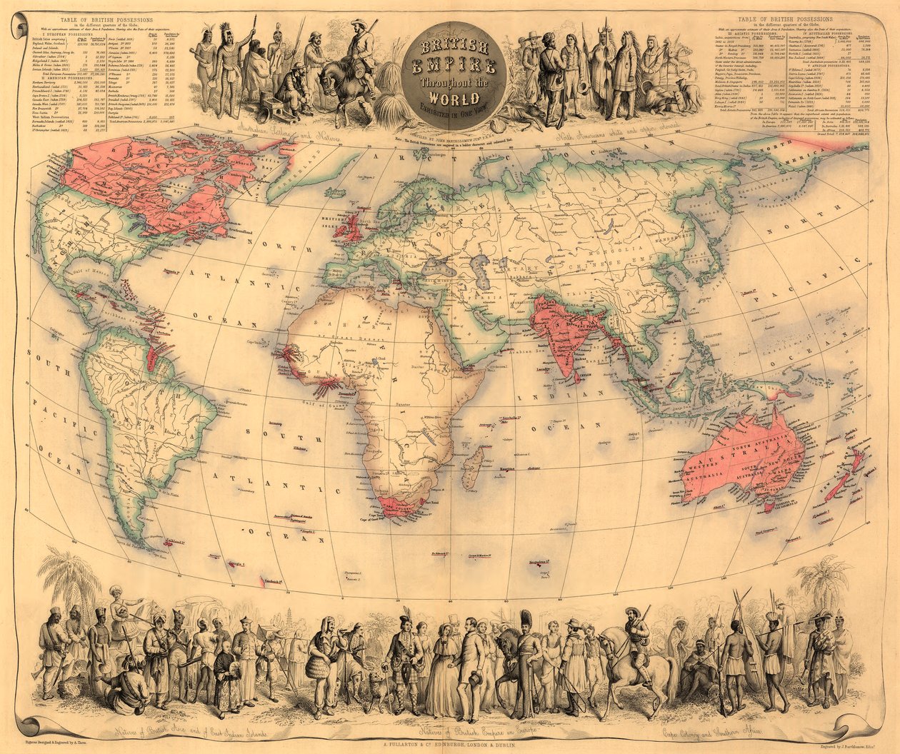
.jpg "World Map with the Colonial British Empire, 1886 Imperial Federation, map of the world showing the extent of the British Empire in 1886 (title on object)")
.jpg "Eastern Hemisphere, from a Series of World Maps published by John Tallis and Co., New York and London")
.jpg "Map of Asia")
.jpg "Physik Atlas, 1848")
.jpg "Geographicus")
.jpg "Commercial Map of the World")
.jpg "A general chart on Mercator")
 - (MeisterDrucke-136775).jpg "The World on Mercator")
.jpg "Sheet from Blaeu")
.jpg "Map of the World")
.jpg "Map of the British world empire, from Castle Line Atlas of South Africa")
.jpg "Double Hemisphere Map of the World")
.jpg "Map of the World, 1780")
.jpg "America or the New World")
.jpg "Map")
.jpg "Stanford")
.jpg "Maps LOC mmorse000105-4")
.jpg "Composite Sheet with Engraving, Scale: circa 1:35,000,000")
.jpg "The World in Hemispheres, 1902")
.jpg "Cartesian Map of Hemispheres")
.jpg "World map from Atlas Maior, c. 1705")
_-_(MeisterDrucke-1417308).jpg "Map of Asia, c.1696")
.jpg "The Visscher Map of the New World")
.jpg "Map of the world showing British possessions in 1904")
.jpg "The World as Peopled by the Descendants of Noah, Showing the Countries Possessed by Shem, Ham & Japhet and Their Posterity after the Confusion of Tongues")
.jpg "Ethnographic map of the world")
.jpg "Map of the World")
.jpg "Map from the National Library")
.jpg "Church and Cottage with Lighted Windows")
.jpg "Portrait of a bodybuilder, c. 1898")
.jpg "The")
.jpg "Portrait of King Richard III")
 c1740-50 - (MeisterDrucke-77045).jpg "Kidbrooke Park, Kent, formerly attributed to George Lambert (1700-65) c.1740-50")
_Socrates_-_-_From_series_-_(MeisterDrucke-1061281).jpg "Portrait of the Greek philosopher Socrates (469-399 BC) - From the series “Leaders of Men” - Chromolithography - English School, 20th century")
_-_(MeisterDrucke-1421446).jpg "Map of Europe in 1910")
.jpg "Detailed Map of Gallipoli Peninsula and the Dardanelles, Turkey, 1915, from")
.jpg "The Kitchen, Cotehele House, c.1830-40")
_p_-_(MeisterDrucke-63913).jpg "Poster advertising ‘A Midsummer Night")
.jpg "Romeo buys poison from the apothecary, illustration from Romeo and Juliet, from \"The Illustrated Library Shakespeare\", published in London 1890")
.jpg "Scorpion Fish, plate 8 from “The Zoology of the Voyage of H.M.S Beagle, 1832-36” by Charles Darwin")
.jpg "An Allegory of the Tudor Succession: The Family of Henry VIII, c. 1589-95")
 - (MeisterDrucke-99297).jpg "Improved Map of India, published in London 1820")
_Henry_M_-_(MeisterDrucke-421535).jpg "A Map of Africa to Illustrate the Travels of David Livingstone (1813-73), Henry Morton Stanley (1841-1904) and Verney Lovett Cameron (1844-94)")
.jpg "Map of Florence, 1584")
 - (MeisterDrucke-94182).jpg "Map of Central Europe, from the")
_-_(MeisterDrucke-232680).jpg "Map of Candia and Corfu, from")
.jpg "Map of North and South America, from the")
.jpg "Detail of Italy from the Peutinger map copy")
.jpg "Septentrionalium terrarum descriptio, map of the Arctic, 1595")
.jpg "A Map of Chelsea, 1746")
.jpg "World Map, from")
_-_(MeisterDrucke-318212).jpg "Map of Wales")
_-_(MeisterDrucke-427355).jpg "Map from")
_1544_-_(MeisterDrucke-417073).jpg "Rc C 2487 Map of the World, designed by Sebastian Cabot (c. 1476-1557), 1544")
.jpg "Ms. Arabe 2221, fol. 203 and 204, Map of the Mediterranean, Europe and Africa, 1300")
.jpg "Map of Florence, 1730")
.jpg "Map of Europe after the Peace of Lunéville, 1801, from")
 - (MeisterDrucke-37902).jpg "Map of Canada, from")
.jpg "Hygieia")
 - (MeisterDrucke-144044).jpg "Diogenes, 1860")
.jpg "The Monk by the Sea, 1808-1810")
.jpg "Oak Grove, 1887")
_-_Pillars_of_Creation_(NIRCam_and_MIRI_Composite)_-_(MeisterDrucke-1429802).jpg "Pillars of Creation (NIRCam and MIRI Composite)")
_-_Lensing_Galaxy_Cluster_(Webbs_First_Deep_Field)_-_(MeisterDrucke-1420924).jpg "Lensing Galaxy Cluster (Webb")
.jpg "The Boulevard Montmartre on a Winter Morning")
.jpg "Seated Woman with Bent Knees, 1917")
.jpg "Wheatfield with Crows")
.jpg "One of the Family")
.jpg "Landscapes, Flowers and Birds: Plum, Qing Dynasty, 1780")
.jpg "Ascending Road")
.jpg "The North Cape by Moonlight, 1848")
.jpg "Lovers of the Sun, 1923")
.jpg "The Carte du Tendre, a map of an imaginary country, from volume II of")

 +43 4257 29415
 support@meisterdrucke.com
 Mo-Do: 7:00 - 16:00 | Fr: 7:00 - 13:00





