support@meisterdrucke.com  ·  0043 4257 29415

Deutsch English Italiano Español Français Nederlands Português Svenska Polski Dansk
Search by artist, work title or style – e.g. Monet, Starry Night, Impressionism, Hokusai wave, nude. Describe the scene – e.g. green meadow, abstract with lots of red, dark oil painting, standing nude next to a tree.

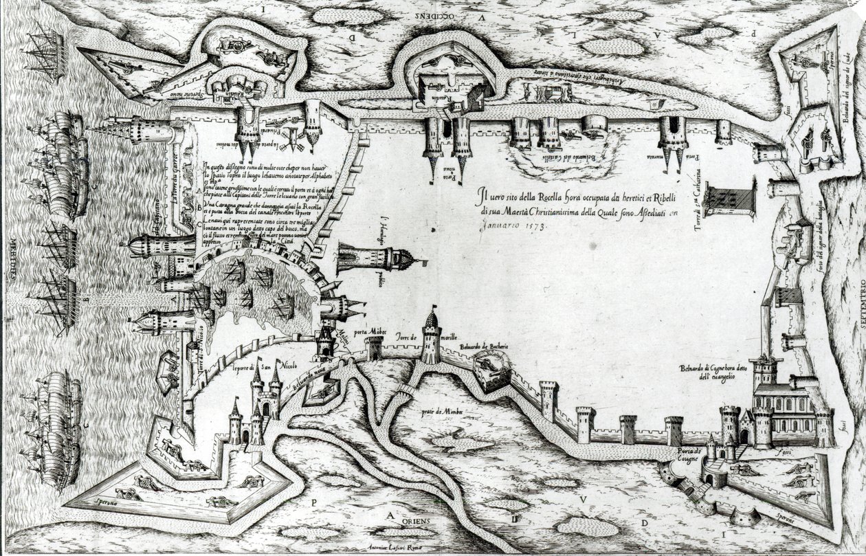
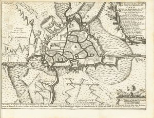
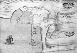
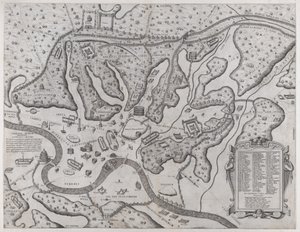
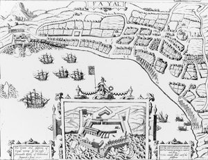
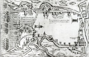
Map illustrating La Rochelle occupied by the Huguenots by Antonio Lafreri

Map illustrating La Rochelle occupied by the Huguenots

(Map illustrating La Rochelle occupied by the Huguenots )


Antonio Lafreri

€ 125.42
Tax-free
   Configure art print
1573  ·  engraving  ·  Image ID: 38322

Renaissance  ·  Cartography

Map illustrating La Rochelle occupied by the Huguenots by Antonio Lafreri. Available as an art print on canvas, photo paper, watercolor board, natural paper, or Japanese paper.
lafrery · city walls · cannon · tower · wall · ship · ships · fleet · navy · fortifications · birds eye view · label · labelling · windmill · harbour · town plan · emplacement · bridge · strategic · strategy · Bibliotheque Municipale, La Rochelle, France / Bridgeman Images
AR/3D   View in 3D / AR zu Favoriten hinzufügen   Add to favorites    Change wall color    View picture in a room
0 Reviews

Configure art print

Picture Frame

Medium & Stretcher

Glass & Passepartout

Miscellaneous & Extras

 Save / compare configuration
Preview Icon

Summary

Gemälde
Veredelung
Keilrahmen
Museumslizenz

€ 125.42
(inkl. 20% MwSt)
   Add to cart

Bildschärfe: PERFEKT

If you'd like us to adjust the brightness, colors, or crop the image, we're happy to do this for you at no extra cost. Just get in touch!

Similar artworks selected for you

Copper Engraving - Abbey and Market Berchtesgaden Bremervörde The Siege of Neuhausel by the Turks in 1663, Illustration from a Book on the Ottoman Campaigns in Europe, Engraved by Paul Furst Londonderry Besieged by General Hamilton and Conrad de Rosen, engraved by J. Sturt, 1689 Nordens View of Windsor Castle, 1607 Map of the City of Durham Bremervörde, Lower Saxony, Germany The Jewish Quarter in Metz during the 16th Century, Illustration from Histoire des Juifs dans le Nord-Est de la France by Emile Auguste Begin Siege of Krakow (1655) Siege of Ghent, 1708 Ostende, from A Plan of the House and Gardens at Stowe, Buckinghamshire Ms 466 fol. 1 Map of the city of Jerusalem, before 1167 Plan of Rhodes (Rodos) - in The port of Alexandria. 17th century drawing Map of Narva Canterbury, 1588 Charles Bridgeman’s (fl. 1713-38) plan for Stowe Gardens, from a book on views of Stowe published by Mrs Charles Bridgeman in 1739 Map of the Island of Voorne and Plan of Brielle, 1572 Siege of Bonn, 1703 A Map of Marylebone, London, 1746 Hollar The Siege of Colchester by the Parliament Forces, 1648 Speculum Romanae Magnificentiae: Ancient Rome and its Hills, from the West The Towne and Platforme of Fayall wonne by the right Honourable Earle of Cumberland, September 2nd 1589 Plan and Map of the Town and Citadel of Mont-Louis New York Malta Besieged by the Infidel (from Plan of Lisle
Show more similar artworks

More art prints by Antonio Lafreri

Scandinavia, detail from the Carta Marina by Olaus Magnus, 1572 Scandinavia, detail from the Carta Marina by Olaus Magnus, 1572 Map of Rome, from the “Speculum Romanae Magnificentiae” published in 1562 Drawing of the Etruscan bronze she-wolf suckling Romulus and Remus, 5th century BC, in the Capitoline Museum, 1552 City map of Milan edited by Antonio Lafreri (Lafrery or Lanfrerius) (1512-1577) in 1573. This is the oldest map of the city. Milan, Milan Museum - Map of Milan. The oldest map of the city in 1573, edited by Antonio Lafreri. Italy, Museum of Milan Ancient Temples and Rotundas (Five Designs) Trajan’s Column in Rome celebrating the Emperor’s campaigns in Dacia, engraved by the artist The Pyramid of Caius Cestius built c. 12 BC, Rome Map illustrating La Rochelle occupied by the Huguenots The Seven Churches of Rome, 1575 The Illustration from Aquatilium animalium historiae, liber primus by Ippolito Salviani, 1554 Map of the city of Rome, engraved by the artist, 1557 Illustration from The Seven Churches of Rome
Show more works by Antonio Lafreri

More motifs from the category Cartography

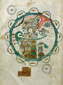
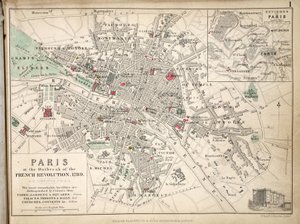
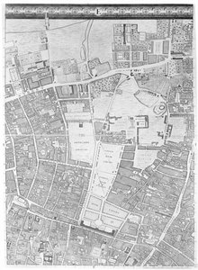
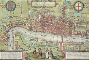
‘Civitas Londinum’, map of London, 1560 Map of North Africa and West Africa, published in Strasbourg in 1522 Ms 988, volume 3, fol. 45, plan and map of the town and citadel of Bayonne, from the Map of the City of New York [as far north as East 53rd Street], 1885 Map of the world in the form of a globe, miniature from Grandes Chroniques de Philippe le Hardi Map of the Moluccas, 1522 Map of the World, Based on Descriptions and Coordinates Given in “Geographia”, by Ptolemy (Claudius Ptolemaeus of Alexandria) (c. 90-168 AD) Map of Paris at the Outbreak of the French Revolution, 1789, published by William Blackwood and Sons, Edinburgh and London, 1848 Map of the City and Portuguese Port of Goa, India, 1595 Indian Campaign of 1832: Map of the Country, 1832 A Map of Moorfields and Hoxton, London, 1746 New and accurate map of the West Indies Map of the New Simplon Pass, 1803 Map No. 5 Showing the route of the Armada fleet, engraved by Augustine Ryther, 1588 Map of London, from “Civitates Orbis Terrarum” by Georg Braun (1542-1622) and Frans Hogenburg (1635-90), c. 1572
View More from "Cartography"

A selection of our top sellers

The Kiss The Magic Circle The Absinthe Drinkers, 1908 Flowering Garden in Spring The sleeping Jesus, or Madonna holding the sleeping Child, accompanied by three angels, 1532 The Lady of Shalott Farm Garden The times of day: The evening, 1821-1822 Standing Nude with Orange Drapery, 1914 Untitled No. 1 from a Series of Altar Paintings, 1915 Alpine Landscape at Sunset The Japanese Bridge The Roses, 1925-26 Blue, 1922 Two Men Contemplating the Moon
Show more artworks


What our customers think about us


Frequently Asked Questions about Meisterdrucke


Personalizing your art print at Meisterdrucke is simple and intuitive: Choose a frame, set the image size, pick a printing medium, and add suitable glazing or a stretcher frame. We also offer additional customization options like mats, fillets, and spacers. If you have any questions, our customer service team is ready to help you create your perfect artwork.

At Meisterdrucke, you can visualize your configured artwork directly in your own room. Simply upload a photo of your space and see how the artwork looks in it. If you're visiting us on a mobile device — phone or tablet — our augmented reality feature brings the picture to life and projects it right into your room. A unique experience that combines art and technology.

Choosing the right medium is often a matter of personal taste. To give you a better idea, we've provided some images for each medium. We also offer a sample set of all paper variants, so you can decide not just visually but by touch as well. You can order the sample set free of charge — only shipping costs apply.

Don't worry! At Meisterdrucke, we don't just process orders mechanically. Every order is manually reviewed by our team. If we spot any inconsistencies or issues with your configuration, we'll get in touch with you right away. And of course, our friendly and patient support team is always here to help you with your configuration. We'll work with you by phone or email to adjust your image so the final result is exactly what you had in mind.


Still have questions?

Are you interested in an art print from our manufactory but still unsure? Do you need advice on choosing the medium or help with the order?

Our experts are happy to assist you.

+43 4257 29415
support@meisterdrucke.com

Mo-Do: 7:00 - 16:00 | Fr: 7:00 - 13:00

Still have questions?

Are you interested in an art print from our manufactory but still unsure? Do you need advice on choosing the medium or help with the order?

Our experts are happy to assist you.

+43 4257 29415
support@meisterdrucke.com
Mo-Do: 7:00 - 16:00 | Fr: 7:00 - 13:00


Meisterdrucke

   Kärntner Strasse 46
        9586 Finkenstein am Faaker See
        Austria
        +43 4257 29415
        support@meisterdrucke.com
Other languages

                   
Erfahrungen & Bewertungen zu Meisterdrucke
Post.at DHL Express Quehenberger Cargoboard
Kaiser Franz Joseph

Meisterdrucke
Kärntner Strasse 46
9586 Finkenstein am Faaker See · Austria
+43 4257 29415 · support@meisterdrucke.com
Post.at DHL Express Quehenberger Cargoboard


(c) 2026 meisterdrucke.uk