-
 ×
- Home
- Art Prints ▸
- Artists ▸
- Categories ▸
- Art Styles ▸
- Picture Frame ▸
- All decorative frames
- Baroque decorative frames
- Simple decorative frames
- Rustic decorative frames
- Floating frames
- Golden decorative frames
- Silver decorative frames
- White decorative frames
- Black decorative frames
- Wood-look decorative frames
- Shabby chic decorative frames
- Thin decorative frames
- Thick decorative frames
- Print Media ▸
- All print media
- Canvas Leonardo (satin)
- Canvas Salvador (matte)
- Canvas Raphael (matte)
- FineArt Photo Matte
- FineArt Photo Satin
- FineArt Photo Baryte
- FineArt Photo Glossy
- Watercolor Paper Munch
- Watercolor Paper Renoir
- Watercolor Paper Turner
- Watercolor Paper Dürer
- Natural Line Hemp
- Natural Line Rice
- Kozo White, 110g
- Kozo Natural, 110g
- Inbe White, 125g
- Unryu, 55g
- Bamboo, 110g
- Premio Unryu, 165g
- Murakumo Natural, 42g
- Bizan Natural, 300g
- Bizan White, 300g
- Aluminum composite 3mm
- Acrylic glass 5mm
- Order Sample Set
- Which print medium is right for you?
Canvas
Photo Paper
Watercolor Board
Natural Line
Japanese Paper
Special Media
More information
- Help & Service ▸
- Contact us
- Sell your art
- Frequently Asked Questions
- Job Openings
- Complaint
- Order Samples
- Order Vouchers
- Shipping costs
- Production time
- Sustainability
- Image research
- Special requests
- Who are we?
- Pricing policy
- Company policy
- Quality promise
- Awards
- Stretcher frame
- Mats
- Decorative frames
- Glazing
- Fillets
- Mounting systems
- Print media
- Care tips
- Legal Notice
- Terms & Conditions
- Privacy Policy
- Right of Cancellation
Info & Service
More information
Good to know
Legal information
- Shop ▸
- Contact




 View in 3D / AR
 Add to favorites
 Change wall color
 View picture in a room


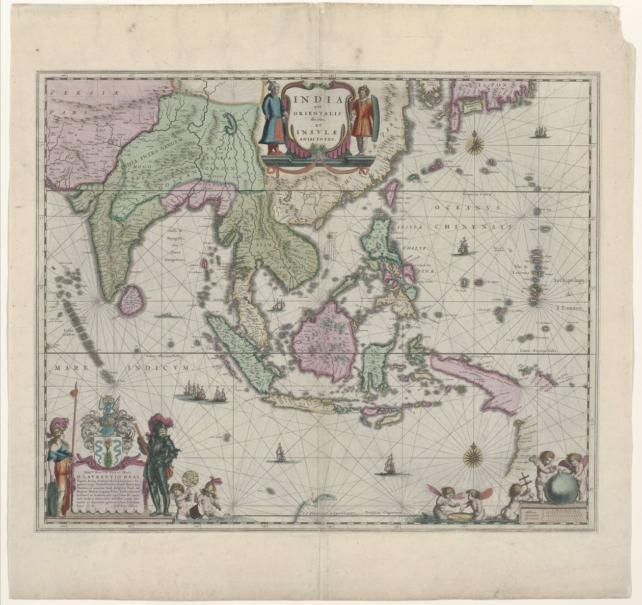
.jpg "India Quae Orientalis Dicitur, Et Insulae Adiacentes, map showing South-East Asia and the East Indies, published in Amsterdam, c.1635")
.jpg "General map extending from India and Ceylon to northwestern Australia by way of southern Japan, the Philippines, the Malay Peninsula and the Indonesian archipelago")


.jpg "Map of East India (South and Southeast Asia: Pakistan, India, Nepal, Bangladesh, Burma, Sri Lanka, Thailand, Malaysia, Vietnam, Cambodia, Laos, Philippines, Singapore and Indonesia)")


 - (MeisterDrucke-77380).jpg "Map of India and the East Indies")
.jpg "East Indies: Sea and coastal chart extending from Southern India to Japan by the way of the East Indian archipelago")


 - (MeisterDrucke-115884).jpg "Map of the North Sea, c.1675")


.jpg "Map of the Zuiderzee and the Wadden Sea")


.jpg "Map of Asia, Tartaria, Japan, the Philippines and the East Indies, engraved by G. van Gouwen, c. 1690")


.jpg "Afbeeldinge der - Produced in Amsterdam")
.jpg "World Map, from")
 - (MeisterDrucke-51893).jpg "Asia noviter delineata")


 - (MeisterDrucke-183730).jpg "Map of")


.jpg "A 17th Century Map by Willem Janszoon Blaeu, Showing Modern-Day Indonesia and Parts of South East Asia")
 - (MeisterDrucke-79146).jpg "Map of Iceland")

.jpg "Marca d")
.jpg "Map of the Lower Elbe, 1:160 000, Copper Engraving, 1628")
.jpg "Frontispiece from the Sailing Manual")
 - (MeisterDrucke-63910).jpg "Africa Nova")


.jpg "Blooming Cherry Tree")
.jpg "Woman at Dawn")
.jpg "Wisteria, 1919-20")
.jpg "Illustration from Edgar Allan Poe")
.jpg "The Taking of Christ")


.jpg "A Storm in the Rocky Mountains, Mt. Rosalie")


 +43 4257 29415
 support@meisterdrucke.com
 Mo-Do: 7:00 - 16:00 | Fr: 7:00 - 13:00




