support@meisterdrucke.com  ·  0043 4257 29415

Deutsch English Italiano Español Français Nederlands Português Svenska Polski Dansk
Search by artist, work title or style – e.g. Monet, Starry Night, Impressionism, Hokusai wave, nude. Describe the scene – e.g. green meadow, abstract with lots of red, dark oil painting, standing nude next to a tree.

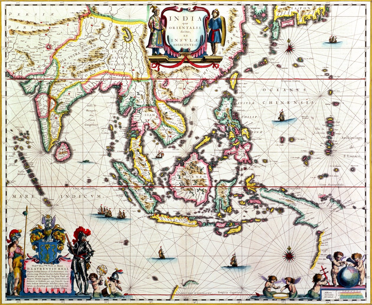
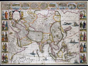
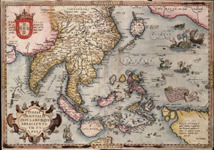
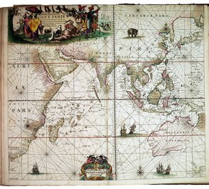
India Quae Orientalis Dicitur, Et Insulae Adiacentes, map showing South-East Asia and the East Indies, published in Amsterdam, c.1635 by Willem Janszoon Blaeu

India Quae Orientalis Dicitur, Et Insulae Adiacentes, map showing South-East Asia and the East Indies, published in Amsterdam, c.1635

(India Quae Orientalis Dicitur, Et Insulae Adiacentes, map showing South-East Asia and The East Indies, published, Amsterdam, c.1635 (hand-coloured engraving))


Willem Janszoon Blaeu

€ 119.3
Tax-free
   Configure art print
Undated  ·  hand-coloured engraving  ·  Image ID: 306692

Nonclassified artists  ·  Cartography

India Quae Orientalis Dicitur, Et Insulae Adiacentes, map showing South-East Asia and the East Indies, published in Amsterdam, c.1635 by Willem Janszoon Blaeu. Available as an art print on canvas, photo paper, watercolor board, natural paper, or Japanese paper.
t land van d' · endracht · cartridge · putti · measuring instruments · Private Collection / Bridgeman Images
Other color versions of this image  
AR/3D   View in 3D / AR zu Favoriten hinzufügen   Add to favorites    Change wall color    View picture in a room
0 Reviews

Configure art print

Picture Frame

Medium & Stretcher

Glass & Passepartout

Miscellaneous & Extras

 Save / compare configuration
Preview Icon

Summary

Gemälde
Veredelung
Keilrahmen
Museumslizenz

€ 119.3
(inkl. 20% MwSt)
   Add to cart

Bildschärfe: PERFEKT

If you'd like us to adjust the brightness, colors, or crop the image, we're happy to do this for you at no extra cost. Just get in touch!

Similar artworks selected for you

A Chart Bound in Van Keulen Map of Africa, India, Indian Ocean and East Indies Geography: map of the East Indies of Frederick de Witt (active around 1650) 17th century Paris, B.N. A 17th-century map by Willem Janszoon Blaeu, showing modern-day Indonesia and parts of Southeast Asia Map of Asia. Plate from an Atlas by Willem Janszoon Blaeu The theatre of the world or the new atlas Amsterdam. Geographic map of Asia by Willem Janszoon Blaeu East Indies: Sea and coastal chart extending from Southern India to Japan by way of the East Indian archipelago Map of Asia from the Bleau Atlas Gulf of Mexico and the Caribbean, from Blaeu East Indies, from Eastern India with Borneo and Philippine (engraving) Map of Asia, c.1696 Map of India to New Guinea, c. 1570-1603 A Map of East Africa, Arabia and India Pakistan, India, Sri Lanka, Nepal, Bhutan, Bangladesh, South China, Burma, Thailand, Laos, Vietnam, Cambodia, Malaysia, Brunei, Indonesia, The Philippines, Taiwan, South Japan Map of the East Indies, published 1635 in Amsterdam America, Plate 84, from Map of the Indies, from Theatrum Orbis Terrarum Map of the North Sea, c.1675 Atlas Willem Janszoon Blaeu (1571 - 1638) 17th-century map centered on the Indian Ocean by Allard Indiae Orientalis Insularumque Adiacientium Typus. Geographical map of East India and Southeast Asian territory from “Theatrum Orbis Terrarum” by Abraham Ortelius (Oertel, Ortell or Ortel). Sheet from Blaeu Map of the East Indies by Ortelius, c.1570 Maris Pacifici Map of East India (South and Southeast Asia: Pakistan, India, Nepal, Bangladesh, Burma, Sri Lanka, Thailand, Malaysia, Vietnam, Cambodia, Laos, Philippines, Singapore and Indonesia)
Show more similar artworks

More art prints by Willem Janszoon Blaeu

World Map, from Asia noviter delineata, 1617 Africa Nova, c.1617 A 17th-century map by Willem Janszoon Blaeu, showing modern-day Indonesia and parts of Southeast Asia Map of Russia and Moscow. From: Theatrum Orbis Terrarum..., 1645 Map of Russia from: Theatrum Orbis Terrarum..., 1645 Map of Russia From: Theatrum Orbis Terrarum..., 1645 Frontispiece from the sailing manual “Light of Zeevaert” Map of the Holy Land, published in Amsterdam, 1629 Map of Iceland Map of Map of Siberia and China from Le Théâtre du Monde or Nouvel Atlas, 1645 Map of the Moluccan Islands, engraved by Jodocus Hondius, 1630 India Quae Orientalis Dicitur, Et Insulae Adiacentes, map showing South-East Asia and the East Indies, published in Amsterdam, c.1635 Rügen From: Theatrum Orbis Terrarum
Show more works by Willem Janszoon Blaeu

More motifs from the category Cartography

Map Charting the Movement of the Earth and Planets, from Map No. 5 Showing the route of the Armada fleet, engraved by Augustine Ryther, 1588 Map of the Caribbean, 1715 Map of China Detailed Map of Gallipoli Peninsula and the Dardanelles, Turkey, 1915, from Map of the United States in 1861, from “Our Whole Country: The Past and Present of the United States, Historical and Descriptive”, by John Warner Barber and Henry Hare, 1861 Map of the Battles of Champaubert and Vauchamps, published by William Blackwood and Sons, Edinburgh and London, 1848 Map of North West Point, Virginia, from Guerre de l’Amerique, 1782 The Triumph of the French Armies, Napoleon and his Generals Holding Maps of their Victories at the Time of the Peace of Loeben, 18th April 1797, c. 1797 Map of the United States, 1816 A map showing the journey of the Israelites out of Egypt and into Canaan, facsimile of an image from the Geneva Bible of 1560 A Map of Old London Bridge, London, 1746 Part of the Tabula Peutingeriana (Peutinger Table, Peutinger Map), an illustrated itinerarium of the road network in the Roman Empire. Detail of Italy from the Peutinger Map copy Map of Corsica Map and fortifications of Neuf-Brisach
View More from "Cartography"

A selection of our top sellers

Beef: diagram depicting the different cuts of meat Ophelia, 1894 The Harvest Self-Portrait (Melancholy of the Mountains). 1929 Colorful in the triangle Madonna of the Yarnwinder Hammamet, 1914 Most Sacred A Young Girl Defending Herself against Eros The Valley of Tears, 1883 Boys Bathing, 1912 The Swing Dancer, 1913 Arab Café (Little Turk) The Great Wave off Kanagawa, after Katsushika Hokusai
Show more artworks


What our customers think about us


Frequently Asked Questions about Meisterdrucke


Personalizing your art print at Meisterdrucke is simple and intuitive: Choose a frame, set the image size, pick a printing medium, and add suitable glazing or a stretcher frame. We also offer additional customization options like mats, fillets, and spacers. If you have any questions, our customer service team is ready to help you create your perfect artwork.

At Meisterdrucke, you can visualize your configured artwork directly in your own room. Simply upload a photo of your space and see how the artwork looks in it. If you're visiting us on a mobile device — phone or tablet — our augmented reality feature brings the picture to life and projects it right into your room. A unique experience that combines art and technology.

Choosing the right medium is often a matter of personal taste. To give you a better idea, we've provided some images for each medium. We also offer a sample set of all paper variants, so you can decide not just visually but by touch as well. You can order the sample set free of charge — only shipping costs apply.

Don't worry! At Meisterdrucke, we don't just process orders mechanically. Every order is manually reviewed by our team. If we spot any inconsistencies or issues with your configuration, we'll get in touch with you right away. And of course, our friendly and patient support team is always here to help you with your configuration. We'll work with you by phone or email to adjust your image so the final result is exactly what you had in mind.


Still have questions?

Are you interested in an art print from our manufactory but still unsure? Do you need advice on choosing the medium or help with the order?

Our experts are happy to assist you.

+43 4257 29415
support@meisterdrucke.com

Mo-Do: 7:00 - 16:00 | Fr: 7:00 - 13:00

Still have questions?

Are you interested in an art print from our manufactory but still unsure? Do you need advice on choosing the medium or help with the order?

Our experts are happy to assist you.

+43 4257 29415
support@meisterdrucke.com
Mo-Do: 7:00 - 16:00 | Fr: 7:00 - 13:00


Meisterdrucke

   Kärntner Strasse 46
        9586 Finkenstein am Faaker See
        Austria
        +43 4257 29415
        support@meisterdrucke.com
Other languages

                   
Erfahrungen & Bewertungen zu Meisterdrucke
Post.at DHL Express Quehenberger Cargoboard
Kaiser Franz Joseph

Meisterdrucke
Kärntner Strasse 46
9586 Finkenstein am Faaker See · Austria
+43 4257 29415 · support@meisterdrucke.com
Post.at DHL Express Quehenberger Cargoboard


(c) 2026 meisterdrucke.uk