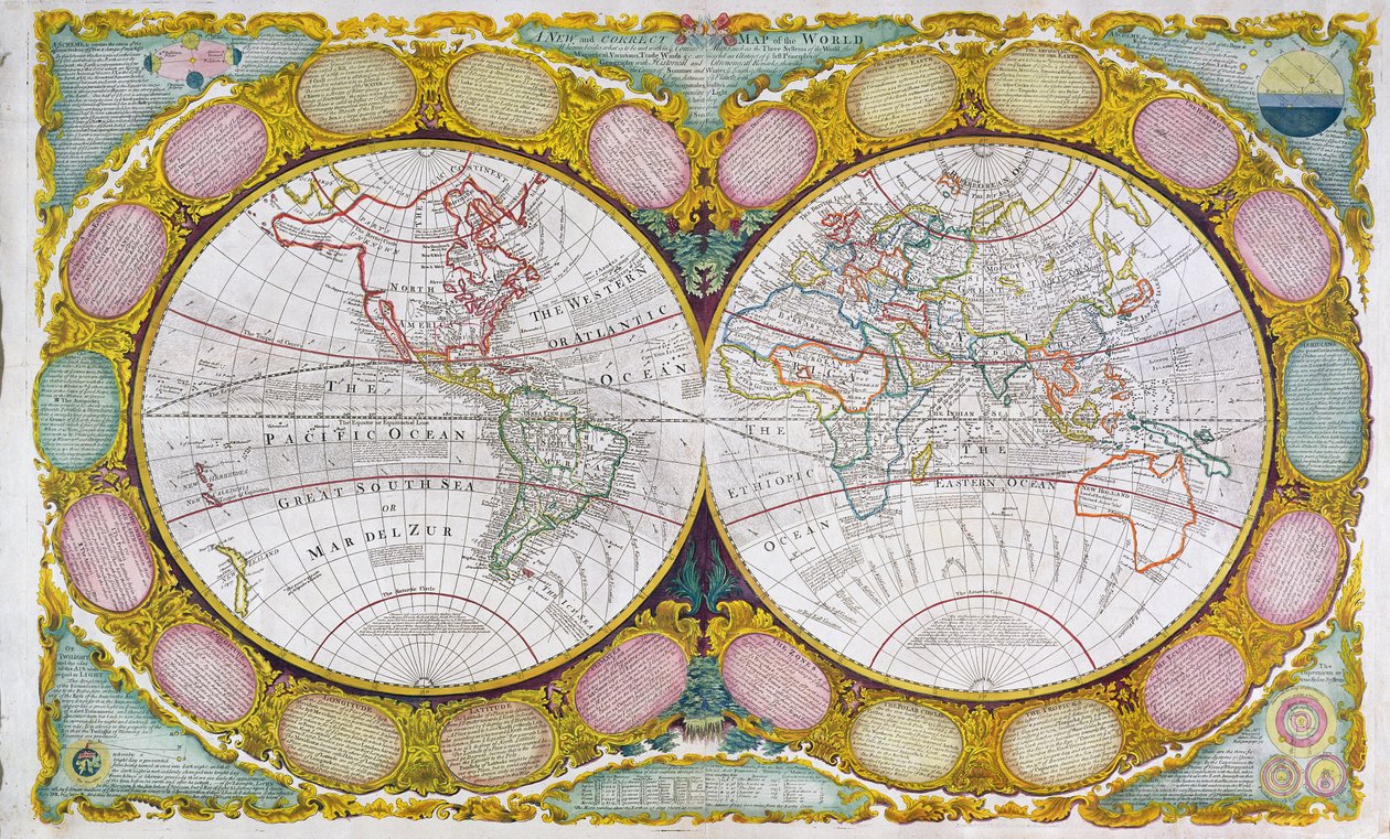
A New and Correct Map of the World, 1770-97 by Robert Wilkinson

A New and Correct Map of the World, 1770-97

(A New and Correct Map of the World, 1770-97 )


Robert Wilkinson

€ 112.27
Enthält 0% MwSt.
   Configure art print
Undated  ·  coloured engraving  ·  Picture ID: 77404

Nonclassified artists  ·  Cartography

A New and Correct Map of the World, 1770-97 by Robert Wilkinson. Available as an art print on canvas, photo paper, watercolor board, uncoated paper or Japanese paper.
trade winds · maps · mapping · cartography · geography · geographical · systems · globe · atlas · double hemisphere · two hemispheres · relief · pictorial · directions · winds · solar system · handwritten · captions · scroll frame · decorative · Private Collection / Bridgeman Images
Other color variations of this picture  
AR/3D   View in 3D / AR zu Favoriten hinzufügen   Add to favorites    Select wall color    View painting in a room
0 Reviews

Configure art print

Picture Frame

Medium & Stretcher

Glass & Passepartout

Miscellaneous & Extras

 Save / compare configuration
Preview Icon

Summary

Gemälde
Veredelung
Keilrahmen
Museumslizenz

€ 112.27
(inkl. 20% MwSt)
   Add to cart

Bildschärfe: PERFEKT

Should you desire adjustments to brightness and color, or a custom crop of the motif, we are happy to make these changes at no additional cost to you. Please do not hesitate to contact us.

Similar artworks selected for you

Map of the Two Hemispheres A New Land and Water Map of the Entire Earth Geo-Hydrographic Mappamonde 1691 Map of the World World Map for the King Terrestrial Globe Map of the World in Hemispheres Map of the World Itinerarium. World map with costumes, natives, ships, plants and animals Planisphere by Frederic de Witt (17th century) World Map, Drawn from Observations of the Royal Academy of Sciences and Others 1594 Double Hemisphere World Map Map of the Whole World - Adorned According to the Observations of the Royal Academy of Sciences and Some Others According to the Latest Annotations Planisphere World World Map, Amsterdam 1633 The world, by A.H. Jaillot in Map of the World New Geographical and Hydrographical Map of the Whole World New Board for All the World The globe (engraving) A New and Accurate Map of the World Two Hemisphere World Map New Geographical and Hydrographical Map of the Whole World Orthographic Projection of the Earth with Various Horizons and Celestial Circles Orbis Terrarum Nova et Accuratissima Tabula, ca 1690 World map by John Seller A New and Accurate Map of the World New Geographical and Hydrographical Map of the Entire World
Show more similar artworks

Other motives from the category Cartography

World Map; Vera Totius Expeditionis Nauticae, charting the circumnavigation of the globe by Sir Francis Drake and Thomas Cavendish c.1595 Map of the Austro-Hungarian empire, illustration from a French geography school textbook, 1905 Map of Brazil, from Dutch Marine Maps, 1637 Map of the City and Portuguese Port of Goa, India (detail) Map of Florence, 1783 Map of Sixteenth Century India, from the Map of Cutch and Kathiawar, published under the direction of Colonel G.C. de Pree, S.C., Surveyor General of India, 1885 A Map of the Coastline of Brittany Map of the city of Siam, capital of the kingdom of that name after a survey done by a French engineer in 1687, published in the 1751 edition of Histoire Generale des Voyages by Antoine Prevost Map of Catania, from Topographical Map and Survey of the Village of Issy, 1740 The Pacific Ocean, from an Atlas of the World in 33 Maps, Venice, 1st September 1553 Map of the City of Ancient Rome During Its Greatness, BC 30-AD 400 Map of Vienna (detail) Map of the Battle of Jena, published by William Blackwood and Sons, Edinburgh and London, 1848
View More from "Cartography"

Excerpt from our top sellers

Beat the Whites with the Red Wedge Poster The Music View of Vétheuil. 1880 Animals in a Landscape Woman with a Parasol Beautiful Princess The Bookworm Rosa Damascena, from Les Roses, 1817-24 Dominant Curve The Blue Rigi: Lake of Lucerne - Sunrise The Fall of the Damned Setting Sun Vassilissa in the Forest, illustration from the Russian folk tale, Anguish Starry Night, c.1850-65
Show More Artworks


What our customers think about us


Frequently Asked Questions about Meisterdrucke


Personalizing your art print at Meisterdrucke is a simple and intuitive process that allows you to design an artwork exactly to your specifications: Choose a frame, determine the image size, decide on a printing medium, and add suitable glazing or a stretcher frame. We also offer customization options such as mats, fillets, and spacers. Our customer service is available to help you design your perfect artwork.

At Meisterdrucke, you have the fascinating option to visualize the artwork you configured directly in your own space. For a tailored preview, simply upload a photo of your room and let the artwork appear on it. If you visit us via a mobile device, be it a phone or tablet, our augmented reality feature brings the image to life and seamlessly projects it into your space. An experience that uniquely combines art and technology.

Choosing the medium is often a matter of personal taste. To give you a clearer idea, we have provided some images for each medium. For a holistic experience, we also offer you a sample set of all paper variants so you can make a decision not just visually but also haptically. You can take advantage of the sample set free of charge – only the shipping costs will apply. You can order the sample set directly.

Do not worry. At Meisterdrucke, we do not proceed mechanically. We manually review each order. If there are any inconsistencies or peculiarities in the configuration, we will immediately contact you. Of course, our courteous and patient support is always at your side to assist you with the configuration. Together with you, we adjust your image by phone or email so that the final result exactly meets your expectations.


Do you have any questions?

Are you interested in an art print from our manufactory but still unsure? Do you need advice on choosing the medium or help with the order?

Our experts are happy to assist you.

+43 4257 29415
support@meisterdrucke.com
Mo-Do: 7:00 - 16:00 | Fr: 7:00 - 13:00

Do you have any questions?

Are you interested in an art print from our manufactory but still unsure? Do you need advice on choosing the medium or help with the order?

Our experts are happy to assist you.

+43 4257 29415
support@meisterdrucke.com
Mo-Do: 7:00 - 16:00 | Fr: 7:00 - 13:00


Meisterdrucke

   Kärntner Strasse 46
        9586 Finkenstein am Faaker See
        Austria
        +43 4257 29415
        support@meisterdrucke.com
Other languages

                   
Erfahrungen & Bewertungen zu Meisterdrucke
Post.at DHL Express Quehenberger Cargoboard
Kaiser Franz Joseph

Meisterdrucke
Kärntner Strasse 46
9586 Finkenstein am Faaker See · Austria
+43 4257 29415 · office@meisterdrucke.com
Post.at DHL Express Quehenberger Cargoboard


Meisterdrucke 2707 Bewertungen auf ProvenExpert.com

(c) 2025 meisterdrucke.uk