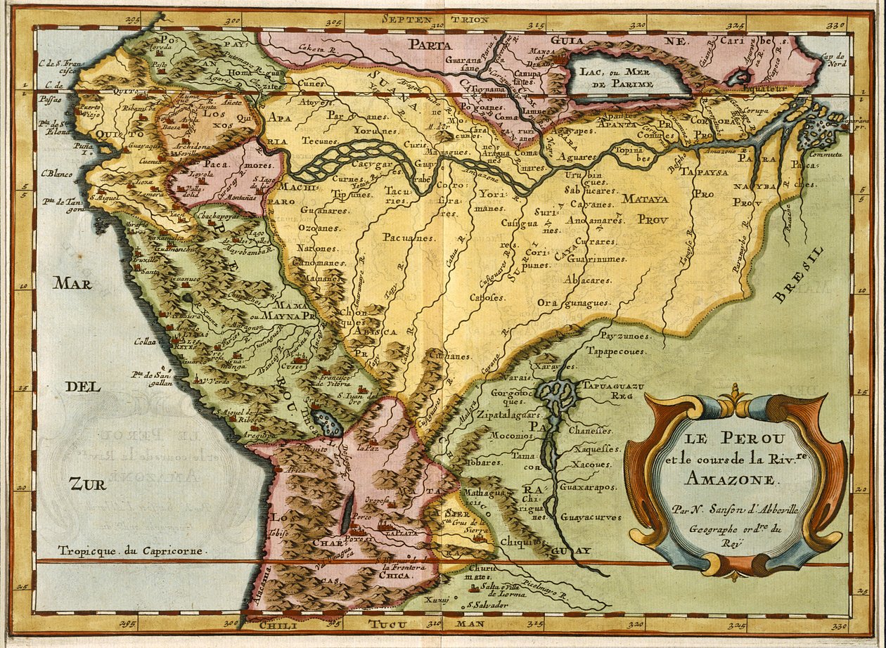
Map of the Amazon Basin, 1680 by Nicolas Sanson

Map of the Amazon Basin, 1680

(Map of the Amazon Basin, 1680 (hand coloured engraving))


Nicolas Sanson

€ 119.25
Enthält 0% MwSt.
   Configure art print
Undated  ·  hand coloured engraving  ·  Picture ID: 303185

Nonclassified artists  ·  Cartography

Map of the Amazon Basin, 1680 by Nicolas Sanson. Available as an art print on canvas, photo paper, watercolor board, uncoated paper or Japanese paper.
cartography · mapping · geography · geographical · amazon · river · amazonian · brazil · south america · south american · Private Collection / Bridgeman Images
zu Favoriten hinzufügen   Add to favorites    Select wall color    View painting in a room AR/3D   View in 3D / AR
0 Reviews

Configure art print

Picture Frame

Medium & Stretcher

Glass & Passepartout

Miscellaneous & Extras

 Save / compare configuration
Preview Icon

Summary

Gemälde
Veredelung
Keilrahmen
Museumslizenz

€ 119.25
(inkl. 20% MwSt)
   Add to cart

Bildschärfe: PERFEKT

Should you desire adjustments to brightness and color, or a custom crop of the motif, we are happy to make these changes at no additional cost to you. Please do not hesitate to contact us.

Similar artworks selected for you

Peru, Brazil and Amazonia Map of South America South America (engraving) Map of Peru, Guyana, Brazil and the Amazon Regions (etching) Brescia and Milan, Italy (engraving) Verona, Vicenza and Padua, Italy (engraving) Map of the Veneto Region, Italy Congo, Central Africa (engraving) South America America Meridionalis: from the Atlas of Gerardus Mercator Gold Yielding Regions of Peru, Volume VII, Atlas Maior, by Joan Blaeu Sclavonia, Croatia, Bosnia and Dalmatia (Engraving) Champagne, France (engraving) Rio de la Plata, Silver River and the Parana Basin in Paraguay, from Willem Blaeu Burgundy, France Geography map of the territory of Hungary from Map of the Gold-Bearing Regions in Peru Geography map of the territory of the Arabian Peninsula from Aragon and Catalonia, Spain (engraving) Map of Colombia and Peru. 1590. Large Pair of Library Globes, the Terrestrial and Celestial Map of the Duchy of Milan, Italy, from Theatrum Orbis Terrarum by Abraham Ortelius Map of South America, 1777 Andalusia, Spain (engraving) Map of the Area of Padua and Polesine (Italy) Map of the Biscay Province (Spain) and the Kingdom of Navarre (France) Geography map of the Duke of Milan from Tartary and Northern Part of China and Korea, in Romagna with Parma, Italy (engraving) Map of Africa, from
Show more similar artworks

Other art prints by Nicolas Sanson

Map of County Mark Map of Britain and Ireland, published Paris 1640 The Kingdom of Bohemia, Duchy of Silesia, Marquisate of Moravia and Lusatia Map of the Amazon Basin, 1680 Pyrenees Mountains and International Border Between France and Spain Showing the Mountain Passes Between the Two Countries Map of Grafschaft Mark, 1681 Paraguay, Chile, the Land, and the Magellanic Islands: Taken from Various Accounts 1654 Map - States of the Empire of the Great Lord of the Turks or Sultan of the Ottomans in Asia, Africa, and Europe Hydrography or Description of Water, That is to Say, of Seas, Gulfs, Lakes, Straits, and Main Rivers on the Surface of the Earth
Discover more works by Nicolas Sanson

Other motives from the category Cartography

Map describing the islands of Salvador, Espanola, Fernanda, Isabella and Conception, 1493 Map of Florence, 1584 Map of Strasbourg, from Map of Florence with a Perspectival View World Map of Telegraph Lines Published by the International Telegraph Bureau, 1901 Map of Paris depicting the city Map of the Bay of Bengal Map of Southern Italy, Corsica, and Sardinia Known in Ancient Times as Great Greece or Magnia Graecia Map of Treviso, from Map of Antwerp, from Map of Jerusalem, 1661 Map of the Battle of Trafalgar, published by William Blackwood and Sons, Edinburgh and London, 1848 Map of Paris at the Outbreak of the French Revolution, published by William Blackwood and Sons Map of the United States in 1861, from Map of the Caribbean, 1715
View More from "Cartography"

Excerpt from our top sellers

Portrait of a Lady Poplars on the River Epte The Singing Man Illustration to the Divine Comedy by Dante Alighieri Abyss of Hell The Great Wave off Kanagawa Renard the Fox The Resurrection De Munnekeholm with the Aduardergasthuis in the Foreground and the West-Indisch Huis in the Background Summer Night by the Beach Night: A Port in the Moonlight, 1748 Cypresses The Greifswald Market Pine Trees View on Delft The Ascent to Heavenly Paradise
Show More Artworks


What our customers think about us


Frequently Asked Questions about Meisterdrucke


Personalizing your art print at Meisterdrucke is a simple and intuitive process that allows you to design an artwork exactly to your specifications: Choose a frame, determine the image size, decide on a printing medium, and add suitable glazing or a stretcher frame. We also offer customization options such as mats, fillets, and spacers. Our customer service is available to help you design your perfect artwork.

At Meisterdrucke, you have the fascinating option to visualize the artwork you configured directly in your own space. For a tailored preview, simply upload a photo of your room and let the artwork appear on it. If you visit us via a mobile device, be it a phone or tablet, our augmented reality feature brings the image to life and seamlessly projects it into your space. An experience that uniquely combines art and technology.

Choosing the medium is often a matter of personal taste. To give you a clearer idea, we have provided some images for each medium. For a holistic experience, we also offer you a sample set of all paper variants so you can make a decision not just visually but also haptically. You can take advantage of the sample set free of charge – only the shipping costs will apply. You can order the sample set directly.

Do not worry. At Meisterdrucke, we do not proceed mechanically. We manually review each order. If there are any inconsistencies or peculiarities in the configuration, we will immediately contact you. Of course, our courteous and patient support is always at your side to assist you with the configuration. Together with you, we adjust your image by phone or email so that the final result exactly meets your expectations.


Do you have any questions?

Are you interested in an art print from our manufactory but still unsure? Do you need advice on choosing the medium or help with the order?

Our experts are happy to assist you.

+43 4257 29415
support@meisterdrucke.com
Mo-Do: 7:00 - 16:00 | Fr: 7:00 - 13:00

Do you have any questions?

Are you interested in an art print from our manufactory but still unsure? Do you need advice on choosing the medium or help with the order?

Our experts are happy to assist you.

+43 4257 29415
support@meisterdrucke.com
Mo-Do: 7:00 - 16:00 | Fr: 7:00 - 13:00


Meisterdrucke

   Kärntner Strasse 46
        9586 Finkenstein am Faaker See
        Austria
        +43 4257 29415
        support@meisterdrucke.com
Other languages

                   
Erfahrungen & Bewertungen zu Meisterdrucke
Partner Logos

Kaiser Franz Joseph

Meisterdrucke
Kärntner Strasse 46
9586 Finkenstein am Faaker See · Austria
+43 4257 29415 · office@meisterdrucke.com
Partner Logos


(c) 2025 meisterdrucke.uk