support@meisterdrucke.com  ·  0043 4257 29415

Deutsch English Italiano Español Français Nederlands Português Svenska Polski Dansk
Search by artist, work title or style – e.g. Monet, Starry Night, Impressionism, Hokusai wave, nude. Describe the scene – e.g. green meadow, abstract with lots of red, dark oil painting, standing nude next to a tree.

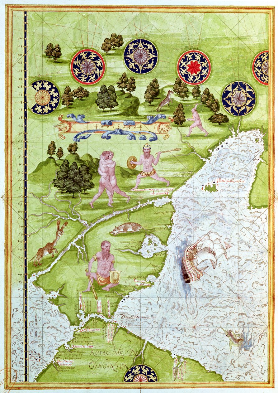
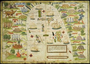
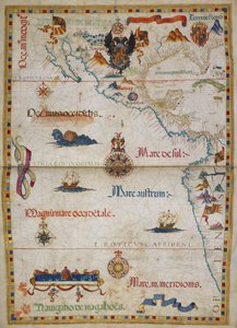
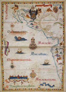
Fol. 40v, Map of the Magellan Straits, from 'Cosmographie Universelle', 1555 by Guillaume Le Testu

Fol. 40v, Map of the Magellan Straits, from 'Cosmographie Universelle', 1555

(Fol.40v Map of the Magellan Straits, from 'Cosmographie Universelle', 1555 )


Guillaume Le Testu

€ 132.32
Tax-free
   Configure art print
1555  ·  Watercolor on paper  ·  Image ID: 91977

Nonclassified artists  ·  Cartography

Fol. 40v, Map of the Magellan Straits, from 'Cosmographie Universelle', 1555 by Guillaume Le Testu. Available as an art print on canvas, photo paper, watercolor board, natural paper, or Japanese paper.
tierra del fuego · patagonia · south american · ocean · animal · bird · compass · native · ship · hunting · strait · savage · wild · Min. Defense - Service Historique de l'Armee de Terre,France / Bridgeman Images
Other color versions of this image  
AR/3D   View in 3D / AR zu Favoriten hinzufügen   Add to favorites    Change wall color    View picture in a room
0 Reviews

Configure art print

Picture Frame

Medium & Stretcher

Glass & Passepartout

Miscellaneous & Extras

 Save / compare configuration
Preview Icon

Summary

Gemälde
Veredelung
Keilrahmen
Museumslizenz

€ 132.32
(inkl. 20% MwSt)
   Add to cart

Bildschärfe: PERFEKT

If you'd like us to adjust the brightness, colors, or crop the image, we're happy to do this for you at no extra cost. Just get in touch!

Similar artworks selected for you

Fol. 41v, Map of Australia, from The Spice Trade in the Moloccas, from Fol. 47v Map of Peru, from Fol. 31v Map of Australia and Magellan Island from “Cosmographie Universelle”, 1555 F.52v Map of Florida and the Antilles, from Fol. 44v Map of Brazil, from Fol.56v Map of Florida, Canada and Labrador, from Fol. 54v Map of Florida, from “Cosmographie Universelle”, 1555 Fol. 10v Map of Scandinavia and Northern Russia, from Fol. 39v Map of the Magellan Straits, from “Cosmographie Universelle”, 1555 Atlas by Diego Homem of South America, showing Indians in their settlements, Spanish Expeditionary Force Camp and Men in Armour Map of the City of Jerusalem, from “Peregrinatio in Terram Sanctam” by Bernhard von Breydenbach (1440-97) Hydrographic Map of Brazil Map of the China Sea, from a facsimile of the Miller Atlas by Pedro and Jorge Reinel, and Lopo Homem, made in 1519 Arabia and India, from the The Indes Portuguese nautical atlas. Page of the Atlas Miller manuscript made in 1519 by Pierre and Georges Reinel, Lopo Homem (cartographers) and Antoine de Hollande (miniaturist) Map of China (Cathay), with descriptions of small scenes, delimitation of the kingdoms with its sovereign represented each time Ms 988 volume 3 fol.31 Map of Concarneau, from the ’Atlas Louis XIV’, 1683-88 Arabian Peninsula Miller Atlas, c1519 Brazil from the Chart of the Mediterranean, Black Sea, and the coasts of western Europe and northwest Africa, c.1559 Map of Sixteenth Century Arabia, from the Map of Europe, from a facsimile of the ‘Miller Atlas’ by Pedro and Jorge Reinel, and Lopo Homem, made in 1519 Map of Asia, including Armenia, Iran and Afghanistan, with wind rose, details of ports, coasts and sea routes, in the Atlas of Joan Martines Geographic map of the Mediterranean Sea showing the coasts of Europe (France, Spain, Italy) and Africa (Tunisia, Algeria, Egypt). The sea is populated with monsters and caravels, while on the land are visible all kinds of animals and inhabitants of the Map, illustration from the Illustration from the
Show more similar artworks

More art prints by Guillaume Le Testu

F.52v Map of Florida and the Antilles, from Fol. 30v Map of the Sea of Maluku, from the Fol. 57v Map of Canada and Florida, from Fol. 31v Map of Australia and Magellan Island from “Cosmographie Universelle”, 1555 Fol. 9v, Map of Western Europe, from Fol. 7v: Map of the North Pole, from Fol. 34v, Map of Australia, from Fol.56v Map of Florida, Canada and Labrador, from Fol. 41v, Map of Australia, from Fol. 54v Map of Florida, from “Cosmographie Universelle”, 1555 Fol. 39v Map of the Magellan Straits, from “Cosmographie Universelle”, 1555 Fol. 40v, Map of the Magellan Straits, from Fol. 47v Map of Peru, from Fol. 44v Map of Brazil, from Fol. 10v Map of Scandinavia and Northern Russia, from
Show more works by Guillaume Le Testu

More motifs from the category Cartography

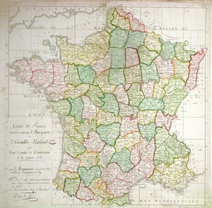
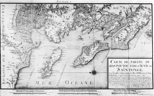
India and Malaysia, from an Atlas of the World in 33 Maps, Venice, 1st September 1553 (detail from 330955) Map showing Tycho Brahe A Map of The King A Map of the North Pole Coast of North Carolina (detail) Map of the Atlantic Ocean, c. 1550 A Map of the Countries Thirty Degrees round the North Pole, from Atlas 131 H.fol. 71, Map of part of Bas-Poitou and the Île de Noirmoutier, 1703 Part of South Australia, from a Series of World Maps published by John Tallis und Co, New York and London Map of Granada, from Civitates Orbis Terrarum by Georg Braun (1541-1622) and Frans Hogenberg (1535-90), 1563 Detail of Italy from the Peutinger map copy Map of France showing plans to divide departments, 1789 Fol. 31v Map of Australia and Magellan Island from “Cosmographie Universelle”, 1555 Atlas 131 H f.1, Map of Bas-Poitou, Pays d Double-hemisphere world map from Goos
View More from "Cartography"

A selection of our top sellers

Angel Traveller Neptune Young Hare The River of Light Saint Michael the Archangel, ca 1663 The Tiger Stein on the Danube (district of Krems) The Gare Saint-Lazare: Arrival of a Train, 1877 The Tortoise Trainer Scenography for “The Magic Flute”, opera by Wolfgang Amadeus Mozart, realised by Karl Schinkel (1781-1841) Four Foxes Actaeon surprises the goddess Artemis (Diana) bathing with her companions Saviour. From the Deesis tier The Seven Works of Mercy A Corner of the Garden at Montgeron, 1876-7
Show more artworks


What our customers think about us


Frequently Asked Questions about Meisterdrucke


Personalizing your art print at Meisterdrucke is simple and intuitive: Choose a frame, set the image size, pick a printing medium, and add suitable glazing or a stretcher frame. We also offer additional customization options like mats, fillets, and spacers. If you have any questions, our customer service team is ready to help you create your perfect artwork.

At Meisterdrucke, you can visualize your configured artwork directly in your own room. Simply upload a photo of your space and see how the artwork looks in it. If you're visiting us on a mobile device — phone or tablet — our augmented reality feature brings the picture to life and projects it right into your room. A unique experience that combines art and technology.

Choosing the right medium is often a matter of personal taste. To give you a better idea, we've provided some images for each medium. We also offer a sample set of all paper variants, so you can decide not just visually but by touch as well. You can order the sample set free of charge — only shipping costs apply.

Don't worry! At Meisterdrucke, we don't just process orders mechanically. Every order is manually reviewed by our team. If we spot any inconsistencies or issues with your configuration, we'll get in touch with you right away. And of course, our friendly and patient support team is always here to help you with your configuration. We'll work with you by phone or email to adjust your image so the final result is exactly what you had in mind.


Still have questions?

Are you interested in an art print from our manufactory but still unsure? Do you need advice on choosing the medium or help with the order?

Our experts are happy to assist you.

+43 4257 29415
support@meisterdrucke.com

Mo-Do: 7:00 - 16:00 | Fr: 7:00 - 13:00

Still have questions?

Are you interested in an art print from our manufactory but still unsure? Do you need advice on choosing the medium or help with the order?

Our experts are happy to assist you.

+43 4257 29415
support@meisterdrucke.com
Mo-Do: 7:00 - 16:00 | Fr: 7:00 - 13:00


Meisterdrucke

   Kärntner Strasse 46
        9586 Finkenstein am Faaker See
        Austria
        +43 4257 29415
        support@meisterdrucke.com
Other languages

                   
Erfahrungen & Bewertungen zu Meisterdrucke
Post.at DHL Express Quehenberger Cargoboard
Kaiser Franz Joseph

Meisterdrucke
Kärntner Strasse 46
9586 Finkenstein am Faaker See · Austria
+43 4257 29415 · support@meisterdrucke.com
Post.at DHL Express Quehenberger Cargoboard


(c) 2026 meisterdrucke.uk