support@meisterdrucke.com  ·  0043 4257 29415

Deutsch English Italiano Español Français Nederlands Português Svenska Polski Dansk
Search by artist, work title or style – e.g. Monet, Starry Night, Impressionism, Hokusai wave, nude. Describe the scene – e.g. green meadow, abstract with lots of red, dark oil painting, standing nude next to a tree.

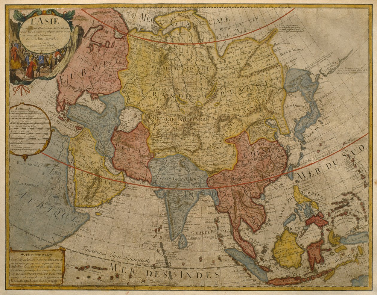
Map of Asia, published in 1700, Paris by Guillaume Delisle

Map of Asia, published in 1700, Paris

(Map of Asia, published in 1700, Paris (colour engraving))


Guillaume Delisle

€ 123.19
Tax-free
   Configure art print
17th century  ·  colour engraving  ·  Image ID: 219723

Nonclassified artists  ·  Cartography

Map of Asia, published in 1700, Paris by Guillaume Delisle. Available as an art print on canvas, photo paper, watercolor board, natural paper, or Japanese paper.
cartography · mapping · continent · geography · geographical · asian · Private Collection / Bridgeman Images
Other color versions of this image  
AR/3D   View in 3D / AR zu Favoriten hinzufügen   Add to favorites    Change wall color    View picture in a room
0 Reviews

Configure art print

Picture Frame

Medium & Stretcher

Glass & Passepartout

Miscellaneous & Extras

 Save / compare configuration
Preview Icon

Summary

Gemälde
Veredelung
Keilrahmen
Museumslizenz

€ 123.19
(inkl. 20% MwSt)
   Add to cart

Bildschärfe: PERFEKT

If you'd like us to adjust the brightness, colors, or crop the image, we're happy to do this for you at no extra cost. Just get in touch!

Similar artworks selected for you

Asia - by A Amsterdam Allard Asia Noviter China Recent Map of Asia, Showing the States and Empires of the Entire East along with the Eastern Indies 1692 Map of Asia Map of Asia, Nuremberg, c.1730 Asia Map of Asia from the Bleau Atlas Map of Asia Map showing the world trade shipping routes, cartography by Pierre Duval published in 1686, Paris Pakistan, India, Nepal, Bhutan, Bangladesh, Sri Lanka, East China, North Korea, South Korea, Japan, Burma, Thailand, Laos, Vietnam, Cambodia, Indonesia, Philippines, Malaysia Asia divided into its main states 1730 map of Asia by Herman Moll Description of the Asian continent, Geography map from Map of Europe, published in 1700, Paris 1695 Map of Asia Map of Asia, c.1696 New Universal Geography The theatre of the world or the new atlas Amsterdam. Geographic map of Asia by Willem Janszoon Blaeu Map of Asia, Tartaria, Japan, the Philippines and the East Indies, engraved by G. van Gouwen, c. 1690 Asia, in Map of Asia Map of Asia. Plate from an Atlas by Willem Janszoon Blaeu A new description of Asia Europe, engraving Map of the Northern Hemisphere of the World Turkey - Arabia and Iran General Map Including Arabia, Japan, the Korean Peninsula and the Greater Part of the Indonesian Archipelago, 1631
Show more similar artworks

More art prints by Guillaume Delisle

Map of the United Provinces of the Netherlands World Map, Drawn from Observations of the Royal Academy of Sciences and Others South Russia Map of Africa, published in 1700, Paris Map of Europe, published in 1700, Paris Map of North Africa (Mauritania, Morocco, Algeria, Tunisia, Libya) and Europe (Spain, Portugal, France, Italy, Greece with Balearic Islands, Sardinia, Corsica and Sicily) Map of Southern Italy, Corsica, and Sardinia known in Ancient Times as Great Greece or Magna Graecia, early 18th century Map of Mexico and Florida (USA) with the Caribbean Islands (Cuba, Haiti, Jamaica, Antilles) (etching) Map of Tartaria (Central Asia, Siberia, Turkestan, Mongolia and Manchuria) Map of Asia, published in 1700, Paris Map of Italy, with Corsica, Sardinia and Sicily Map of South America, published in 1700, Paris Map of Egypt, Nubia (Sudan) and Abyssinia (Ethiopia) Map of the Iberian Peninsula, Kingdom of Portugal and Spain Map of North America (Greenland, Canada, USA, Mexico and the Caribbean Islands: Cuba, Haiti, Jamaica, West Indies)
Show more works by Guillaume Delisle

More motifs from the category Cartography

Ms. 988 Vol. 3, fol. 61 Map of Wratislava, Breslau, from World map, illustration from Atlas Géographique Moderne by Prosper-Auguste Poulain de Bossay, c. 1850 Map of Eastern North America: Florida to Chesapeake Bay Map of the Voyage of the Argonauts, from the “Theatrum Orbis Terrarum”, 1603 Geological Map of the Kutch Region of India, Geological Survey of India 1868-69 The Site of Shakespeare Map Showing the Military Campaigns of Louis XIV in the Low Countries, from Atlas Géographique et Militaire, Published in Paris, 1763 Map of the Valley of Mexico at the time of the conquest, from History of the Conquest of Mexico, published 1850 Map of the Southern Hemisphere, from Map of Amsterdam, 1662 Map of Frankfurt and the surrounding area, from „Nova Hanc Territori Francofurtensis Tabulum“, 1649 Map of France showing plans to divide departments, 1789 Map of Rome, from Map of the town and citadel of Bellisle, from the
View More from "Cartography"

A selection of our top sellers

Nude in an Interior The Artist Two riders on the beach Arab Café (Little Turk) The Poor Poet The Great Wave of Kanagawa The Isle of the Dead Antibes, The Fort, 1888 Fish Magic Wiltshire Landscape, 1937 The Kiss Lowlands The Roundel in the Hedge Garden with a Flower Waterer Princess Tuvstarr Is Still Sitting There Wistfully Looking into the Water, 1913 The Kiss, 1907-08, detail of 601
Show more artworks


What our customers think about us


Frequently Asked Questions about Meisterdrucke


Personalizing your art print at Meisterdrucke is simple and intuitive: Choose a frame, set the image size, pick a printing medium, and add suitable glazing or a stretcher frame. We also offer additional customization options like mats, fillets, and spacers. If you have any questions, our customer service team is ready to help you create your perfect artwork.

At Meisterdrucke, you can visualize your configured artwork directly in your own room. Simply upload a photo of your space and see how the artwork looks in it. If you're visiting us on a mobile device — phone or tablet — our augmented reality feature brings the picture to life and projects it right into your room. A unique experience that combines art and technology.

Choosing the right medium is often a matter of personal taste. To give you a better idea, we've provided some images for each medium. We also offer a sample set of all paper variants, so you can decide not just visually but by touch as well. You can order the sample set free of charge — only shipping costs apply.

Don't worry! At Meisterdrucke, we don't just process orders mechanically. Every order is manually reviewed by our team. If we spot any inconsistencies or issues with your configuration, we'll get in touch with you right away. And of course, our friendly and patient support team is always here to help you with your configuration. We'll work with you by phone or email to adjust your image so the final result is exactly what you had in mind.


Still have questions?

Are you interested in an art print from our manufactory but still unsure? Do you need advice on choosing the medium or help with the order?

Our experts are happy to assist you.

+43 4257 29415
support@meisterdrucke.com
Mo-Do: 7:00 - 16:00 | Fr: 7:00 - 13:00

Still have questions?

Are you interested in an art print from our manufactory but still unsure? Do you need advice on choosing the medium or help with the order?

Our experts are happy to assist you.

+43 4257 29415
support@meisterdrucke.com
Mo-Do: 7:00 - 16:00 | Fr: 7:00 - 13:00


Meisterdrucke

   Kärntner Strasse 46
        9586 Finkenstein am Faaker See
        Austria
        +43 4257 29415
        support@meisterdrucke.com
Other languages

                   
Erfahrungen & Bewertungen zu Meisterdrucke
Post.at DHL Express Quehenberger Cargoboard
Kaiser Franz Joseph

Meisterdrucke
Kärntner Strasse 46
9586 Finkenstein am Faaker See · Austria
+43 4257 29415 · support@meisterdrucke.com
Post.at DHL Express Quehenberger Cargoboard


(c) 2026 meisterdrucke.uk