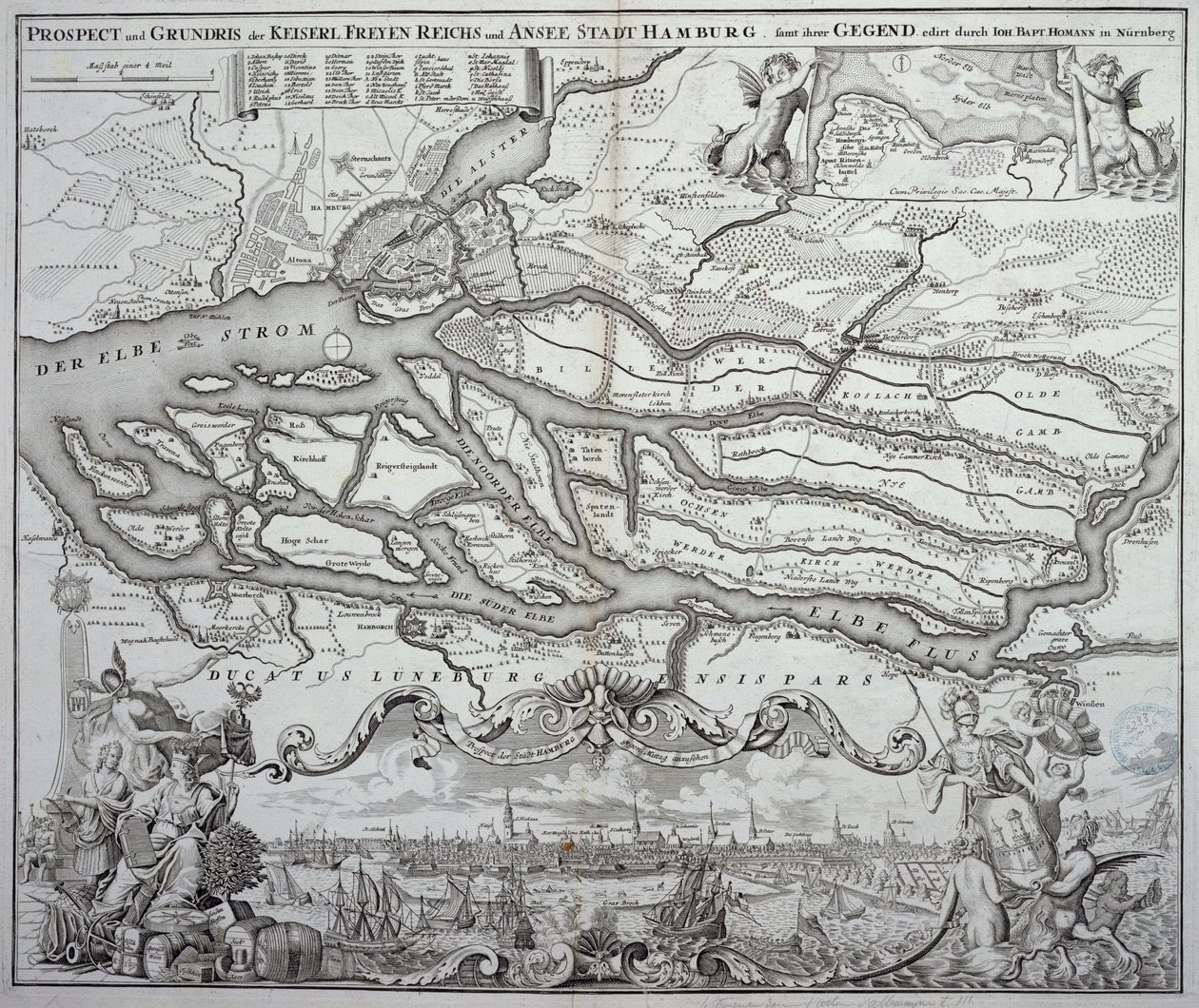
Map of Hamburg and the surrounding area, published in Nuremberg by German School

Map of Hamburg and the surrounding area, published in Nuremberg

(Map of Hamburg and the surrounding area, published in Nuremberg )


German School

€ 109.31
Enthält 0% MwSt.
   Configure art print
Undated  ·  engraving  ·  Picture ID: 424428

Cultural Circles  ·  Cartography

Map of Hamburg and the surrounding area, published in Nuremberg by German School. Available as an art print on canvas, photo paper, watercolor board, uncoated paper or Japanese paper.
the port of hamburg · plan · harbor · river · elbe · germany · Archives du Ministere des Affaires Etrangeres, Paris, France / Bridgeman Images
AR/3D   View in 3D / AR zu Favoriten hinzufügen   Add to favorites    Select wall color    View painting in a room
0 Reviews

Configure art print

Picture Frame

Medium & Stretcher

Glass & Passepartout

Miscellaneous & Extras

 Save / compare configuration
Preview Icon

Summary

Gemälde
Veredelung
Keilrahmen
Museumslizenz

€ 109.31
(inkl. 20% MwSt)
   Add to cart

Bildschärfe: PERFEKT

Should you desire adjustments to brightness and color, or a custom crop of the motif, we are happy to make these changes at no additional cost to you. Please do not hesitate to contact us.

Similar artworks selected for you

Battle of Ter won by the King The Principality of Orange and Comtat Venaissin The very famous River Elbe newly delineated A Map of Austria and Czechoslovakia Siege of Saint-Omer Groningae et Omlandiae Dominium (Province of City and Land) The Map of New England from William Hubbard Allegorical Map of the Stages of Love A Map of the Country and City of Panama. Part. 3 : Chap : 5. (engraving) Battle of Höchstädt, 1704 Siege of Hulst by Archduke Albert, 1596 Battle of Cassel, 1677 French Guiana, South America The Siege of La Rochelle Map of the Landing and Expedition of the Allies at Cadiz, 1702 A Map of New-England, from Map of Northern Norway with Enlarged Sections of Vardø and Kildin by Willem Barents Map of Chile Compiled by Jesuits Plan of the Glorious Action Near Pultawa in Ukraine Between the Armies of Tsar Peter the Great of Russia and King Charles XII of Sweden, June 27 - July 8, 1709 Speculum Romanae Magnificentiae: Ancient Rome, and its Hills, from the West, 1582 Map of Toulon (France) Toulon, France The Battle of Falkirk, 28 January 1746 Map of the Canal du Midi, with Its Aqueducts Project for the construction of a channel of communication between the Atlantic ocean and the Mediterranean sea, inclusive part approximately between Pexiora and Ouveillan; in the region of Languedoc-Roussillon, France Parke of the Artillery from Aubry de La Mottraye Trinity Island, engraving from Universal Cosmology Paris, France
Show more similar artworks

Other art prints by German School

Poster advertising the Hamburg-Amerika Line Wyk auf Föhr, Poster Advertising the Wyk Steam Shipping Company, 1897 Poster advertising the Hamburg-Amerika Line Woman Bathing St. Brendan and a Siren, from the German Translation of Navigatio Sancti Brendani Abbatis Poster for the Industrial Exhibition in Berlin, Germany, 1896 Arthur Schopenhauer Portrait of Kaiser Wilhelm II (1859-1941) The Whore of Babylon, from the Luther Bible Fantastic Depiction of the Solar System Poster Advertising the German East Africa Line, 1890 Battle in the streets of Bazeilles, Franco-Prussian War, 1 September 1870 Sylt North Sea Baths, Poster Advertising the Sylt Steamship Company, 1893 Poster advertising Hamburg-Amerika Linie routes to the West Indies and Central America King Frederick William I on Horseback with Potsdam in the background, c.1735
Discover more works by German School

Other motives from the category Cartography

Tombleson Map of the Island of Minorca, c.1740 Map of Paris c.1540, known as the Plan de la Tapisserie, made as a tapestry c.1571, 1818 The Restitutio-Allardt Map of New Amsterdam, Engraved and Published by Carolus Allardt, 1673 Map of India, published under the direction of Colonel H.R. Thuillier, Surveyor General of India Royal Commission of London Traffic, 1904; Principal Factories and Works in the Metropolitan Area Map of the Magellan Straits, Patagonia Map of the New England coastline in 1614, engraved by Simon de Passe Map of the North Sea, c.1675 Part of the Tabula Peutingeriana, an illustrated itinerarium of the road network in the Roman Empire. Detail of Italy from the Peutinger map copy Map Showing the Military Campaigns of Louis XIV in the Low Countries, from Atlas Géographique et Militaire, Published in Paris, 1763 Reproduction of Map of Routes of St. James of Compostel, Originally Engraved by D. Serveaux 1648 Map of the village of Belchamp St. Paul Map of Palestine, Palestina Antiqua, from Admiranta Narratio... Map of Virginia, 1585-1588
View More from "Cartography"

Excerpt from our top sellers

View of L Ponte Fabricio Haystacks View from a Window The Water-Lily Pond After Sunset Starry Night over the Rhone Pillars of Creation (NIRCam and MIRI Composite) The Road to Bas-Breau, Fontainebleau (Le Pave de Chailly) Paris Street; Rainy Day The Embrace Roses, or The Artist The Goldfinch Vesuvius in Eruption Portrait of a Young Woman, Drawing
Show More Artworks


What our customers think about us


Frequently Asked Questions about Meisterdrucke


Personalizing your art print at Meisterdrucke is a simple and intuitive process that allows you to design an artwork exactly to your specifications: Choose a frame, determine the image size, decide on a printing medium, and add suitable glazing or a stretcher frame. We also offer customization options such as mats, fillets, and spacers. Our customer service is available to help you design your perfect artwork.

At Meisterdrucke, you have the fascinating option to visualize the artwork you configured directly in your own space. For a tailored preview, simply upload a photo of your room and let the artwork appear on it. If you visit us via a mobile device, be it a phone or tablet, our augmented reality feature brings the image to life and seamlessly projects it into your space. An experience that uniquely combines art and technology.

Choosing the medium is often a matter of personal taste. To give you a clearer idea, we have provided some images for each medium. For a holistic experience, we also offer you a sample set of all paper variants so you can make a decision not just visually but also haptically. You can take advantage of the sample set free of charge – only the shipping costs will apply. You can order the sample set directly.

Do not worry. At Meisterdrucke, we do not proceed mechanically. We manually review each order. If there are any inconsistencies or peculiarities in the configuration, we will immediately contact you. Of course, our courteous and patient support is always at your side to assist you with the configuration. Together with you, we adjust your image by phone or email so that the final result exactly meets your expectations.


Do you have any questions?

Are you interested in an art print from our manufactory but still unsure? Do you need advice on choosing the medium or help with the order?

Our experts are happy to assist you.

+43 4257 29415
support@meisterdrucke.com
Mo-Do: 7:00 - 16:00 | Fr: 7:00 - 13:00

Do you have any questions?

Are you interested in an art print from our manufactory but still unsure? Do you need advice on choosing the medium or help with the order?

Our experts are happy to assist you.

+43 4257 29415
support@meisterdrucke.com
Mo-Do: 7:00 - 16:00 | Fr: 7:00 - 13:00


Meisterdrucke

   Kärntner Strasse 46
        9586 Finkenstein am Faaker See
        Austria
        +43 4257 29415
        support@meisterdrucke.com
Other languages

                   
Erfahrungen & Bewertungen zu Meisterdrucke
Post.at DHL Express Quehenberger Cargoboard
Kaiser Franz Joseph

Meisterdrucke
Kärntner Strasse 46
9586 Finkenstein am Faaker See · Austria
+43 4257 29415 · office@meisterdrucke.com
Post.at DHL Express Quehenberger Cargoboard


Meisterdrucke 2716 Bewertungen auf ProvenExpert.com

(c) 2025 meisterdrucke.uk