support@meisterdrucke.com  ·  0043 4257 29415

Deutsch English Italiano Español Français Nederlands Português Svenska Polski Dansk
Search by artist, work title or style – e.g. Monet, Starry Night, Impressionism, Hokusai wave, nude. Describe the scene – e.g. green meadow, abstract with lots of red, dark oil painting, standing nude next to a tree.

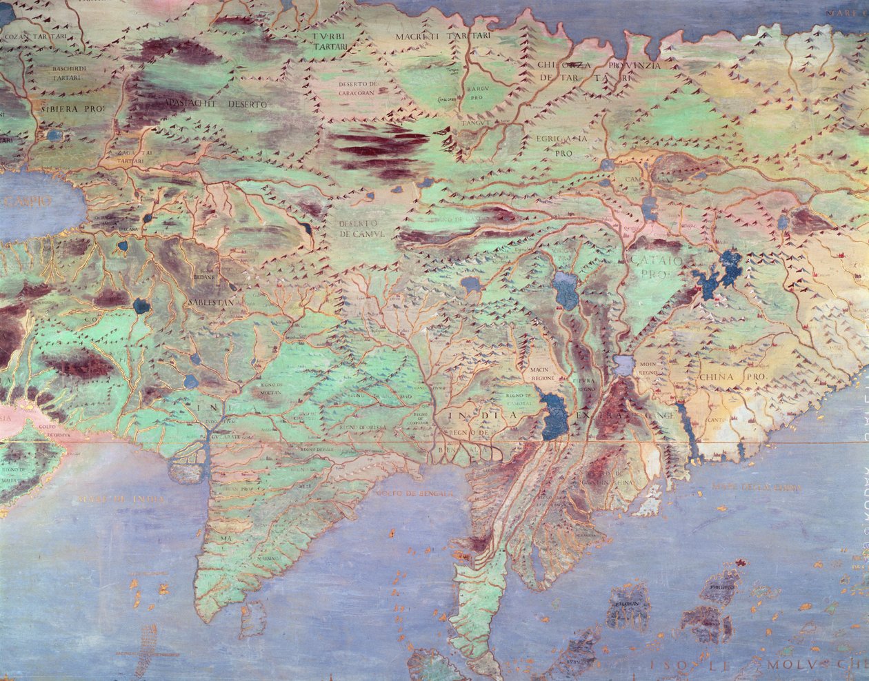
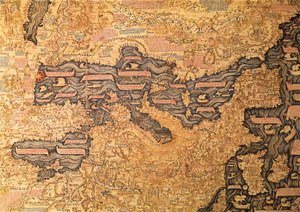
Map of Asia, from the 'Sala del Mappamondo' (Hall of the World Maps) by Antonio Giovanni de Varese

Map of Asia, from the 'Sala del Mappamondo' (Hall of the World Maps)

(Map of Asia, from the 'Sala Del Mappamondo' (Hall of the World Maps) )


Antonio Giovanni de Varese

€ 123.19
Tax-free
   Configure art print
Undated  ·  Fresh  ·  Image ID: 106075

Nonclassified artists  ·  Cartography

Map of Asia, from the 'Sala del Mappamondo' (Hall of the World Maps) by Antonio Giovanni de Varese. Available as an art print on canvas, photo paper, watercolor board, natural paper, or Japanese paper.
country · countries · cartography · mural · interior · Villa Farnese, Caprarola, Lazio, Italy / Bridgeman Images
AR/3D   View in 3D / AR zu Favoriten hinzufügen   Add to favorites    Change wall color    View picture in a room
0 Reviews

Configure art print

Picture Frame

Medium & Stretcher

Glass & Passepartout

Miscellaneous & Extras

 Save / compare configuration
Preview Icon

Summary

Gemälde
Veredelung
Keilrahmen
Museumslizenz

€ 123.19
(inkl. 20% MwSt)
   Add to cart

Bildschärfe: PERFEKT

If you'd like us to adjust the brightness, colors, or crop the image, we're happy to do this for you at no extra cost. Just get in touch!

Similar artworks selected for you

Map of Europe and Africa, from the ‘Sala del Mappamondo’ (Hall of the World Maps) Map of the Countries of the Persian Gulf, from the “Sala del Mappamondo” (Hall of the World Maps) Map of Cuba and the Caribbean Map of Central Europe, from the The Map is Published in Christiania Map of Sixteenth-Century Europe, from the “Sala del Mappamondo” (Hall of the World Maps), c.1574-5 Map of North and South America, from the Map of Sixteenth Century Europe, from the Map of Mexico and Central America, from the Map of Sixteenth Century India, from the World map by Camaldolese monk Fra Mauro Map of France, Spain and North-West Africa, from the Nansenbushu Bankoku Shoka No Zu First Japanese Buddhist Map of the World Detail of the Mediterranean, from Large Planisphere, or Mappa Mondo of 1459 Map of Mediterranean Sea Map of Persia Map of Asia at the time of the greatest extent of the domination of the Mongols in the reign of Kublai Khan, from L Iran Ireland between Londonderry and Dublin A 1929 copy with names transliterated into Latin script of the 1154 Arabic Tabula Rogeriana, upside-down with north oriented up Roy Military Survey of Scotland Gulf of Mexico, Cuba and Southern United States Mexico, Cuba, Florida and Jamaica. Map made by Egnazio Danti (1536-1586), Italian mathematician, cosmographer and architect. Around 1567. Florence, Palazzo Vecchio, Sala del Mappamondo The Selden Map of China Copy of the Map of Lake Garda and Surrounding Areas Luxembourg (engraving) Roy Military Survey of Scotland Map of New Spain (North America)
Show more similar artworks

More art prints by Antonio Giovanni de Varese

Map of Central Europe, from the Map of North and South America, from the Ferdinand Magellan (c. 1480-1521) from the Map of Africa in the Sala del Mappamondo Map of Europe and Africa, from the ‘Sala del Mappamondo’ (Hall of the World Maps) Map of France, Spain and North-West Africa, from the Map of the Countries of the Persian Gulf, from the “Sala del Mappamondo” (Hall of the World Maps) Map of Asia, from the Marco Polo from the Amerigo Vespucci from the Portrait of Marco Polo
Show more works by Antonio Giovanni de Varese

More motifs from the category Cartography

India and Malaysia, from an Atlas of the World in 33 Maps, Venice, 1st September 1553 (detail from 330955) Map of Canaan, or Palestine, published by A. K. Johnstone The Middle East, from an Atlas of the World in 33 Maps, Venice, 1st September 1553 Typus Orbis Terrarum, map of the world, from Ortelius Map of Southern India Map of Corsica Detail from Europe and Central Asia, from an Atlas of the World in 33 Maps, Venice, 1st September 1553 Map of the East Indies, published 1635 in Amsterdam Map of Sevastopol, 1854 Admiranta Narratio... Map of Virginia (pages 44-45), 1585-1588, colour engraving Double Hemisphere World Map, 1587 Map of the Known World, from „Geographia“ A Map of the Province of New York with Part of Pennsylvania and New England, from an Actual Survey by Captain Montrésor, Engineer, 1775, 10 June 1775 Map of the Kingdom of Great Britain and Ireland, 1610 Map of Europe at the Time of the Third Crusade, 1190, from
View More from "Cartography"

A selection of our top sellers

Winter, c. 1910 View of Venice: The Ducal Palace, Dogana and Part of San Giorgio, 1841 Yacht Approaching the Coast Sack of Rome (455) - The Course of Empire - Destruction - 1836 - New York Historical Society - (Rome, Roman Empire, Gaiseric, Genseric, Migration Period, Barbarian Invasions, Vandals, Fall of Western Roman Empire, Fall of Rome, Sack of Rome) Open Window, Collioure Group of Egrets, 1925-36 Tondal The Golden Fish Animals in a Landscape, 1914 The Harvest Small Rhythmic Landscape Two Men Contemplating the Moon Sin Woman with a Veil, 1915 Cosmic Cliffs in the Carina Nebula (NIRCam Image)
Show more artworks


What our customers think about us


Frequently Asked Questions about Meisterdrucke


Personalizing your art print at Meisterdrucke is simple and intuitive: Choose a frame, set the image size, pick a printing medium, and add suitable glazing or a stretcher frame. We also offer additional customization options like mats, fillets, and spacers. If you have any questions, our customer service team is ready to help you create your perfect artwork.

At Meisterdrucke, you can visualize your configured artwork directly in your own room. Simply upload a photo of your space and see how the artwork looks in it. If you're visiting us on a mobile device — phone or tablet — our augmented reality feature brings the picture to life and projects it right into your room. A unique experience that combines art and technology.

Choosing the right medium is often a matter of personal taste. To give you a better idea, we've provided some images for each medium. We also offer a sample set of all paper variants, so you can decide not just visually but by touch as well. You can order the sample set free of charge — only shipping costs apply.

Don't worry! At Meisterdrucke, we don't just process orders mechanically. Every order is manually reviewed by our team. If we spot any inconsistencies or issues with your configuration, we'll get in touch with you right away. And of course, our friendly and patient support team is always here to help you with your configuration. We'll work with you by phone or email to adjust your image so the final result is exactly what you had in mind.


Still have questions?

Are you interested in an art print from our manufactory but still unsure? Do you need advice on choosing the medium or help with the order?

Our experts are happy to assist you.

+43 4257 29415
support@meisterdrucke.com

Mo-Do: 7:00 - 16:00 | Fr: 7:00 - 13:00

Still have questions?

Are you interested in an art print from our manufactory but still unsure? Do you need advice on choosing the medium or help with the order?

Our experts are happy to assist you.

+43 4257 29415
support@meisterdrucke.com
Mo-Do: 7:00 - 16:00 | Fr: 7:00 - 13:00


Meisterdrucke

   Kärntner Strasse 46
        9586 Finkenstein am Faaker See
        Austria
        +43 4257 29415
        support@meisterdrucke.com
Other languages

                   
Erfahrungen & Bewertungen zu Meisterdrucke
Post.at DHL Express Quehenberger Cargoboard
Kaiser Franz Joseph

Meisterdrucke
Kärntner Strasse 46
9586 Finkenstein am Faaker See · Austria
+43 4257 29415 · support@meisterdrucke.com
Post.at DHL Express Quehenberger Cargoboard


(c) 2026 meisterdrucke.uk