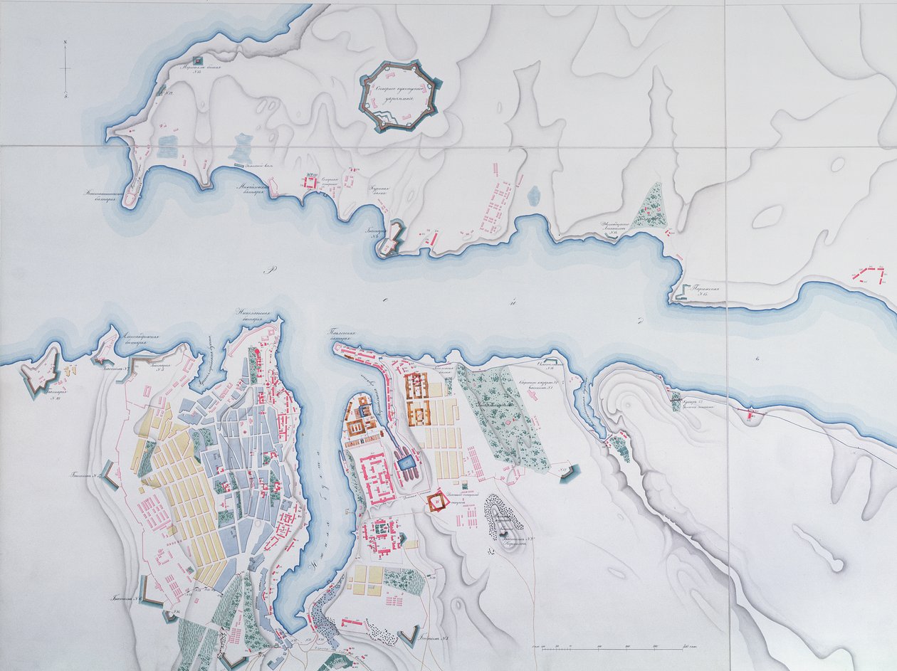
Map of Sevastopol by Russian School

Map of Sevastopol

(Map of Sevastopol, 1854 )


Russian School

€ 117.86
Enthält 0% MwSt.
   Configure art print
1854  ·  colour lithograph  ·  Picture ID: 441841

Cultural Circles  ·  Cartography

Map of Sevastopol by Russian School. Available as an art print on canvas, photo paper, watercolor board, uncoated paper or Japanese paper.
crimea · mapping · carte · harbour · port · geography · geographical · cartography · coast · strategic city · aerial view · Archives des Tsars, St. Petersburg, Russia / Bridgeman Images
AR/3D   View in 3D / AR zu Favoriten hinzufügen   Add to favorites    Select wall color    View painting in a room
0 Reviews

Configure art print

Picture Frame

Medium & Stretcher

Glass & Passepartout

Miscellaneous & Extras

 Save / compare configuration
Preview Icon

Summary

Gemälde
Veredelung
Keilrahmen
Museumslizenz

€ 117.86
(inkl. 20% MwSt)
   Add to cart

Bildschärfe: PERFEKT

Should you desire adjustments to brightness and color, or a custom crop of the motif, we are happy to make these changes at no additional cost to you. Please do not hesitate to contact us.

Similar artworks selected for you

Plan for the Construction of the Coast Batteries for the Defence of Breton Harbour in 1848 Map of Friderichstad and Its Situation Plan of the Siege of Sebastopol, 1883 A Sketch of the River Tagus from the Bar of Alcacova up to Coffin Plan of the Siege of Sebastopol 1854-55, engraved by Robert Walker, pub. William Mackenzie, c.1860 Map showing the Siege of Sevastopol, Crimean War, 1854-1855, 1893 Map of Rhode Island, from The Port of Mahon and surrounding area, from Cala Murte to Cala Rafalet Roy Military Survey of Scotland Map of the Operations of the American Army in the Valley of Mexico in August and September 1847 during the Mexican-American War Peterhof, Russia: Elevation of the English Palace and plan of the park Greece, the Peiraeus or Port Drako Surveyed by Commander Thomas Graves, H.M.S. Beacon 1840 (Detail) Map of Rhode Island at the time of its occupation 1780-81 by the French Army on the orders of Jean-Baptiste de Vimeur Count of Rochambeau Reconnaissance of King Map for the Battle of Austerlitz, December 2nd, 1805 Peterhof, Russia: Elevation of the English Palace and Plan of the Park Wonsan Chongyong Map of Düsseldorf England East Coast Entrance to the River Humber Surveyed by Staff Captain J. Parsons, Royal Navy Black Sea Sebastopol from a Russian Survey of 1836 Map of the bay and city of S. Phelipe de Portobelo Map of Phillipsburg, from Sketch of the Fortress of Ghuznee. Taken by Storm on the 23rd July 1839 Plan of Jerusalem in 1308, illustration from a facsimile edition of Liber de Expeditione Terrae Sanctae by Marino Sanuto di Torcello Venice Liquid Streets (2008) Map of the St. Lawrence Estuary Geological Map of the Cutch Desert, 1870 Map of Sofala, Mozambique, from A Plan of St. Philips Castle and Fortifications in the Island of Minorca
Show more similar artworks

Other art prints by Russian School

St. George and the Dragon, Russian Icon from Vologda, 15th Century Archangel Gabriel (Angel with Golden Hair), Russian Icon, 12th Century Soviet Poster of Stalin Reading a Telegram, 1949 Horse Drawn Sleigh Russian sailor in the Uniform of the Russian Navy at the end of the nineteenth century Siberian Tiger Attacking a Cossack Portrait of Elizabeth Petrovna, Empress of Russia, c.1750 Horse Drawn Sleigh (detail) The Black Madonna of Jasna Gora Mitre crown set with pearls and precious stones The Saviour, early 14th century Horse Drawn Sleigh (digital detail) Tsarevna Sophia Alexeevna, (1657-1704) 1680s Alexander Pushkin, Russian novelist, poet and playwright Portrait of Pyotr Ilyich Tchaikovsky
Discover more works by Russian School

Other motives from the category Cartography

An inciting map of the Turbid Amazon, illustration from Map of Cumberland Map of Asia, Tartaria, Japan, the Philippines and the East Indies, engraved by G. van Gouwen, c.1690 Map and Plan of Saint-Malo, from the Map from De La Situation du Paradis Terrestre, 1691 Map to Illustrate the War of American Independence, from Map of Sixteenth Century Arabia, from the Map of Phoenicia, Mesopotamia and Babylon Detail showing an African ruler from a Renaissance map of Europe, Jacopo Russo (after) 1528 Map of Illinois Central Railroad Company Map illustrating the Naval Attack on England by Napoleon Bonaparte, c.1803-04 Map of Tenochtitlan and the Gulf of Mexico, from Praeclara Ferdinadi Cortesii de Nova maris Oceani Hyspania Narratio by Hernando Cortes (1485-1547) 1524 Map of Greece, Hungary and Their Surrounding Countries Map of Montpellier, from A new and correct map of the world laid down according to the newest discoveries and from the most exact observations
View More from "Cartography"

Excerpt from our top sellers

The Monk by the Sea, 1808-1810 Appian Way The River of Light The Harvesters Wandering Shadows Girl with a Pearl Earring The Sun Tibet. Himalayas Water Serpents II Supper at Emmaus Horse Study The Lady of Shalott The Birth of Venus Summer The Magpie
Show More Artworks

Excerpt from our top sellers

The Monk by the Sea, 1808-1810 Appian Way The River of Light The Harvesters Wandering Shadows Girl with a Pearl Earring The Sun Tibet. Himalayas Water Serpents II Supper at Emmaus Horse Study The Lady of Shalott The Birth of Venus Summer The Magpie
Show More Artworks


What our customers think about us


Frequently Asked Questions about Meisterdrucke


Personalizing your art print at Meisterdrucke is a simple and intuitive process that allows you to design an artwork exactly to your specifications: Choose a frame, determine the image size, decide on a printing medium, and add suitable glazing or a stretcher frame. We also offer customization options such as mats, fillets, and spacers. Our customer service is available to help you design your perfect artwork.

At Meisterdrucke, you have the fascinating option to visualize the artwork you configured directly in your own space. For a tailored preview, simply upload a photo of your room and let the artwork appear on it. If you visit us via a mobile device, be it a phone or tablet, our augmented reality feature brings the image to life and seamlessly projects it into your space. An experience that uniquely combines art and technology.

Choosing the medium is often a matter of personal taste. To give you a clearer idea, we have provided some images for each medium. For a holistic experience, we also offer you a sample set of all paper variants so you can make a decision not just visually but also haptically. You can take advantage of the sample set free of charge – only the shipping costs will apply. You can order the sample set directly.

Do not worry. At Meisterdrucke, we do not proceed mechanically. We manually review each order. If there are any inconsistencies or peculiarities in the configuration, we will immediately contact you. Of course, our courteous and patient support is always at your side to assist you with the configuration. Together with you, we adjust your image by phone or email so that the final result exactly meets your expectations.


Do you have any questions?

Are you interested in an art print from our manufactory but still unsure? Do you need advice on choosing the medium or help with the order?

Our experts are happy to assist you.

+43 4257 29415
support@meisterdrucke.com
Mo-Do: 7:00 - 16:00 | Fr: 7:00 - 13:00

Do you have any questions?

Are you interested in an art print from our manufactory but still unsure? Do you need advice on choosing the medium or help with the order?

Our experts are happy to assist you.

+43 4257 29415
support@meisterdrucke.com
Mo-Do: 7:00 - 16:00 | Fr: 7:00 - 13:00


Meisterdrucke

   Kärntner Strasse 46
        9586 Finkenstein am Faaker See
        Austria
        +43 4257 29415
        support@meisterdrucke.com
Other languages

                   
Erfahrungen & Bewertungen zu Meisterdrucke
Post.at DHL Express Quehenberger Cargoboard
Kaiser Franz Joseph

Meisterdrucke
Kärntner Strasse 46
9586 Finkenstein am Faaker See · Austria
+43 4257 29415 · office@meisterdrucke.com
Post.at DHL Express Quehenberger Cargoboard


Meisterdrucke 2705 Bewertungen auf ProvenExpert.com

(c) 2025 meisterdrucke.uk