support@meisterdrucke.com  ·  0043 4257 29415

Deutsch English Italiano Español Français Nederlands Português Svenska Polski Dansk
Search by artist, work title or style – e.g. Monet, Starry Night, Impressionism, Hokusai wave, nude. Describe the scene – e.g. green meadow, abstract with lots of red, dark oil painting, standing nude next to a tree.

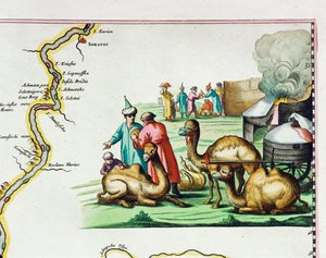
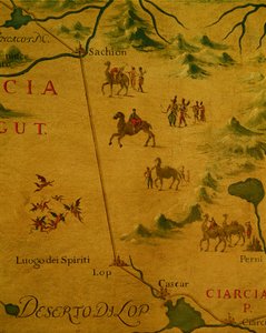
Map of Africa in 1686 by Joan Blaeu (detail) by Joan Blaeu

Map of Africa in 1686 by Joan Blaeu (detail)

(Map of Africa in 1686 by Joan Blaeu, detail)


Joan Blaeu

€ 123.19
Tax-free
   Configure art print
Undated  ·  engraving  ·  Image ID: 1103995

Nonclassified artists

Map of Africa in 1686 by Joan Blaeu (detail) by Joan Blaeu. Available as an art print on canvas, photo paper, watercolor board, natural paper, or Japanese paper.
/ Bridgeman Images
AR/3D   View in 3D / AR zu Favoriten hinzufügen   Add to favorites    Change wall color    View picture in a room
0 Reviews

Configure art print

Picture Frame

Medium & Stretcher

Glass & Passepartout

Miscellaneous & Extras

 Save / compare configuration
Preview Icon

Summary

Gemälde
Veredelung
Keilrahmen
Museumslizenz

€ 123.19
(inkl. 20% MwSt)
   Add to cart

Bildschärfe: PERFEKT

If you'd like us to adjust the brightness, colors, or crop the image, we're happy to do this for you at no extra cost. Just get in touch!

Similar artworks selected for you

Desert of Lop and home of spirits and ghosts as crossed by Marco Polo Detail from the Catalan Atlas, 1375 (detail of 151844) Detail of Copy of a Catalan Map of Europe and North Africa, presented to Charles V of France in 1381 Detail of Marco Polo Detail of a Catalan nautical chart (portolan) representing Asia of the 13th century, on which one can see a caravan walking towards Cathay (name given by Marco Polo to designate the region of North China): Silk Route taken by Marco Polo. Catalan Atlas by Marco Polo The Carte du Tendre, a map of an imaginary country, from volume II of Eastern Europe and Balkans 1575 Harbor of Palos, by Abraham Ortelius (1528-1598), Plate Joan Blaeu The North Coast of Africa, from a nautical atlas, 1651 (detail) Detail of Roman Gaul from the Peutinger map copy Saxton Catalan map of the European continent with the Atlantic and the Mediterranean Sea Ethiopia, the Red Sea and Saudi Arabia, from an Atlas of the World in 33 Maps, Venice, 1st September 1553, detail from 330946 Merchants Travelling to Cathay, China, Following in Marco Polo Map of the City of Jerusalem, from “Peregrinatio in Terram Sanctam” by Bernhard von Breydenbach (1440-97) Arabia and India, from the Map of Raab, from Civitates Orbis Terrarum by Georg Braun (1541-1622) and Frans Hogenberg (1535-90), 1597 Coast of North Carolina (detail) Map of South America, 1593 Africa: Egypt and Saudi Arabia, from Atlas of the World in Thirty-Three Maps 1592 Map of Africa Map of the Russian Empire in the sixteenth century, copy of an original of 1571 The Red Sea (detail) Marco Polo Nautical chart of Mediterranean area, including Europe with British Isles and part of Scandinavia A Nautical Map, detail of Western Europe, 1564 Map of the Russian Empire, 1588
Show more similar artworks

More art prints by Joan Blaeu

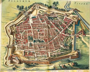
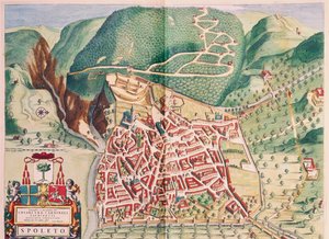
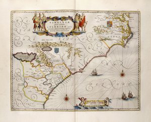
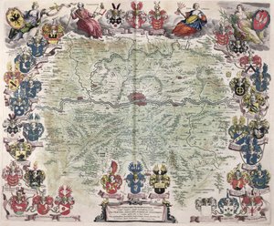
Map of East Prussia, from Italy, Map of Pesaro, from Theatrum civitatum et admirandorum Italiae by Joan Blaeu, engraving Map of Spoleto from Theatrum civitatum et admirandorum Italiae, by Joan Blaeu Luxembourg, the capital of the Duchy Map of Virginia and Florida Map of New Belgium and New England, published in Amsterdam c.1640 Map of Frankfurt and the surrounding area, from „Nova Hanc Territori Francofurtensis Tabulum“, 1649 Map of the travels of Alexander the Great (356-323 BC) from Tycho Brahe’s observatory Uraniborg from Joan Blaeu’s ’Atlas Major’, 1663 Map of China, from ”Atlas Maior Sive Cosmographia Blaviana”, 1662 Map of Assisi from Theatrum civitatum et admirandorum Italiae, by Joan Blaeu Map of Europe from: Atlas Maior Map of Europe, 1686, by Joan Blaeu Map of the gold-bearing regions in Peru, from the Atlas Maior, Sive Cosmographia Blaviana, 1662 Map of Cambridgeshire, published Amsterdam c.1647-48
Show more works by Joan Blaeu

A selection of our top sellers

Ponte Fabricio Breakfast with the Morning Newspaper, 1898 The Entrance to the Grand Canal, Venice Fish Blood Women from Galicia at the Window, c. 1655-1660 The Sun Free Curve to the Point - Accompanying Sound of Geometric Curves, 1925 The Family Sailing Ship in the Fog Moonrise over the Sea Reflection in the Surface of the Water, Misaka, Kai Province from the series Thirty-Six Views of Mt Fuji, 1830-1833 Winter, 1573 The Bathing Pool Japanese Vase with Roses and Anemones, 1890 Buddha
Show more artworks


What our customers think about us


Frequently Asked Questions about Meisterdrucke


Personalizing your art print at Meisterdrucke is simple and intuitive: Choose a frame, set the image size, pick a printing medium, and add suitable glazing or a stretcher frame. We also offer additional customization options like mats, fillets, and spacers. If you have any questions, our customer service team is ready to help you create your perfect artwork.

At Meisterdrucke, you can visualize your configured artwork directly in your own room. Simply upload a photo of your space and see how the artwork looks in it. If you're visiting us on a mobile device — phone or tablet — our augmented reality feature brings the picture to life and projects it right into your room. A unique experience that combines art and technology.

Choosing the right medium is often a matter of personal taste. To give you a better idea, we've provided some images for each medium. We also offer a sample set of all paper variants, so you can decide not just visually but by touch as well. You can order the sample set free of charge — only shipping costs apply.

Don't worry! At Meisterdrucke, we don't just process orders mechanically. Every order is manually reviewed by our team. If we spot any inconsistencies or issues with your configuration, we'll get in touch with you right away. And of course, our friendly and patient support team is always here to help you with your configuration. We'll work with you by phone or email to adjust your image so the final result is exactly what you had in mind.


Still have questions?

Are you interested in an art print from our manufactory but still unsure? Do you need advice on choosing the medium or help with the order?

Our experts are happy to assist you.

+43 4257 29415
support@meisterdrucke.com

Mo-Do: 7:00 - 16:00 | Fr: 7:00 - 13:00

Still have questions?

Are you interested in an art print from our manufactory but still unsure? Do you need advice on choosing the medium or help with the order?

Our experts are happy to assist you.

+43 4257 29415
support@meisterdrucke.com
Mo-Do: 7:00 - 16:00 | Fr: 7:00 - 13:00


Meisterdrucke

   Kärntner Strasse 46
        9586 Finkenstein am Faaker See
        Austria
        +43 4257 29415
        support@meisterdrucke.com
Other languages

                   
Erfahrungen & Bewertungen zu Meisterdrucke
Post.at DHL Express Quehenberger Cargoboard
Kaiser Franz Joseph

Meisterdrucke
Kärntner Strasse 46
9586 Finkenstein am Faaker See · Austria
+43 4257 29415 · support@meisterdrucke.com
Post.at DHL Express Quehenberger Cargoboard


(c) 2026 meisterdrucke.uk