support@meisterdrucke.com  ·  0043 4257 29415

Deutsch English Italiano Español Français Nederlands Português Svenska Polski Dansk
Search by artist, work title or style – e.g. Monet, Starry Night, Impressionism, Hokusai wave, nude. Describe the scene – e.g. green meadow, abstract with lots of red, dark oil painting, standing nude next to a tree.

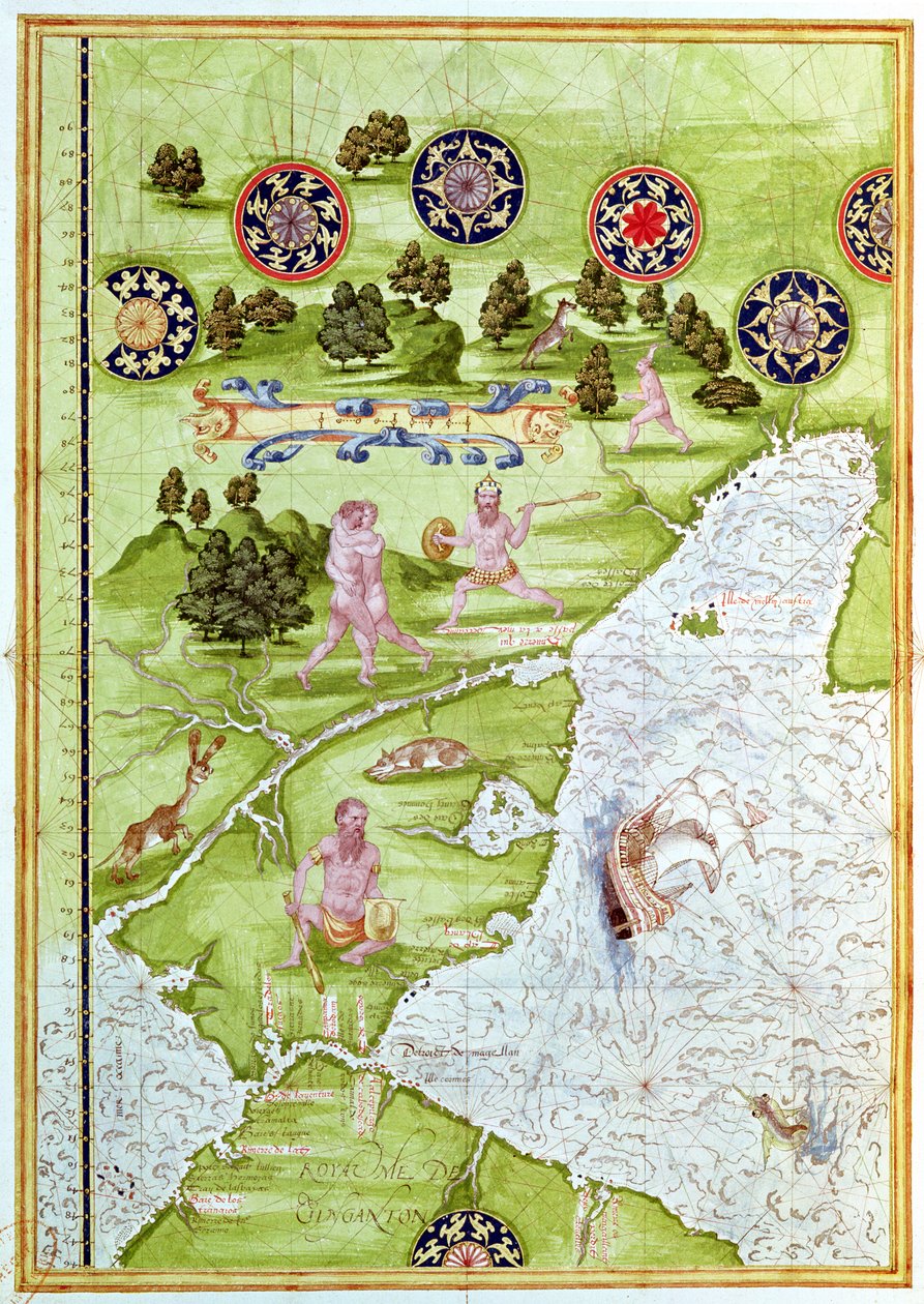
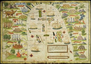
Fol. 40v, Map of the Magellan Straits, from

Fol. 40v, Map of the Magellan Straits, from 'Cosmographie Universelle', 1555

(Fol.40v Map of the Magellan Straits, from 'Cosmographie Universelle', 1555 )


Guillaume Le Testu

€ 132.32
Tax-free
   Configure art print
1555  ·  Watercolor on paper  ·  Image ID: 91977

Nonclassified artists  ·  Cartography

Fol. 40v, Map of the Magellan Straits, from 'Cosmographie Universelle', 1555 by Guillaume Le Testu. Available as an art print on canvas, photo paper, watercolor board, natural paper, or Japanese paper.
tierra del fuego · patagonia · south american · ocean · animal · bird · compass · native · ship · hunting · strait · savage · wild · Min. Defense - Service Historique de l'Armee de Terre,France / Bridgeman Images
Other color versions of this image  
AR/3D   View in 3D / AR zu Favoriten hinzufügen   Add to favorites    Change wall color    View picture in a room
0 Reviews

Configure art print

Picture Frame

Medium & Stretcher

Glass & Passepartout

Miscellaneous & Extras

 Save / compare configuration
Preview Icon

Summary

Gemälde
Veredelung
Keilrahmen
Museumslizenz

€ 132.32
(inkl. 20% MwSt)
   Add to cart

Bildschärfe: PERFEKT

If you'd like us to adjust the brightness, colors, or crop the image, we're happy to do this for you at no extra cost. Just get in touch!

Similar artworks selected for you

Map of Australia, from The Spice Trade in the Moloccas, from Fol. 47v Map of Peru, from Map of Australia and Magellan Island from Map of Florida and the Antilles, from Map of Florida, Canada and Labrador (from Fol. 44v Map of Brazil, from Map of Florida, from Fol. 10v Map of Scandinavia and Northern Russia, from Map of the Magellan Straits, from Atlas by Diego Homem of South America, showing Indians in their settlements, Spanish Expeditionary Force Camp and Men in Armour Map of the City of Jerusalem, from Hydrographic Map of Brazil Map of the China Sea, from a facsimile of the Miller Atlas by Pedro and Jorge Reinel, and Lopo Homem, made in 1519 Arabia and India, from the The Indes Portuguese nautical atlas. Page of the Atlas Miller manuscript made in 1519 by Pierre and Georges Reinel, Lopo Homem (cartographers) and Antoine de Hollande (miniaturist) Map of China (Cathay), with descriptions of small scenes, delimitation of the kingdoms with its sovereign represented each time Map of Concarneau, from the Arabian Peninsula Miller Atlas, c1519 Brazil from the Chart of the Mediterranean, Black Sea, and the coasts of western Europe and northwest Africa, c.1559 Map of Sixteenth Century Arabia, from the Map of Europe, from a facsimile of the ‘Miller Atlas’ by Pedro and Jorge Reinel, and Lopo Homem, made in 1519 Map of Asia, Including Armenia, Iran, Afghanistan, with Wind Rose, Details of Ports, Coasts and Sea Routes, in Atlas de Joan Martines Geographic map of the Mediterranean Sea showing the coasts of Europe (France, Spain, Italy) and Africa (Tunisia, Algeria, Egypt). The sea is populated with monsters and caravels, while on the land are visible all kinds of animals and inhabitants of the Map of the Sea of Maluku, from the Cosmographie Universelle Portulan of the West Coast of Africa with the Canary Islands
Show more similar artworks

More art prints by Guillaume Le Testu

Fol. 47v Map of Peru, from Fol. 40v, Map of the Magellan Straits, from Fol. 10v Map of Scandinavia and Northern Russia, from Fol. 44v Map of Brazil, from Map of the North Pole, from Map of Australia, from Map of Western Europe, from Map of the Sea of Maluku, from the Cosmographie Universelle Map of Florida and the Antilles, from Map of Florida, Canada and Labrador (from Map of Australia and Magellan Island from Map of Canada and Florida, from Map of Australia, from Map of the Magellan Straits, from The Spice Trade in the Moloccas, from
Show more works by Guillaume Le Testu

More motifs from the category Cartography

Map of Philadelphia, from an Atlas of the United States, 1824 Map of Europe, published in 1700, Paris Reproduction of the Basel Map of Paris, originally produced in 1552-59 Map of Central Europe, from The Pacific Ocean, from an Atlas of the World in 33 Maps, Venice, 1st September 1553 Map of the Middle East, from Theatrum Orbis Terrarum, 1570 Detail from a Renaissance map of Europe, Jacopo Russo (after) 1528 Map of Rome, from Map of the United States, 1816 Map showing the route of the Armada fleet, engraved by Augustine Ryther The Site of Shakespeare Detail of the Right Bank, from the Map of Paris c. 1540, known as the Plan de la Tapisserie, made as a Tapestry c. 1570 Map of the Old and New Worlds, c. 1500 Map of the Southern Hemisphere, from “The Celestial Atlas, or The Harmony of the Universe” (Atlas coelestis seu harmonia macrocosmica), published by Joannes Janssonius, Amsterdam, 1660-61, hand-coloured engraving Fan with Maple Design
View More from "Cartography"

A selection of our top sellers

The Crucifixion, from the Isenheim Altarpiece, c.1512-15 The Quarrel of Oberon and Titania The Zaporozhye Cossacks Writing a Letter to the Turkish Sultan, 1890-91 A Gotthelf reader The Garden of the Artist in Wannsee, 1918 The Plague Is Coming Iron Rolling Mill The Sun Fast Sinks in the West One of the Family Avenue near Arles with Houses Ploughing in Nivernais, 1849 Girl Reading, 1874 Snow at Benzaiten Shrine in the Pond of Inokashira, 1843-1847 Midsummer Eve Young Hare
Show more artworks


What our customers think about us


Frequently Asked Questions about Meisterdrucke


Personalizing your art print at Meisterdrucke is simple and intuitive: Choose a frame, set the image size, pick a printing medium, and add suitable glazing or a stretcher frame. We also offer additional customization options like mats, fillets, and spacers. If you have any questions, our customer service team is ready to help you create your perfect artwork.

At Meisterdrucke, you can visualize your configured artwork directly in your own room. Simply upload a photo of your space and see how the artwork looks in it. If you're visiting us on a mobile device — phone or tablet — our augmented reality feature brings the picture to life and projects it right into your room. A unique experience that combines art and technology.

Choosing the right medium is often a matter of personal taste. To give you a better idea, we've provided some images for each medium. We also offer a sample set of all paper variants, so you can decide not just visually but by touch as well. You can order the sample set free of charge — only shipping costs apply.

Don't worry! At Meisterdrucke, we don't just process orders mechanically. Every order is manually reviewed by our team. If we spot any inconsistencies or issues with your configuration, we'll get in touch with you right away. And of course, our friendly and patient support team is always here to help you with your configuration. We'll work with you by phone or email to adjust your image so the final result is exactly what you had in mind.


Still have questions?

Are you interested in an art print from our manufactory but still unsure? Do you need advice on choosing the medium or help with the order?

Our experts are happy to assist you.

+43 4257 29415
support@meisterdrucke.com

Mo-Do: 7:00 - 16:00 | Fr: 7:00 - 13:00

Still have questions?

Are you interested in an art print from our manufactory but still unsure? Do you need advice on choosing the medium or help with the order?

Our experts are happy to assist you.

+43 4257 29415
support@meisterdrucke.com
Mo-Do: 7:00 - 16:00 | Fr: 7:00 - 13:00


Meisterdrucke

   Kärntner Strasse 46
        9586 Finkenstein am Faaker See
        Austria
        +43 4257 29415
        support@meisterdrucke.com
Other languages

                   
Erfahrungen & Bewertungen zu Meisterdrucke
Post.at DHL Express Quehenberger Cargoboard
Kaiser Franz Joseph

Meisterdrucke
Kärntner Strasse 46
9586 Finkenstein am Faaker See · Austria
+43 4257 29415 · support@meisterdrucke.com
Post.at DHL Express Quehenberger Cargoboard


(c) 2026 meisterdrucke.uk