support@meisterdrucke.com  ·  0043 4257 29415

Deutsch English Italiano Español Français Nederlands Português Svenska Polski Dansk
Search by artist, work title or style – e.g. Monet, Starry Night, Impressionism, Hokusai wave, nude. Describe the scene – e.g. green meadow, abstract with lots of red, dark oil painting, standing nude next to a tree.

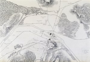
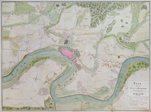
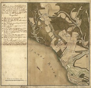
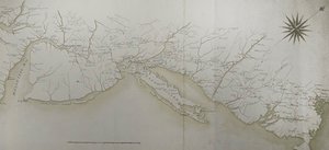
Map of Phillipsburg, from 'Guerre de l'Amérique', 1782 by F. Dubourg

Map of Phillipsburg, from 'Guerre de l'Amérique', 1782

(Map of Phillipsburg, from 'Guerre de l'Amerique', 1782 (colour engraving))


F. Dubourg

€ 124.41
Tax-free
   Configure art print
1782  ·  colour engraving  ·  Image ID: 85508

Nonclassified artists  ·  Cartography

Map of Phillipsburg, from 'Guerre de l'Amérique', 1782 by F. Dubourg. Available as an art print on canvas, photo paper, watercolor board, natural paper, or Japanese paper.
american war of independence · revolutionary war · phillipsburg · new jersey · plan · land · army · battlefield · Hudson river · Service Historique de la Marine, Vincennes, France / Bridgeman Images
AR/3D   View in 3D / AR zu Favoriten hinzufügen   Add to favorites    Change wall color    View picture in a room
0 Reviews

Configure art print

Picture Frame

Medium & Stretcher

Glass & Passepartout

Miscellaneous & Extras

 Save / compare configuration
Preview Icon

Summary

Gemälde
Veredelung
Keilrahmen
Museumslizenz

€ 124.41
(inkl. 20% MwSt)
   Add to cart

Bildschärfe: PERFEKT

If you'd like us to adjust the brightness, colors, or crop the image, we're happy to do this for you at no extra cost. Just get in touch!

Similar artworks selected for you

A Survey of English Harbour in the Island of Antigua made by Order of Commissioner Laforey in 1783 Peterhof, Russia: Elevation of the English Palace and plan of the park Map of the Siege of York in 1781, from Plan of the Position of the Army under the command of Lieut. Genl. Burgoyne near Still Water, in which it encamped on 20th September 1777 Peterhof, Russia: Elevation of the English Palace and Plan of the Park Map of the Battle of Gettysburg, Pennsylvania, 1-3 July 1863, 1862-1867 Map of the City of Lutetia (Lutetia Parisorium Today Paris) and Its Surroundings Made in 1882 Disposition of British Troops, with Fortifications North of Fort Knipehausen to Fort Independence A Sketch of the Battle of Waterloo, 18 June 1815 Plan of the Battle of Culloden, April 16th, 1746 Map of the area of Bourges Antietam Sharpsburg and vicinity. Constructed and engraved to illustrate "The war with the South" Plan of the Battle of Blenheim between the Imperial Army and the Franco-Bavarian Army, 13th August 1704 Map from "Red Books", for "Mogenhanger in Bedfordshire, a Seat of Godfrey Thornton Esq." (1792) Plan of the Battle of Mollwitz on 10 April 1741 The bombardment by the Royal Navy of the harbour of Kagoshima, Japan, 1863 Greece, the Peiraeus or Port Drako Surveyed by Commander Thomas Graves, H.M.S. Beacon 1840 (Detail) Plan of the Siege of Sebastopol, 1883 Map of Battle of Savuchny, 1739-1740 Sketch of the Fortress of Ghuznee. Taken by Storm on the 23rd July 1839 Survey of the Field of Agincourt The Battle of Waterloo, 1815-1816 Map of the Battle of Austerlitz, 2nd December 1805 Map of Dusseldorf and surrounding areas Plan of Ladysmith and Chronicle of Events, 1900 Map of Antietam, Sharpsburg and Vicinity, Maryland Speculum Romanae Magnificentiae: Ancient Rome, and its Hills, from the West, 1582 Battle of Green Spring, Map of the Land on the Left Bank of the James River Opposite Jamestown in Virginia Where the Battle of July 6 Map of Cochin, India
Show more similar artworks

More art prints by F. Dubourg

Map of Phillipsburg, from Map of Rhode Island, from Map of the Siege of York in 1781, from “Guerre de l’Amérique”, 1782 Map of Fisk-Kill and the position of the French army in 1782, from “Guerre de l Map of North West Point, Virginia, from Guerre de l’Amerique, 1782 Map of South West Point, Virginia, from ’Guerre de l’Amérique’, 1782 Map of Crompond, from ’Guerre de l’Amerique’, 1782 Reconnaissance of King General map of the camps and marches of the army in America on the orders of Rochambeau (detail) Reconnaissance of King General map of the camps and march of the army in America on the orders of Rochambeau, detail of the left side, from Guerre de l Front cover of the atlas Guerre de l
Show more works by F. Dubourg

More motifs from the category Cartography

Map of Berlin showing buildings of interest, 1773 Map of Philadelphia, from an Atlas of the United States, 1824 Copy of Catalan Map of Europe, North Africa and the Middle East Map of Valencia, from ’Civitates Orbis Terrarum’ by Georg Braun (1541-1622) and Frans Hogenberg (1535-90) c.1572-1617 Map of South America, published in 1700, Paris Map of the City of New York [as far north as East 53rd Street], 1885 Map of Trento, from Les Villes de Venetie, 1704, published by Pierre Mortier in Amsterdam Ms. 988, Vol.3 fol.10 Map of Saint-Quentin, from the ’Atlas Louis XIV’, 1683-88 Map of the New World, c. 1532 Map of New France dedicated to Colbert by Duchesneau, Intendant, 1681 (detail) A Map of the World, Corrected from the Observations Communicated to the Royal Societies of London and Paris, to the Right Honourable Richard Boyle, 1711 World map, illustration from Atlas Géographique Moderne by Prosper-Auguste Poulain de Bossay, c. 1850 Ms. 986, Vol. 1, Plan and Map of Cambrai, from the “Atlas Louis XIV”, 1683-88 Map of New Belgium and New England, published in Amsterdam c.1640 Map of Caernarvon, 1616
View More from "Cartography"

A selection of our top sellers

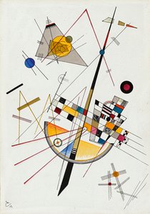
The North Cape by Moonlight, 1848 The garden of the magician Klingsor, from the Parzival cycle, Great Music Room, c. 1883-84 The Boulevard Montmartre on a Winter Morning The Tortoise Trainer, 1906 La Primavera Iseh in Morning Light Saint Michael the Archangel, ca 1663 Luncheon of the Boating Party Delicate Tension No. 85, 1923 Una and the Lion, from Spenser Flowers in a Crystal Vase, c.1882 Birth of Venus Benedictine Monk with Wine at Morning Drinks The Waterlily Pond with the Japanese Bridge Meadows near Greifswald
Show more artworks


What our customers think about us


Frequently Asked Questions about Meisterdrucke


Personalizing your art print at Meisterdrucke is simple and intuitive: Choose a frame, set the image size, pick a printing medium, and add suitable glazing or a stretcher frame. We also offer additional customization options like mats, fillets, and spacers. If you have any questions, our customer service team is ready to help you create your perfect artwork.

At Meisterdrucke, you can visualize your configured artwork directly in your own room. Simply upload a photo of your space and see how the artwork looks in it. If you're visiting us on a mobile device — phone or tablet — our augmented reality feature brings the picture to life and projects it right into your room. A unique experience that combines art and technology.

Choosing the right medium is often a matter of personal taste. To give you a better idea, we've provided some images for each medium. We also offer a sample set of all paper variants, so you can decide not just visually but by touch as well. You can order the sample set free of charge — only shipping costs apply.

Don't worry! At Meisterdrucke, we don't just process orders mechanically. Every order is manually reviewed by our team. If we spot any inconsistencies or issues with your configuration, we'll get in touch with you right away. And of course, our friendly and patient support team is always here to help you with your configuration. We'll work with you by phone or email to adjust your image so the final result is exactly what you had in mind.


Still have questions?

Are you interested in an art print from our manufactory but still unsure? Do you need advice on choosing the medium or help with the order?

Our experts are happy to assist you.

+43 4257 29415
support@meisterdrucke.com

Mo-Do: 7:00 - 16:00 | Fr: 7:00 - 13:00

Still have questions?

Are you interested in an art print from our manufactory but still unsure? Do you need advice on choosing the medium or help with the order?

Our experts are happy to assist you.

+43 4257 29415
support@meisterdrucke.com
Mo-Do: 7:00 - 16:00 | Fr: 7:00 - 13:00


Meisterdrucke

   Kärntner Strasse 46
        9586 Finkenstein am Faaker See
        Austria
        +43 4257 29415
        support@meisterdrucke.com
Other languages

                   
Erfahrungen & Bewertungen zu Meisterdrucke
Post.at DHL Express Quehenberger Cargoboard
Kaiser Franz Joseph

Meisterdrucke
Kärntner Strasse 46
9586 Finkenstein am Faaker See · Austria
+43 4257 29415 · support@meisterdrucke.com
Post.at DHL Express Quehenberger Cargoboard


(c) 2026 meisterdrucke.uk