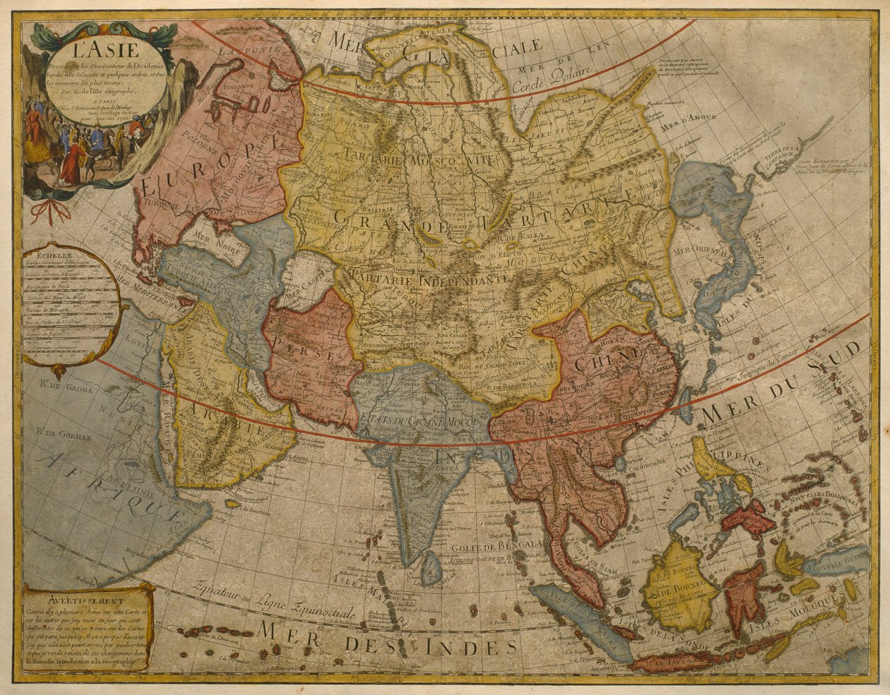
Map of Asia, Published in 1700, Paris by Guillaume Delisle

Map of Asia, Published in 1700, Paris

(Map of Asia, published in 1700, Paris (colour engraving))


Guillaume Delisle

€ 114.31
Enthält 0% MwSt.
   Configure art print
17th century  ·  colour engraving  ·  Picture ID: 219723

Nonclassified artists  ·  Cartography

Map of Asia, Published in 1700, Paris by Guillaume Delisle. Available as an art print on canvas, photo paper, watercolor board, uncoated paper or Japanese paper.
cartography · mapping · continent · geography · geographical · asian · Private Collection / Bridgeman Images
Other color variations of this picture  
AR/3D   View in 3D / AR zu Favoriten hinzufügen   Add to favorites    Select wall color    View painting in a room
0 Reviews

Configure art print

Picture Frame

Medium & Stretcher

Glass & Passepartout

Miscellaneous & Extras

 Save / compare configuration
Preview Icon

Summary

Gemälde
Veredelung
Keilrahmen
Museumslizenz

€ 114.31
(inkl. 20% MwSt)
   Add to cart

Bildschärfe: PERFEKT

Should you desire adjustments to brightness and color, or a custom crop of the motif, we are happy to make these changes at no additional cost to you. Please do not hesitate to contact us.

Similar artworks selected for you

Asia - by A Amsterdam Allard Asia Noviter China 1692 Map of Asia Recent Map of Asia, Showing the States and Empires of the Entire East along with the Eastern Indies Map of Asia, Nuremberg Asia Map of Asia from the Bleau Atlas Map of Asia Map showing the world trade shipping routes, cartography by Pierre Duval published in 1686, Paris Pakistan, India, Nepal, Bhutan, Bangladesh, Sri Lanka, East China, North Korea, South Korea, Japan, Burma, Thailand, Laos, Vietnam, Cambodia, Indonesia, Philippines, Malaysia Asia divided into its main states 1730 map of Asia by Herman Moll Description of the Asian continent, Geography map from 1695 Map of Asia Map of Europe, Published in 1700, Paris Map of Asia New Universal Geography Map of Asia, c.1696 The theatre of the world or the new atlas Amsterdam. Geographic map of Asia by Willem Janszoon Blaeu Asia, in Map of Asia, Tartaria, Japan, the Philippines and the East Indies, engraved by G. van Gouwen, c.1690 Map of Asia Map of Asia. Plate from an Atlas by Willem Janszoon Blaeu A new description of Asia Map of Asia Europe, engraving Map of the Northern Hemisphere of the World
Show more similar artworks

Other art prints by Guillaume Delisle

Map of the United Provinces of the Netherlands South Russia Map of Africa, Published in 1700, Paris Map of Italy, with Corsica, Sardinia and Sicily Map of Europe, Published in 1700, Paris Map of Tartaria (Central Asia, Siberia, Turkestan, Mongolia and Manchuria) Map of North Africa and Europe Map of Egypt, Nubia (Sudan) and Abyssinia (Ethiopia) Map of Mexico and Florida with the Caribbean Islands (Cuba, Haiti, Jamaica, Antilles) (etching) Map of the Nordic countries, kingdoms of Denmark, Sweden and Norway Map of Southern Italy, Corsica, and Sardinia Known in Ancient Times as Great Greece or Magnia Graecia Map of South America, published in 1700, Paris Map of Barbaria (Morocco, Algeria, Tunisia, Libya), Nigritude (Mali, Burkina Faso, Niger) and Guinee (Senegal, Guinea, Sierra Leone, Liberia, Ivory Coast, Ghana, Togo, Benin, Nigeria) (etching) Map of Asia, Published in 1700, Paris Map of neighboring countries of the Caspian Sea (Russia, Armenia, Persia, Kazakhstan, Turkmenistan)
Discover more works by Guillaume Delisle

Other motives from the category Cartography

Map of Tenochtitlan and the Gulf of Mexico, from Praeclara Ferdinadi Cortesii de Nova maris Oceani Hyspania Narratio by Hernando Cortes (1485-1547) 1524 Typus Orbis Terrarum, map of the world, from Ortelius Map of Toledo, from A New and Accurate Map of the World Map of Laputa, Balnibari, Luggnagg, Glubbdubdrib and Japan, illustration from the first edition of Map of England, Britannia Antiqua, from The Continent of Europe, from an Atlas of the World in 33 Maps, Venice, 1st September 1553 Map of Westminster from Map of the Town of Lille, from Map of Florida and the Antilles, from Map Of The World Map of London, from Map of Rotterdam and Gouda, from Coast of North Carolina (detail) Map of the Battles of Champaubert and Vauchamps, published by William Blackwood and Sons, Edinburgh and London, 1848
View More from "Cartography"

Excerpt from our top sellers

The Guardian of Paradise Study for Hylas and the Water Nymphs The Girl with a Pearl Earring Dance at Le Moulin de la Galette Lying Dog in the Snow The River of Light Girl by the Birch Trunk (also: Girl by the Tree) Luncheon of the Boating Party Kite Flying Animals in a Landscape Camelot, illustration from Playing Forms Lascaux Cave Painting, Bordeaux, France Self-Portrait in Fur Coat
Show More Artworks


What our customers think about us


Frequently Asked Questions about Meisterdrucke


Personalizing your art print at Meisterdrucke is a simple and intuitive process that allows you to design an artwork exactly to your specifications: Choose a frame, determine the image size, decide on a printing medium, and add suitable glazing or a stretcher frame. We also offer customization options such as mats, fillets, and spacers. Our customer service is available to help you design your perfect artwork.

At Meisterdrucke, you have the fascinating option to visualize the artwork you configured directly in your own space. For a tailored preview, simply upload a photo of your room and let the artwork appear on it. If you visit us via a mobile device, be it a phone or tablet, our augmented reality feature brings the image to life and seamlessly projects it into your space. An experience that uniquely combines art and technology.

Choosing the medium is often a matter of personal taste. To give you a clearer idea, we have provided some images for each medium. For a holistic experience, we also offer you a sample set of all paper variants so you can make a decision not just visually but also haptically. You can take advantage of the sample set free of charge – only the shipping costs will apply. You can order the sample set directly.

Do not worry. At Meisterdrucke, we do not proceed mechanically. We manually review each order. If there are any inconsistencies or peculiarities in the configuration, we will immediately contact you. Of course, our courteous and patient support is always at your side to assist you with the configuration. Together with you, we adjust your image by phone or email so that the final result exactly meets your expectations.


Do you have any questions?

Are you interested in an art print from our manufactory but still unsure? Do you need advice on choosing the medium or help with the order?

Our experts are happy to assist you.

+43 4257 29415
support@meisterdrucke.com
Mo-Do: 7:00 - 16:00 | Fr: 7:00 - 13:00

Do you have any questions?

Are you interested in an art print from our manufactory but still unsure? Do you need advice on choosing the medium or help with the order?

Our experts are happy to assist you.

+43 4257 29415
support@meisterdrucke.com
Mo-Do: 7:00 - 16:00 | Fr: 7:00 - 13:00


Meisterdrucke

   Kärntner Strasse 46
        9586 Finkenstein am Faaker See
        Austria
        +43 4257 29415
        support@meisterdrucke.com
Other languages

                   
Erfahrungen & Bewertungen zu Meisterdrucke
Post.at DHL Express Quehenberger Cargoboard
Kaiser Franz Joseph

Meisterdrucke
Kärntner Strasse 46
9586 Finkenstein am Faaker See · Austria
+43 4257 29415 · office@meisterdrucke.com
Post.at DHL Express Quehenberger Cargoboard


Meisterdrucke 2707 Bewertungen auf ProvenExpert.com

(c) 2025 meisterdrucke.uk