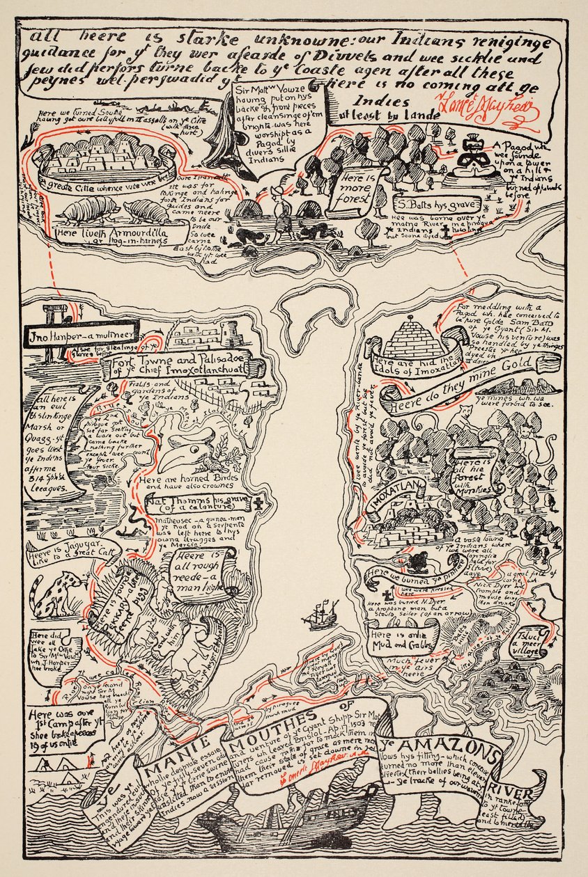
An inciting map of the Turbid Amazon, illustration from

An inciting map of the Turbid Amazon, illustration from 'Just So Stories for Little Children' by Rudyard Kipling, pub. London, 1951

(An inciting map of the Turbid Amazon, illustration from 'Just So Stories for Little Children' by Rudyard Kipling, pub. London, 1951 )


Joseph Rudyard Kipling

€ 127.55
Enthält 0% MwSt.
   Configure art print
Undated  ·  colour lithograph  ·  Picture ID: 160767

Nonclassified artists  ·  Cartography

An inciting map of the Turbid Amazon, illustration from 'Just So Stories for Little Children' by Rudyard Kipling, pub. London, 1951 by Joseph Rudyard Kipling. Available as an art print on canvas, photo paper, watercolor board, uncoated paper or Japanese paper.
mapping · cartography · armadillo · royal tiger · adventures · adventurers · explorers · exploration · south america · Private Collection / Bridgeman Images
zu Favoriten hinzufügen   Add to favorites    Select wall color    View painting in a room AR/3D   View in 3D / AR
0 Reviews

Configure art print

Picture Frame

Medium & Stretcher

Glass & Passepartout

Miscellaneous & Extras

 Save / compare configuration
Preview Icon

Summary

Gemälde
Veredelung
Keilrahmen
Museumslizenz

€ 127.55
(inkl. 20% MwSt)
   Add to cart

Bildschärfe: PERFEKT

Should you desire adjustments to brightness and color, or a custom crop of the motif, we are happy to make these changes at no additional cost to you. Please do not hesitate to contact us.

Similar artworks selected for you

Map of the Turbid Amazon in Red and Black Just So Stories by Rudyard Kipling View of Mount Sibille (Paradise of Queen Sybille) - Antoine de La Sale Map of Palestine - in Map of Trinity Island in the Antilles from Universal Cosmography Game of the Star-Spangled Banner or Emigrants to the United States Map of New York and the Vicinity King Edward the Confessor Map of America and Directions to China Map of Stockholm from Aubry de La Mottraye Map of the City of Jerusalem, from Game of the Star-Spangled Banner or Emigrants to the United States, c.1840 Parke of the Artillery from Aubry de La Mottraye Plan of New York Island with Part of Long Island, Staten Island and East New Jersey and the Engagement on the Woody Heights of Long Island between the British Forces, under the command of General Sir William Howe Map of the Dardanelles, First World War, 1915, c1920 Patagonia and Tierra del Fuego Showing the Strait that Will Later Take the Navigator French Guiana, South America Atlas by Diego Homem of South America, showing Indians in their settlements, Spanish Expeditionary Force Camp and Men in Armour Peter Pan Map of South Kensington Copy of an 8th Century Beatus Mappamundi Plan of Ladysmith and Chronicle of Events, 1900 Connecticut The Map of New England from William Hubbard Trinity Island, engraving from Universal Cosmology Map Of The World Map of Palestine, from a Passover Haggadah, printed in 1695 Geography map of the Loire territory with the castles and towns bordering the river (Beaumont, Aigueperse, Clermont and Montferan, Beauregard, Cignac, Montaigu, Puy Guillaume) taken from 25th Anniversary of Wilhelmina Boston and Its Environs in 1775 and 1776
Show more similar artworks

Other art prints by Joseph Rudyard Kipling

The Cat that Walked by Himself, illustration from An inciting map of the Turbid Amazon, illustration from The Parsee Beginning to Eat His Cake on the Uninhabited Island The Djinn in Charge of All Deserts Guiding the Magic with His Magic Fan, Illustration from Pau Amma the Crab Rising Out of the Sea as Tall as the Smoke of Three Volcanoes, Illustration from The Elephant Old Man Kangaroo at five in the afternoon, illustration from The Song of Songs Which Is Solomon The Wise Baviaan the dog-headed Baboon, who is Quite the Wisest Animal in All South Africa, illustration from The Whale Looking for the The Animal that came out of the sea and ate up all the food that Suleiman-bin-Daoud had made ready for all the animals in all the world, illustration from The four gull-winged Djinns lifting up Suleiman-bin-Daoud Old Man Kangaroo when he was the Different Animal with four short legs, illustration from The Elephant
Discover more works by Joseph Rudyard Kipling

Other motives from the category Cartography

Map of Europe after the Peace of Luneville, 1801, from Map of Paris at the Outbreak of the French Revolution, published by William Blackwood and Sons Map Showing the Geography of the Hebrews and Exhibiting the Dispersion of the Descendants of Noah Map of the regions and districts of France, known as the Carte de Necker Map of Jerusalem, 1661 Map of Vienna, published by Klimsch und Co., Frankfurt, c.1860 Map of Bergen, from Map of Crompond, from Map of the Kingdom of Great Britain and Ireland, 1610 Map of Asia, Tartaria, Japan, the Philippines and the East Indies, engraved by G. van Gouwen, c.1690 Miniature Nautical Map of the Central Mediterranean, 1560 Map of Lisbon, from Map of Lisbon, and Cascais, from Map of Africa, Published in 1700, Paris A Map of the World, Corrected from the Observations Communicated to the Royal Societies of London and Paris, to the Right Honourable Richard Boyle
View More from "Cartography"

Excerpt from our top sellers

Alpine Hut in Rainy Weather Illustration for Milton The Dream Seated Woman with Bent Knees Sack of Rome (455) - The Destiny of Empires - Destruction - by Thomas Cole - 1836- New York Historical Society - (Rome, Roman Empire, Gaiseric, Genseric, Migration Period, Barbarian Invasions, Vandals, Fall of Western Roman Empire, Fall of Rome, Sack of Ro Isle of the Dead Birth of Jesus, from the Book of Hours of the Master of Jacques de Besançon Wiltshire Landscape, 1937 Roses, or The Artist Montage of 8 Pages from the Catalan Atlas by Cresques; the Then Known World Sadko Woman in Tehuantepec, Mexico The Stadtbahn Pavilion of the Vienna Underground Railway, Design Showing the Exterior and a View of the Railway Platform, c.1894-97 K. Kollwitz, Head of a Child in Hands Olive Trees with Yellow Sky and Sun
Show More Artworks


What our customers think about us


Frequently Asked Questions about Meisterdrucke


Personalizing your art print at Meisterdrucke is a simple and intuitive process that allows you to design an artwork exactly to your specifications: Choose a frame, determine the image size, decide on a printing medium, and add suitable glazing or a stretcher frame. We also offer customization options such as mats, fillets, and spacers. Our customer service is available to help you design your perfect artwork.

At Meisterdrucke, you have the fascinating option to visualize the artwork you configured directly in your own space. For a tailored preview, simply upload a photo of your room and let the artwork appear on it. If you visit us via a mobile device, be it a phone or tablet, our augmented reality feature brings the image to life and seamlessly projects it into your space. An experience that uniquely combines art and technology.

Choosing the medium is often a matter of personal taste. To give you a clearer idea, we have provided some images for each medium. For a holistic experience, we also offer you a sample set of all paper variants so you can make a decision not just visually but also haptically. You can take advantage of the sample set free of charge – only the shipping costs will apply. You can order the sample set directly.

Do not worry. At Meisterdrucke, we do not proceed mechanically. We manually review each order. If there are any inconsistencies or peculiarities in the configuration, we will immediately contact you. Of course, our courteous and patient support is always at your side to assist you with the configuration. Together with you, we adjust your image by phone or email so that the final result exactly meets your expectations.


Do you have any questions?

Are you interested in an art print from our manufactory but still unsure? Do you need advice on choosing the medium or help with the order?

Our experts are happy to assist you.

+43 4257 29415
support@meisterdrucke.com
Mo-Do: 7:00 - 16:00 | Fr: 7:00 - 13:00

Do you have any questions?

Are you interested in an art print from our manufactory but still unsure? Do you need advice on choosing the medium or help with the order?

Our experts are happy to assist you.

+43 4257 29415
support@meisterdrucke.com
Mo-Do: 7:00 - 16:00 | Fr: 7:00 - 13:00


Meisterdrucke

   Kärntner Strasse 46
        9586 Finkenstein am Faaker See
        Austria
        +43 4257 29415
        support@meisterdrucke.com
Other languages

                   
Erfahrungen & Bewertungen zu Meisterdrucke
Partner Logos

Kaiser Franz Joseph

Meisterdrucke
Kärntner Strasse 46
9586 Finkenstein am Faaker See · Austria
+43 4257 29415 · office@meisterdrucke.com
Partner Logos


(c) 2025 meisterdrucke.uk