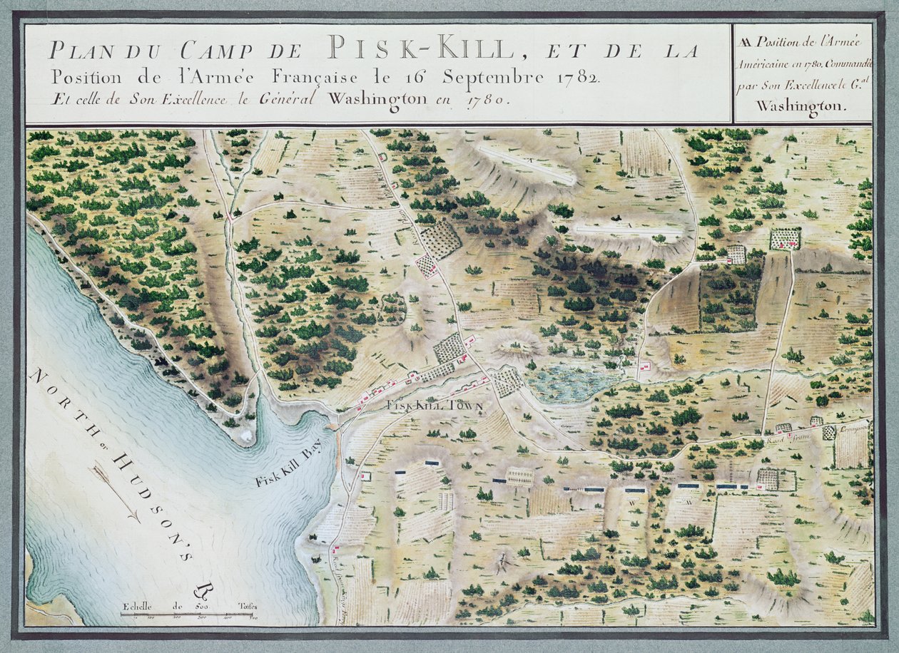
Map of Fisk-Kill and the Position of the French Army by F. Dubourg

Map of Fisk-Kill and the Position of the French Army

(Map of Fisk-Kill and the position of the French army in 1782, from 'Guerre de l'Amerique', 1782 (colour engraving))


F. Dubourg

€ 119.98
Enthält 0% MwSt.
   Configure art print
1782  ·  colour engraving  ·  Picture ID: 69388

Nonclassified artists  ·  Cartography

Map of Fisk-Kill and the Position of the French Army by F. Dubourg. Available as an art print on canvas, photo paper, watercolor board, uncoated paper or Japanese paper.
american war of independence · revolutionary war · french army · america · fishkill · fish-kill · pisk-kill · fisk-kill · town · new york state · plan · Hudson river · bay · Service Historique de la Marine, Vincennes, France / Bridgeman Images
AR/3D   View in 3D / AR zu Favoriten hinzufügen   Add to favorites    Select wall color    View painting in a room
0 Reviews

Configure art print

Picture Frame

Medium & Stretcher

Glass & Passepartout

Miscellaneous & Extras

 Save / compare configuration
Preview Icon

Summary

Gemälde
Veredelung
Keilrahmen
Museumslizenz

€ 119.98
(inkl. 20% MwSt)
   Add to cart

Bildschärfe: PERFEKT

Should you desire adjustments to brightness and color, or a custom crop of the motif, we are happy to make these changes at no additional cost to you. Please do not hesitate to contact us.

Similar artworks selected for you

Map of South West-Point, Virginia Map of Phillipsburg, from Plan of events at the Battle of Gunzburg between Austrian and French Troops in 1805, 1808 Plan of Jacmel Town with Fortifications Peterhof, Russia: Elevation of the English Palace and plan of the park Map of the Siege of York in 1781, from Map of Newport, Rhode Island Map of the Battle at Narva Map of North West-Point, Virginia, from Map of Fort Rosalie des Natchez, Louisiana View of Limerick, c.1750 Map of Dusseldorf and surrounding areas Map of Cochin, India Map of the area of Bourges Plan of the Siege of the Turkish Fortress of Bender by the Russian Army in November 1789, 1789 Sketch of the skirmish at Petersburg: between the Royal Army under the command of Major Gel. Phillips and the American army commanded by Major Genl. Steuben in which the latter were defeated, 25th April 1781 Plan of the Position of the Army under the command of Lieut. Genl. Burgoyne near Still Water, in which it encamped on 20th September 1777 Plan of the Battle of Blenheim between the Imperial Army and the Franco-Bavarian Army, 13th August 1704 The City of London in the Time of the Saxon Dynasty, about the Year One Thousand, pub. by William Darton, London Map of Dusseldorf and fortified encampments Map of Plon from Civitates Orbis Terrarum A Plan of Fishguard Bay Near Which the French Landed 1200 Men 22nd February 1797 and Surrendered Prisoners to Lord Cawdor on the 24th Map of the Battle of Poltava on 27 June 1709 Siege of Huy, 1705 Battle of Nieuwpoort, 1600 The present church of the Holy Cross was built on the site of the old church. Greeks and Philhellenes and another to the Plantza A Map inspired by Candide by Francois Voltaire for a competition organised by the Ecole Nationale des Ponts et Chaussees in Paris Diagram of Battle Lines of the Battle of Camden, South Carolina, on August 16 Map of the Country of Lourdes in 1877
Show more similar artworks

Other art prints by F. Dubourg

Map of Rhode Island, from Map of the Siege of York in 1781, from Map of Phillipsburg, from Map of North West-Point, Virginia, from Map of Crompond, from Map of Fisk-Kill and the Position of the French Army General map of the camps and march of the army in America on the orders of Rochambeau, detail of the left side, from Guerre de l Map of South West-Point, Virginia Reconnaissance of King Reconnaissance of King General map of the camps and marches of the army in America on the orders of Rochambeau (detail) Front cover of the atlas Guerre de l
Discover more works by F. Dubourg

Other motives from the category Cartography

Map Showing the Geography of the Hebrews and Exhibiting the Dispersion of the Descendants of Noah Map of Milan, from Madagascar, from an Atlas of the World in 33 Maps, Venice, 1st September 1553 (detail) Seat of War in the Crimea, Map of the Country between Simpheropol and Baidar to Illustrate the Movements of the Allied and Russian Armies Map of Massachusetts, from Map of Frankfurt and the Surrounding Area, from World map tracing Magellan Map of the City of London, 1633 Map of the Battle of Wagram, published by William Blackwood and Sons, Edinburgh and London, 1848 A Map of the Countries Thirty Degrees round the North Pole, from Map of the City of New York [as far north as East 53rd Street], 1885 Map of the United States in 1861, from Map of Yorktown, Virginia, October 1781 Panoramic View of the Baltic Sea and the Route of the Fleet from Spithead to St. Petersburg, from Government Maps and Charts Made Under the Supervision of an Officer in the Expedition Under Sir Charle
View More from "Cartography"

Excerpt from our top sellers

The Resurrection The Tropics Impression: Sunrise, 1872 Sun Glitter Over the Sea, Skagen Yellow – Red – Blue Flute Concert with Frederick the Great in Sanssouci, 1850-1852 Spruce Thicket in the Snow Breakfast of the Rowers Self-Portrait with Physalis The Crucifixion, from the Isenheim Altarpiece Free Curve to the Point - Accompanying Sound of Geometric Curves Night: A Port in the Moonlight, 1748 Rain Steam and Speed, The Great Western Railway Landscape Scene from Thanatopsis Wheat Field
Show More Artworks


What our customers think about us


Frequently Asked Questions about Meisterdrucke


Personalizing your art print at Meisterdrucke is a simple and intuitive process that allows you to design an artwork exactly to your specifications: Choose a frame, determine the image size, decide on a printing medium, and add suitable glazing or a stretcher frame. We also offer customization options such as mats, fillets, and spacers. Our customer service is available to help you design your perfect artwork.

At Meisterdrucke, you have the fascinating option to visualize the artwork you configured directly in your own space. For a tailored preview, simply upload a photo of your room and let the artwork appear on it. If you visit us via a mobile device, be it a phone or tablet, our augmented reality feature brings the image to life and seamlessly projects it into your space. An experience that uniquely combines art and technology.

Choosing the medium is often a matter of personal taste. To give you a clearer idea, we have provided some images for each medium. For a holistic experience, we also offer you a sample set of all paper variants so you can make a decision not just visually but also haptically. You can take advantage of the sample set free of charge – only the shipping costs will apply. You can order the sample set directly.

Do not worry. At Meisterdrucke, we do not proceed mechanically. We manually review each order. If there are any inconsistencies or peculiarities in the configuration, we will immediately contact you. Of course, our courteous and patient support is always at your side to assist you with the configuration. Together with you, we adjust your image by phone or email so that the final result exactly meets your expectations.


Do you have any questions?

Are you interested in an art print from our manufactory but still unsure? Do you need advice on choosing the medium or help with the order?

Our experts are happy to assist you.

+43 4257 29415
support@meisterdrucke.com
Mo-Do: 7:00 - 16:00 | Fr: 7:00 - 13:00

Do you have any questions?

Are you interested in an art print from our manufactory but still unsure? Do you need advice on choosing the medium or help with the order?

Our experts are happy to assist you.

+43 4257 29415
support@meisterdrucke.com
Mo-Do: 7:00 - 16:00 | Fr: 7:00 - 13:00


Meisterdrucke

   Kärntner Strasse 46
        9586 Finkenstein am Faaker See
        Austria
        +43 4257 29415
        support@meisterdrucke.com
Other languages

                   
Erfahrungen & Bewertungen zu Meisterdrucke
Post.at DHL Express Quehenberger Cargoboard
Kaiser Franz Joseph

Meisterdrucke
Kärntner Strasse 46
9586 Finkenstein am Faaker See · Austria
+43 4257 29415 · office@meisterdrucke.com
Post.at DHL Express Quehenberger Cargoboard


Meisterdrucke hat 4,92 von 5 Sternen 2701 Bewertungen auf ProvenExpert.com

(c) 2025 meisterdrucke.uk