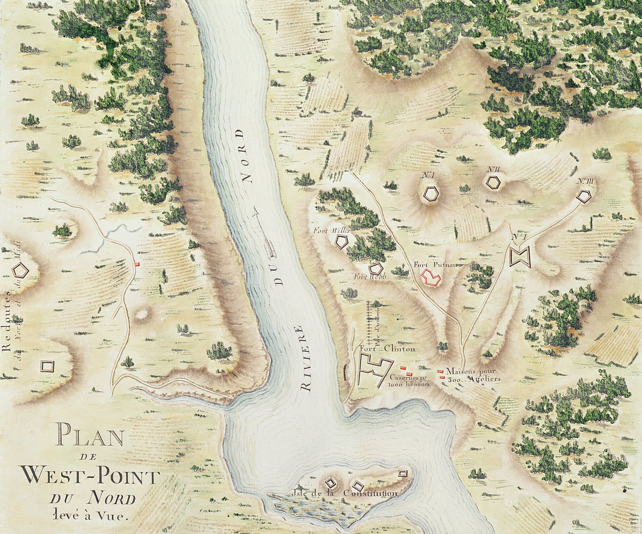
Map of North West-Point, Virginia, from

Map of North West-Point, Virginia, from 'Guerre de l'Amerique', 1782

(Map of north West-Point, Virginia, from 'Guerre de l'Amerique', 1782 (colour engraving))


F. Dubourg

€ 107.73
Enthält 0% MwSt.
   Configure art print
1782  ·  colour engraving  ·  Picture ID: 52014

Nonclassified artists  ·  Cartography

Map of North West-Point, Virginia, from 'Guerre de l'Amerique', 1782 by F. Dubourg. Available as an art print on canvas, photo paper, watercolor board, uncoated paper or Japanese paper.
american war of independence · revolutionary war · plan · west-point · west point · virginia · hudson river · fort · forts · land · birds eye view · USA · Service Historique de la Marine, Vincennes, France / Bridgeman Images
AR/3D   View in 3D / AR zu Favoriten hinzufügen   Add to favorites    Select wall color    View painting in a room
0 Reviews

Configure art print

Picture Frame

Medium & Stretcher

Glass & Passepartout

Miscellaneous & Extras

 Save / compare configuration
Preview Icon

Summary

Gemälde
Veredelung
Keilrahmen
Museumslizenz

€ 107.73
(inkl. 20% MwSt)
   Add to cart

Bildschärfe: PERFEKT

Should you desire adjustments to brightness and color, or a custom crop of the motif, we are happy to make these changes at no additional cost to you. Please do not hesitate to contact us.

Similar artworks selected for you

Map of South West-Point, Virginia Map of Phillipsburg, from Peterhof, Russia: Elevation of the English Palace and plan of the park Peterhof, Russia: Elevation of the English Palace and Plan of the Park Map of the Siege of York in 1781, from Map of Fisk-Kill and the Position of the French Army Reconnaissance of King Roy Military Survey of Scotland Plan of events at the Battle of Gunzburg between Austrian and French Troops in 1805, 1808 Captain Snow Reconnaissance of King Capture of Mobile, Alabama The Battle of Blindheim on August 13 Speculum Romanae Magnificentiae: Ancient Rome, and its Hills, from the West, 1582 Plan of the defeat of the American Fleet on Lake Champlain Attack on Fort Pulaski, Savannah, Georgia, April 1862 Disposition of British Troops, with Fortifications North of Fort Knipehausen to Fort Independence Port of St. Louis, Plan of the Siege of Sebastopol, 1883 Map of Crompond, from Plan of Ladysmith and Chronicle of Events, 1900 Plan of the Position of the Army under the command of Lieut. Genl. Burgoyne near Still Water, in which it encamped on 20th September 1777 Map of the Siege of Quebec by the British Fleet, 1670 2nd Attack on Fort McAllister on the Ogeechee River, Georgia Plan of the Investment of York and Gloucester, February 1782 Plan of the Battle of Culloden, April 16th, 1746 Battle of Green Spring, Map of the Land on the Left Bank of the James River Opposite Jamestown in Virginia Where the Battle of July 6 A Plan of Fishguard Bay Near Which the French Landed 1200 Men 22nd February 1797 and Surrendered Prisoners to Lord Cawdor on the 24th Map of Newport, Rhode Island
Show more similar artworks

Other art prints by F. Dubourg

Map of Fisk-Kill and the Position of the French Army Map of Rhode Island, from Map of the Siege of York in 1781, from Reconnaissance of King Map of South West-Point, Virginia Map of Phillipsburg, from Reconnaissance of King Map of North West-Point, Virginia, from General map of the camps and marches of the army in America on the orders of Rochambeau (detail) Map of Crompond, from General map of the camps and march of the army in America on the orders of Rochambeau, detail of the left side, from Guerre de l Front cover of the atlas Guerre de l
Discover more works by F. Dubourg

Other motives from the category Cartography

Map of Laos and the Mekong River Showing the Route of the Voyage of Henri Mouhot, Illustration from Travels in the Central Parts of Indo-China (Siam), Cambodia, and Laos During the Years 1858, 1859 Map of Ancient Egypt Map of the New Simplon Pass, 1803 Map of the United States, 1816 Map of Tenochtitlan and the Gulf of Mexico, from Praeclara Ferdinadi Cortesii de Nova maris Oceani Hyspania Narratio by Hernando Cortes (1485-1547) 1524 Map of Novara, from Map of Paris at the Outbreak of the French Revolution, published by William Blackwood and Sons Map of Jerusalem and Palestine, Including the Sacred Sites and the Temple of Solomon Map of the City of New York [as far north as East 53rd Street], 1885 Map of South America, 1777 Map of the city of Siam, capital of the kingdom of that name after a survey done by a French engineer in 1687, published in the 1751 edition of Histoire Generale des Voyages by Antoine Prevost Map of Eastern North America: Florida to Chesapeake Bay Map of Raleigh Map of Surrey, described and divided into hundreds Map of Nouvelle-France (Canada) 1699
View More from "Cartography"

Excerpt from our top sellers

Self-Portrait as the Allegory of Painting Seaport with the Embarkation of the Queen of Sheba Evening at the Iris Field White Waterlilies Salvator Mundi Beat the Whites with the Red Wedge Poster The Isle of the Dead, Fifth Version, 1886 Moa Death and Life, c.1911 View of the Naruto Whirlpools at Awa, from the Series Villa by the Sea Madonna with Child and Two Angels Tibet. Himalayas Battle of Waterloo, 18th June 1815 Christ Pantocrator
Show More Artworks


What our customers think about us


Frequently Asked Questions about Meisterdrucke


Personalizing your art print at Meisterdrucke is a simple and intuitive process that allows you to design an artwork exactly to your specifications: Choose a frame, determine the image size, decide on a printing medium, and add suitable glazing or a stretcher frame. We also offer customization options such as mats, fillets, and spacers. Our customer service is available to help you design your perfect artwork.

At Meisterdrucke, you have the fascinating option to visualize the artwork you configured directly in your own space. For a tailored preview, simply upload a photo of your room and let the artwork appear on it. If you visit us via a mobile device, be it a phone or tablet, our augmented reality feature brings the image to life and seamlessly projects it into your space. An experience that uniquely combines art and technology.

Choosing the medium is often a matter of personal taste. To give you a clearer idea, we have provided some images for each medium. For a holistic experience, we also offer you a sample set of all paper variants so you can make a decision not just visually but also haptically. You can take advantage of the sample set free of charge – only the shipping costs will apply. You can order the sample set directly.

Do not worry. At Meisterdrucke, we do not proceed mechanically. We manually review each order. If there are any inconsistencies or peculiarities in the configuration, we will immediately contact you. Of course, our courteous and patient support is always at your side to assist you with the configuration. Together with you, we adjust your image by phone or email so that the final result exactly meets your expectations.


Do you have any questions?

Are you interested in an art print from our manufactory but still unsure? Do you need advice on choosing the medium or help with the order?

Our experts are happy to assist you.

+43 4257 29415
support@meisterdrucke.com
Mo-Do: 7:00 - 16:00 | Fr: 7:00 - 13:00

Do you have any questions?

Are you interested in an art print from our manufactory but still unsure? Do you need advice on choosing the medium or help with the order?

Our experts are happy to assist you.

+43 4257 29415
support@meisterdrucke.com
Mo-Do: 7:00 - 16:00 | Fr: 7:00 - 13:00


Meisterdrucke

   Kärntner Strasse 46
        9586 Finkenstein am Faaker See
        Austria
        +43 4257 29415
        support@meisterdrucke.com
Other languages

                   
Erfahrungen & Bewertungen zu Meisterdrucke
Post.at DHL Express Quehenberger Cargoboard
Kaiser Franz Joseph

Meisterdrucke
Kärntner Strasse 46
9586 Finkenstein am Faaker See · Austria
+43 4257 29415 · office@meisterdrucke.com
Post.at DHL Express Quehenberger Cargoboard


Meisterdrucke 2707 Bewertungen auf ProvenExpert.com

(c) 2025 meisterdrucke.uk