Wallis

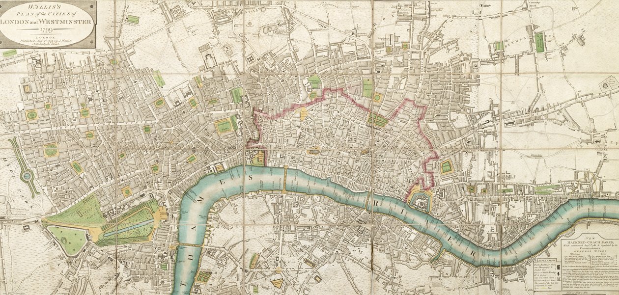
Wallis's Folded Map of the City of London and Westminster

(Walliss Folded Map of the City of London and Westminster, 1799)


English School

€ 97.68
Enthält 0% MwSt.
   Configure art print
Undated  ·  Picture ID: 413798

Cultural Circles  ·  Cartography

Wallis's Folded Map of the City of London and Westminster by English School. Available as an art print on canvas, photo paper, watercolor board, uncoated paper or Japanese paper.
London Metropolitan Archives, City of London / Bridgeman Images
Other color variations of this picture  
AR/3D   View in 3D / AR zu Favoriten hinzufügen   Add to favorites    Select wall color    View painting in a room
0 Reviews

Configure art print

Picture Frame

Medium & Stretcher

Glass & Passepartout

Miscellaneous & Extras

 Save / compare configuration
Preview Icon

Summary

Gemälde
Veredelung
Keilrahmen
Museumslizenz

€ 97.68
(inkl. 20% MwSt)
   Add to cart

Bildschärfe: PERFEKT

Should you desire adjustments to brightness and color, or a custom crop of the motif, we are happy to make these changes at no additional cost to you. Please do not hesitate to contact us.

Similar artworks selected for you

Map of London, 1852 A New and Exact Plan of the Cities of London and Westminster and the Borough of Southwark, 1725 Map of Westminster, the City of London, Southwark and Surrounding Areas Map of Islington, Westminster, City and Southwark Unknown Image A Plan of London, Westminster and Southwark Map of London Tallis Map of London, 1761 (The City Guide or a Pocket Plan of London, Westminster and Southwark with the New Buildings to the Year 1761) Map of London, 1666 Sheet from Map of London, 1823 Stratford, London, 1746 Map of London and Westminster and the Suburb of Southwark Map of London, 1851 Laurie and Whittle Plate from Map of London, from Map of Barnes, Battersea, Putney and Wandsworth Plan of London from Actual Survey Talliss Illustrated Plan of London and its Environs, in Commemoration of the Great Exhibition of Industry of all Nations, 1851, published by John Tallis & Co. Map of Battersea & Chelsea, 1748 Plan of London and Westminster, 1749 Plan of London, The Strand, Westminster Bridge Map of Hounslow, Twickenham and Richmond A Map of Lambeth and Vauxhall, London, 1746 General Maps of the Kingdoms of Europe and Particulars of France
Show more similar artworks

Other art prints by English School

Church and Cottage with Lighted Windows The Nonpareil with Portraits of Queen Victoria and Prince Albert Woman beating her husband with a shoe Portrait of a bodybuilder The Great Green Tree Frog English Rose Ships Arriving Roman Augurs Elephant (engraving) Lavater Lee and Sons, acrobats Homeric Table, the Shield of Achilles, designed by John Henning, Junior, Esquire Princes Street Edinburgh - West End English Rose View of the Acropolis of Athens
Discover more works by English School

Other motives from the category Cartography

Map of the Coast of Africa and the River Gambia Map of the Gold Coast at the Time of the Third Ashanti Expedition in 1874 Abraham Ortel Oretelius and his world map of 1569, illustration from Map of Kutch and Runn, India, 1854 Map Showing the Principal Stars Visible in Great Britain (Plate XXIX), from Map from Gulliver Map Showing the Kremlin, Moscow Map of Africa showing Treaty Boundaries, 1891 Map of Vienna Map of Massachusetts, from Map of the Country between Auckland and the River Waikato, New Zealand, illustrating the War with the Natives A Relief Map of the Fortress of Canea, Crete in 1608 Map of Rhode Island at the time of its occupation 1780-81 by the French Army on the orders of Jean-Baptiste de Vimeur Count of Rochambeau Scene of the Zodiac including a Galleon (detail) Map of Palermo, from
View More from "Cartography"

Excerpt from our top sellers

The Annunciation, c.1438-45 Ponte Fabricio Summer Night by the Beach Dancer (Die Tänzerin), 1913 The Garden at Giverny, 1900 Still Life with Coffee Composition VIII The Disciples Peter and John Running to the Sepulchre on the Morning of the Resurrection The Boxer The Wanderer above the Sea of Fog Emilie Floege Nymphs and Satyr Port Light The Dutch Proverbs Eiger, Monk and Jungfrau in Morning Sun
Show More Artworks


What our customers think about us


Frequently Asked Questions about Meisterdrucke


Personalizing your art print at Meisterdrucke is a simple and intuitive process that allows you to design an artwork exactly to your specifications: Choose a frame, determine the image size, decide on a printing medium, and add suitable glazing or a stretcher frame. We also offer customization options such as mats, fillets, and spacers. Our customer service is available to help you design your perfect artwork.

At Meisterdrucke, you have the fascinating option to visualize the artwork you configured directly in your own space. For a tailored preview, simply upload a photo of your room and let the artwork appear on it. If you visit us via a mobile device, be it a phone or tablet, our augmented reality feature brings the image to life and seamlessly projects it into your space. An experience that uniquely combines art and technology.

Choosing the medium is often a matter of personal taste. To give you a clearer idea, we have provided some images for each medium. For a holistic experience, we also offer you a sample set of all paper variants so you can make a decision not just visually but also haptically. You can take advantage of the sample set free of charge – only the shipping costs will apply. You can order the sample set directly.

Do not worry. At Meisterdrucke, we do not proceed mechanically. We manually review each order. If there are any inconsistencies or peculiarities in the configuration, we will immediately contact you. Of course, our courteous and patient support is always at your side to assist you with the configuration. Together with you, we adjust your image by phone or email so that the final result exactly meets your expectations.


Do you have any questions?

Are you interested in an art print from our manufactory but still unsure? Do you need advice on choosing the medium or help with the order?

Our experts are happy to assist you.

+43 4257 29415
support@meisterdrucke.com
Mo-Do: 7:00 - 16:00 | Fr: 7:00 - 13:00

Do you have any questions?

Are you interested in an art print from our manufactory but still unsure? Do you need advice on choosing the medium or help with the order?

Our experts are happy to assist you.

+43 4257 29415
support@meisterdrucke.com
Mo-Do: 7:00 - 16:00 | Fr: 7:00 - 13:00


Meisterdrucke

   Kärntner Strasse 46
        9586 Finkenstein am Faaker See
        Austria
        +43 4257 29415
        support@meisterdrucke.com
Other languages

                   
Erfahrungen & Bewertungen zu Meisterdrucke
Post.at DHL Express Quehenberger Cargoboard
Kaiser Franz Joseph

Meisterdrucke
Kärntner Strasse 46
9586 Finkenstein am Faaker See · Austria
+43 4257 29415 · office@meisterdrucke.com
Post.at DHL Express Quehenberger Cargoboard


Meisterdrucke 2717 Bewertungen auf ProvenExpert.com

(c) 2025 meisterdrucke.uk