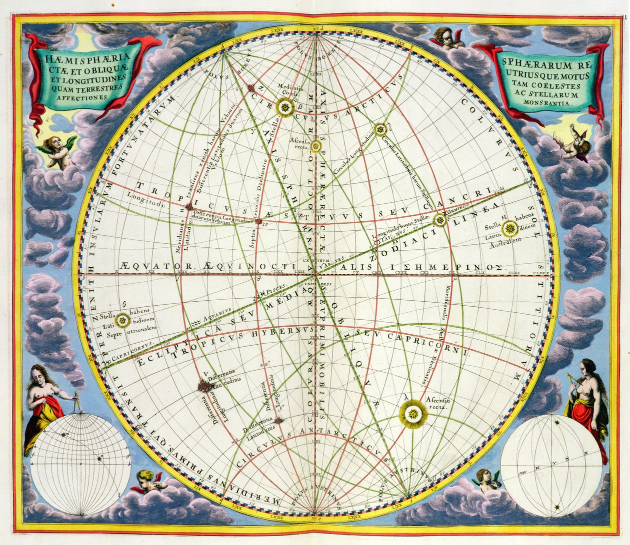
Map Charting the Movement of the Earth and Planets, from

Map Charting the Movement of the Earth and Planets, from 'The Celestial Atlas, or The Harmony of the Universe'

(Map Charting the Movement of the Earth and Planets, from 'The Celestial Atlas, or The Harmony of the Universe' (Atlas coelestis seu harmonia macrocosmica) pub. by Joannes Janssonius, Amsterdam, 1660-6)


Andreas Cellarius

€ 107.05
Enthält 0% MwSt.
   Configure art print
Undated  ·  hand coloured engraving  ·  Picture ID: 215663

Nonclassified artists  ·  Cartography

Map Charting the Movement of the Earth and Planets, from 'The Celestial Atlas, or The Harmony of the Universe' by Andreas Cellarius. Available as an art print on canvas, photo paper, watercolor board, uncoated paper or Japanese paper.
chart · planet · planetary · astronomy · orbit · movement earth planets · planet · Private Collection / Bridgeman Images
Other color variations of this picture  
AR/3D   View in 3D / AR zu Favoriten hinzufügen   Add to favorites    Select wall color    View painting in a room
0 Reviews

Configure art print

Picture Frame

Medium & Stretcher

Glass & Passepartout

Miscellaneous & Extras

 Save / compare configuration
Preview Icon

Summary

Gemälde
Veredelung
Keilrahmen
Museumslizenz

€ 107.05
(inkl. 20% MwSt)
   Add to cart

Bildschärfe: PERFEKT

Should you desire adjustments to brightness and color, or a custom crop of the motif, we are happy to make these changes at no additional cost to you. Please do not hesitate to contact us.

Similar artworks selected for you

Phases of Moon and its orbit, engraving from Harmonia Macrocosmica, by Andreas Cellarius 1660 celestial chart illustrating the motions of both the upright sphere and the oblique sphere The Situation of the Earth in the Heavens, Plate 74 from Map Showing Tycho Brahe Phillips, 4274 Planesphaeri Coelestis Hemisphaerium Meridionale Map Charting the Orbit of the Moon around the Earth, from Planisphere, from World map with encircling zodiac, Polus Antarcticus Scenography of the Ptolemaic Cosmography from Andreas Cellarius Harmonia Macrocosmica Ancient Hemispheres of the World, plate 94 from Map Showing Tycho Brahe From Andreas Cellarius Harmonia Macrocosmica, 1660/61. Chart Showing Signs of the Zodiac and the Solar System with World at Centre. Plate 2 Star Chart Made and Published by C. Allard, Amsterdam Harmonia Macrocosmica, Ptolemaic theory of planetary motion Cellarius Ptolemaic System The Ptolemy system. Andrea Cellarius The Conjunction of the Planets, from Planesphaerii Coelestis Hemisphaerium Septentrionale Map of Christian Constellations, from Terra Australis 1660 Celestial Map Star Map of the Southern Sky Planisphaerii Coelestis Hemisphaerium Meridionale (from Atlas Coelestis, 1706) 1660 Geocentric Model Chart The Antarctic Pole
Show more similar artworks

Other art prints by Andreas Cellarius

Map of the Southern Hemisphere, from Map showing Tycho Brahe Scenographia: Systematis Copernicani Astrological Chart (c.1543) devised by Nicolaus Copernicus (1473-1543), from The Situation of the Earth in the Heavens, Plate 74 from Planetary orbits, plate 18 from Nicolaus Copernicus, Detail from a Map Showing the Copernican System of Planetary Orbits, Map of the celestial Southern Hemisphere Harmonia Macrocosmica, Ptolemaic theory of planetary motion, engraving, by Andreas Cellarius Map of the Christian Constellations as Depicted by Julius Schiller, from Scenographia: Systematis Copernicani Astrological Chart devised by Nicolaus Copernicus, from Harmonia Macrocosmica. The planisphere of Copernicus Phases of the Moon, from Celestial Map Illustrating Ptolemy Map of Christian Constellations, 1660-1661 World Map, Study of the Earth Based on Ptolemy
Discover more works by Andreas Cellarius

Other motives from the category Cartography

Nova Scotia and Newfoundland, from a Series of World Maps published by John Tallis und Co., New York and London, 1850s Map of Canada from London: Whitechapel section, from a descriptive map of East End Poverty, 1887 Map of the Caribbean Islands and the American State of Florida Map Showing the Geography of the Hebrews and Exhibiting the Dispersion of the Descendants of Noah Map of Poitiers, from Map of India and Ceylon, from the Map of the United States in 1803, from Our Whole Country: The Past and Present of the United States, Historical and Descriptive, by John Warner Barber and Henry Hare, 1861 Map of Europe, Published in 1700, Paris Map of Russia and Eastern Europe from Atlas Minor, 1745 Ethiopia, the Red Sea and Saudi Arabia, from an Atlas of the World in 33 Maps, Venice, 1st September 1553 (Detail) Map of the Kingdom of Siam Map of Jerusalem, from Confederate Civil War map of the Army of Mississippi camp at Corinth, Mississippi, May 1862 Map of the Strait of Magellan
View More from "Cartography"

Excerpt from our top sellers

The Roses of Heliogabalus After the Bath Montage of 8 Pages from the Catalan Atlas by Cresques; the Then Known World The Horse’s Bath Starry Night, c.1850-65 Beethoven Frieze Red Tree The Redoutable at Trafalgar, 21st October 1805 The Jumantsubo Plain in Susaki near Fukagawa Sunset over Yalta Iseh in morning light Chichester Canal, c.1829 Haymaking World Map Universalis Cosmographia, 1507 Moonrise by the Sea
Show More Artworks


What our customers think about us


Frequently Asked Questions about Meisterdrucke


Personalizing your art print at Meisterdrucke is a simple and intuitive process that allows you to design an artwork exactly to your specifications: Choose a frame, determine the image size, decide on a printing medium, and add suitable glazing or a stretcher frame. We also offer customization options such as mats, fillets, and spacers. Our customer service is available to help you design your perfect artwork.

At Meisterdrucke, you have the fascinating option to visualize the artwork you configured directly in your own space. For a tailored preview, simply upload a photo of your room and let the artwork appear on it. If you visit us via a mobile device, be it a phone or tablet, our augmented reality feature brings the image to life and seamlessly projects it into your space. An experience that uniquely combines art and technology.

Choosing the medium is often a matter of personal taste. To give you a clearer idea, we have provided some images for each medium. For a holistic experience, we also offer you a sample set of all paper variants so you can make a decision not just visually but also haptically. You can take advantage of the sample set free of charge – only the shipping costs will apply. You can order the sample set directly.

Do not worry. At Meisterdrucke, we do not proceed mechanically. We manually review each order. If there are any inconsistencies or peculiarities in the configuration, we will immediately contact you. Of course, our courteous and patient support is always at your side to assist you with the configuration. Together with you, we adjust your image by phone or email so that the final result exactly meets your expectations.


Do you have any questions?

Are you interested in an art print from our manufactory but still unsure? Do you need advice on choosing the medium or help with the order?

Our experts are happy to assist you.

+43 4257 29415
support@meisterdrucke.com
Mo-Do: 7:00 - 16:00 | Fr: 7:00 - 13:00

Do you have any questions?

Are you interested in an art print from our manufactory but still unsure? Do you need advice on choosing the medium or help with the order?

Our experts are happy to assist you.

+43 4257 29415
support@meisterdrucke.com
Mo-Do: 7:00 - 16:00 | Fr: 7:00 - 13:00


Meisterdrucke

   Kärntner Strasse 46
        9586 Finkenstein am Faaker See
        Austria
        +43 4257 29415
        support@meisterdrucke.com
Other languages

                   
Erfahrungen & Bewertungen zu Meisterdrucke
Post.at DHL Express Quehenberger Cargoboard
Kaiser Franz Joseph

Meisterdrucke
Kärntner Strasse 46
9586 Finkenstein am Faaker See · Austria
+43 4257 29415 · office@meisterdrucke.com
Post.at DHL Express Quehenberger Cargoboard


Meisterdrucke 2717 Bewertungen auf ProvenExpert.com

(c) 2025 meisterdrucke.uk