Search by artist, work title or style – e.g. Monet, Starry Night, Impressionism, Hokusai wave, nude. Describe the scene – e.g. green meadow, abstract with lots of red, dark oil painting, standing nude next to a tree.

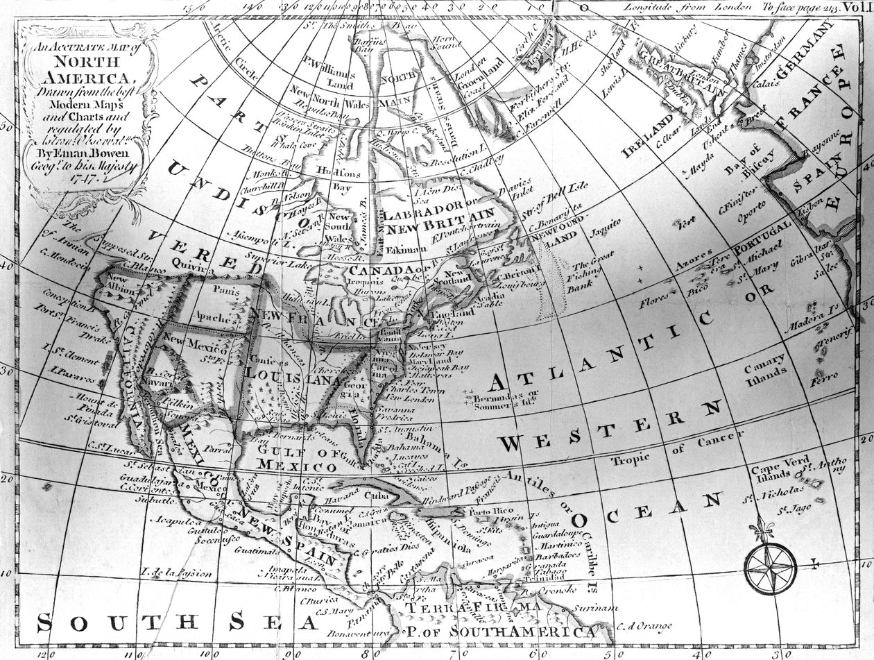
Map of North America, 1747 by American School

Map of North America, 1747

(Map of North America, 1747 )


American School

€ 120
Enthält 0% MwSt.
   Configure art print
1747  ·  lithograph  ·  Picture ID: 430227

Cultural Circles  ·  Cartography

Map of North America, 1747 by American School. Available as an art print on canvas, photo paper, watercolor board, uncoated paper or Japanese paper.
American Antiquarian Society, Worcester, Massachusetts, USA / Bridgeman Images
AR/3D   View in 3D / AR zu Favoriten hinzufügen   Add to favorites    Select wall color    View painting in a room
0 Reviews

Configure art print

Picture Frame

Medium & Stretcher

Glass & Passepartout

Miscellaneous & Extras

 Save / compare configuration
Preview Icon

Summary

Gemälde
Veredelung
Keilrahmen
Museumslizenz

€ 120
(inkl. 20% MwSt)
   Add to cart

Bildschärfe: PERFEKT

Should you desire adjustments to brightness and color, or a custom crop of the motif, we are happy to make these changes at no additional cost to you. Please do not hesitate to contact us.

Similar artworks selected for you

Map of the West Indies, Florida and South America The North Part of America: conteyning Newfoundland, New England, Virginia, by Henry Briggs Sir John Narbrough North America, from North America Map of Slavery in the United States A general chart for the purpose of pricking off ship Map of the New World 1587 A general chart for the purpose of picking off a ship Map of the World, According to Ptolemy, 1923 Colony of Georgia, America America, from Map of the Travels and the Expeditions of Alexander the Great in Asia Map depicting North America as Divided by the European Powers, 1774 A Double-Page Map of North America Map of the North Atlantic by Mount and Page Map of North America, c. 1720 Map of North America, Published by T. Stackhouse, 1783 Map of Central and North America (Les Indes Orientales et Occidentales et autres lieux) A General Map, from The Empire of China and Island of Japan Map of the Proposed Route to China from British Burmah The World as known to the Ancients, showing the Dispersion and Supposed Settling of the Descendants of Noah Map of North America New Atlas of China, Chinese Tartary, and Tibet, The Hague 1737 Nova Totius Terrarum Orbis Geographica Ac Hydrographica Tabula A Correct Map of the United States of North America; Including the British and Spanish Territories, Carefully Laid Down Agreeable to the Treaty of 1784 The West-India Islands, 1794-1801 World map displaying the tracks of Captain Cook
Show more similar artworks

Other art prints by American School

Hoffman House Bouquet Cigars, 1893 Statue of Germania on the Niederwald The Port of New York: Bird California, Cornucopia of the World, published by Rand McNally & Co. The Panama Canal, Pacific and Atlantic oceans kissing Advertisement for Dentacura Dentifrice, from Theatre Magazine, England, 1901 Poster advertising The Sandow Trocadero Vaudevilles c.1894 Farewell address of the late General George Washington, 17th September 1796 Franco-Prussian War 1870-1871: The surrender of Napoleon III after the battle of Sedan, 2 September 1870 - Color line engraving, American, c1871 - War of 1870: Napoleon III (1808-1873) prisoner following the battle of Sedan meets William I of Prussia (1797 Robert Fulton The Battle of Little Big Horn, June 25th 1876, 1889 Map of Africa Showing Its Most Recent Discoveries with the Island of St. Helena Inset from Mitchell Laocoon Group, Vatican Pallas Athene, Illustration from History of Greece by Victor Duruy, Published 1890 Poster Advertising
Discover more works by American School

Other motives from the category Cartography

Map of Asia Minor Showing Norway, Sweden, Denmark, Lapland, Poland, Turkey, Russia and the Moscow Region, c.1626 Map of the Holy Land, based on descriptions and co-ordinates given in Cosmographica, by Ptolemy (Claudius Ptolemaeus of Alexandria) published in Ulm, Germany, by Johann Reger Map of Palestine, from Theatrvm Orbis Terrarvm, 1570 Map of India, showing the progress of the Imperial Surveys, published under the direction of Colonel H.R. Thuillier, R.E., Surveyor General of India, 1888 Map of Africa, Published in 1700, Paris Map of Phoenicia, Mesopotamia and Babylon Map of Southern Italy, Corsica, and Sardinia Known in Ancient Times as Great Greece or Magnia Graecia Map of Sixteenth Century Europe, from the Part of the Tabula Peutingeriana, an illustrated itinerarium of the road network in the Roman Empire. Detail of Italy from the Peutinger map copy Map of Europe, Published in 1700, Paris Map of Zamosc, from Map of South Chicago Map of the Moon, Illustration from Sidereus Nuncius by Galileo Galilei, 1610 Map of the city of Siam, capital of the kingdom of that name after a survey done by a French engineer in 1687, published in the 1751 edition of Histoire Generale des Voyages by Antoine Prevost A New and Correct Map of the World, 1770-97
View More from "Cartography"

Excerpt from our top sellers

View of the Naruto Whirlpools at Awa, from the Series Camelot, illustration from The Death of Socrates Beach Study The Boulevard Montmartre on a Winter Morning Rosa: Bengale the Hymenes, from Children Moon Over Landscape Sunflowers. Arles, January 1889 Village Landscape in Morning Light White Waterlilies In Bed: The Kiss Mother of the World The Fourth Estate P. Mönsted, Sunny Forest Stream
Show More Artworks


What our customers think about us


Frequently Asked Questions about Meisterdrucke


Personalizing your art print at Meisterdrucke is a simple and intuitive process that allows you to design an artwork exactly to your specifications: Choose a frame, determine the image size, decide on a printing medium, and add suitable glazing or a stretcher frame. We also offer customization options such as mats, fillets, and spacers. Our customer service is available to help you design your perfect artwork.

At Meisterdrucke, you have the fascinating option to visualize the artwork you configured directly in your own space. For a tailored preview, simply upload a photo of your room and let the artwork appear on it. If you visit us via a mobile device, be it a phone or tablet, our augmented reality feature brings the image to life and seamlessly projects it into your space. An experience that uniquely combines art and technology.

Choosing the medium is often a matter of personal taste. To give you a clearer idea, we have provided some images for each medium. For a holistic experience, we also offer you a sample set of all paper variants so you can make a decision not just visually but also haptically. You can take advantage of the sample set free of charge – only the shipping costs will apply. You can order the sample set directly.

Do not worry. At Meisterdrucke, we do not proceed mechanically. We manually review each order. If there are any inconsistencies or peculiarities in the configuration, we will immediately contact you. Of course, our courteous and patient support is always at your side to assist you with the configuration. Together with you, we adjust your image by phone or email so that the final result exactly meets your expectations.


Do you have any questions?

Are you interested in an art print from our manufactory but still unsure? Do you need advice on choosing the medium or help with the order?

Our experts are happy to assist you.

+43 4257 29415
support@meisterdrucke.com
Mo-Do: 7:00 - 16:00 | Fr: 7:00 - 13:00

Do you have any questions?

Are you interested in an art print from our manufactory but still unsure? Do you need advice on choosing the medium or help with the order?

Our experts are happy to assist you.

+43 4257 29415
support@meisterdrucke.com
Mo-Do: 7:00 - 16:00 | Fr: 7:00 - 13:00


Meisterdrucke

   Kärntner Strasse 46
        9586 Finkenstein am Faaker See
        Austria
        +43 4257 29415
        support@meisterdrucke.com
Other languages

                   
Erfahrungen & Bewertungen zu Meisterdrucke
Post.at DHL Express Quehenberger Cargoboard
Kaiser Franz Joseph

Meisterdrucke
Kärntner Strasse 46
9586 Finkenstein am Faaker See · Austria
+43 4257 29415 · office@meisterdrucke.com
Post.at DHL Express Quehenberger Cargoboard


Meisterdrucke 2764 Bewertungen auf ProvenExpert.com

(c) 2025 meisterdrucke.uk